Rain and thunderstorms will soak a large area of northern and eastern QLD this week, with potential for heavy falls, severe storms and flooding.
A near-stationary low pressure trough and one or two low pressure systems will produce a prolonged spell of rain and storms over QLD during the next five to seven days.
Early in the week, showers and storms will extend from the state’s northwest down to the southeast on Monday and Tuesday, affecting areas from Brisbane to Burketown. Severe thunderstorms are a good chance on both days, with heavy rain and damaging winds the main threats, but large hail also possible.
Rain and storms will then continue over northern and eastern QLD during the middle of the week as a low pressure trough extends from the western Coral Sea up to the Gulf of Carpentaria.
There are indications that one or two low pressure systems could develop within this trough on Wednesday or Thursday, most likely near the state’s central coast and over the eastern Gulf of Carpentaria. Both lows, should they develop, are likely to cause focussed areas of heavy rain that may lead to flooding.
There is quite a lot of uncertainty regarding what the trough and low(s) will do towards the end of the week. However, there is potential for more heavy rain and flooding over parts of northern and central eastern QLD from Friday into the weekend.
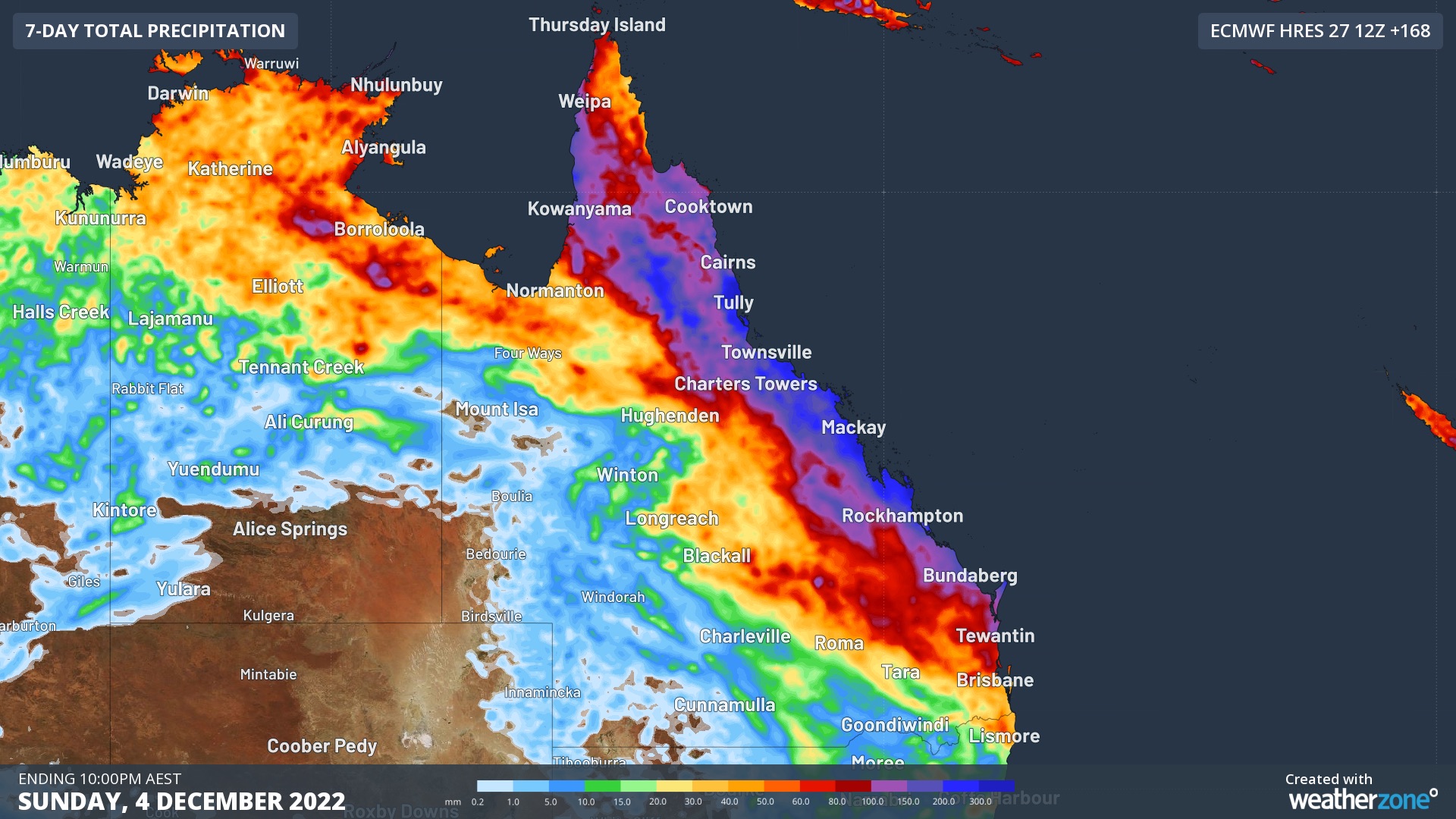
The maps below show how much total accumulated rainfall two different computer models are predicting this week. Comparing these two models highlights both the potential for heavy rain and the uncertainty around where and how much will fall.

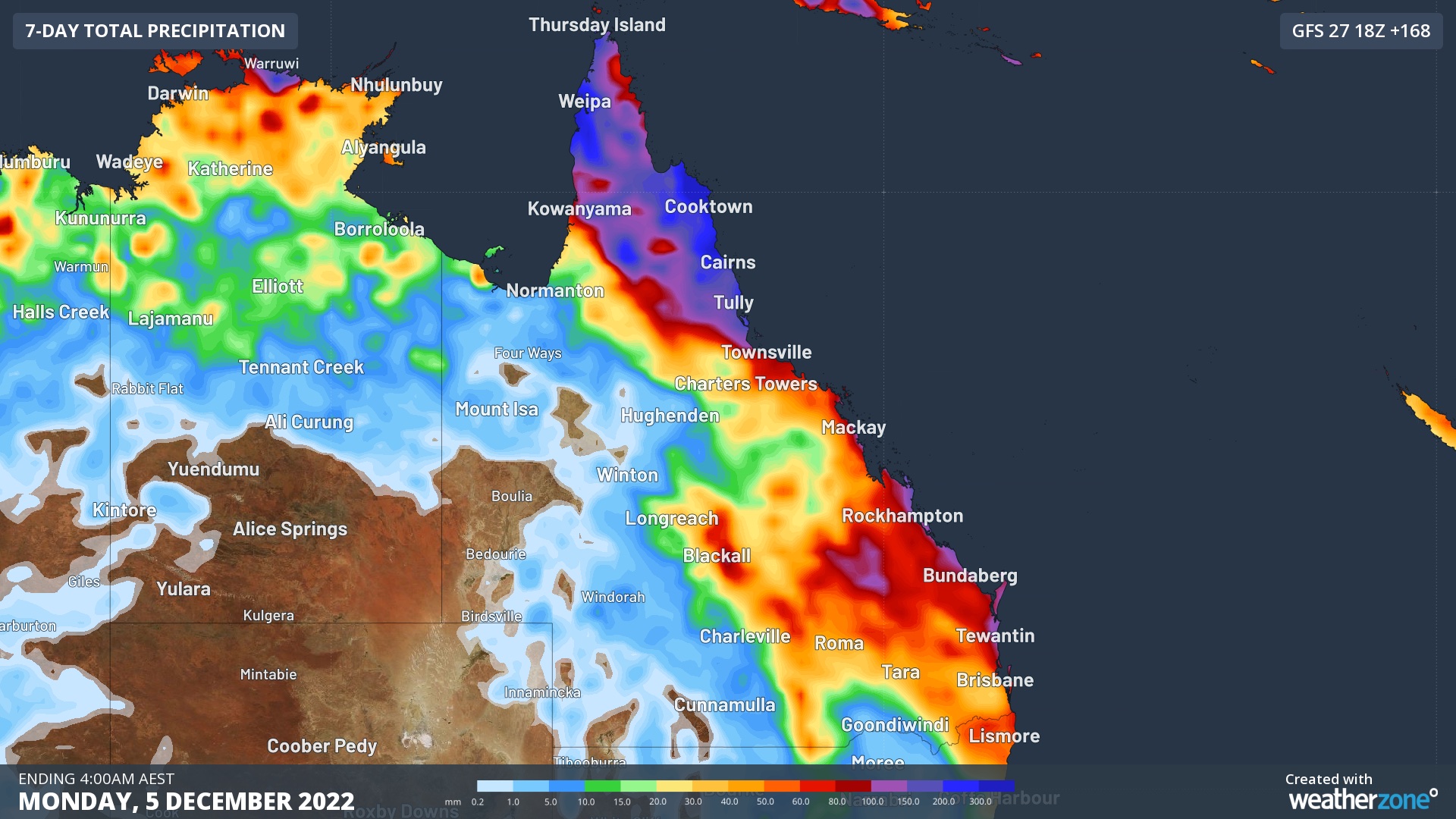
Images: Forecast weekly rainfall according to two different computer models. Top image: ECMWF model’s forecast accumulated precipitation during the 7 days ending at 11pm AEST on Sunday, December 4. Bottom image: GFS model’s forecast accumulated precipitation during the 7 days ending at 4am AEST on Monday, December 5.
At this stage, it is unlikely that either low pressure system will strengthen into a tropical cyclone near Australia.
Stay up to date with the latest forecasts and warnings throughout the week for the most accurate information on these evolving weather systems.
DTN APAC operational insights and alerts for lightning strikes as they happen. These services allow your assets and personnel to be well-informed and safe during thunderstorms, but also minimise costly downtime when they do occur. To find out more, please email us at apac.sales@dtn.com.


