
Prosper in a dynamic world
Search

Severe storms slam Sydney

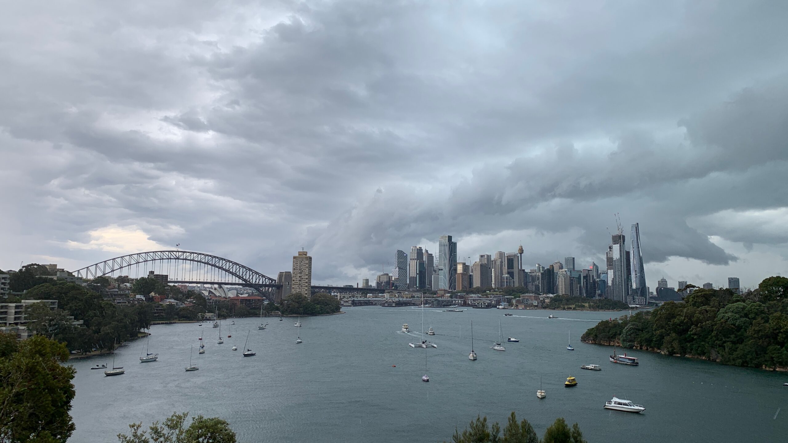
A line of thunderstorms is moving across the entire Sydney basin and nearby areas on Monday morning, with strong squalls, heavy rain and a rapid drop in temperatures.

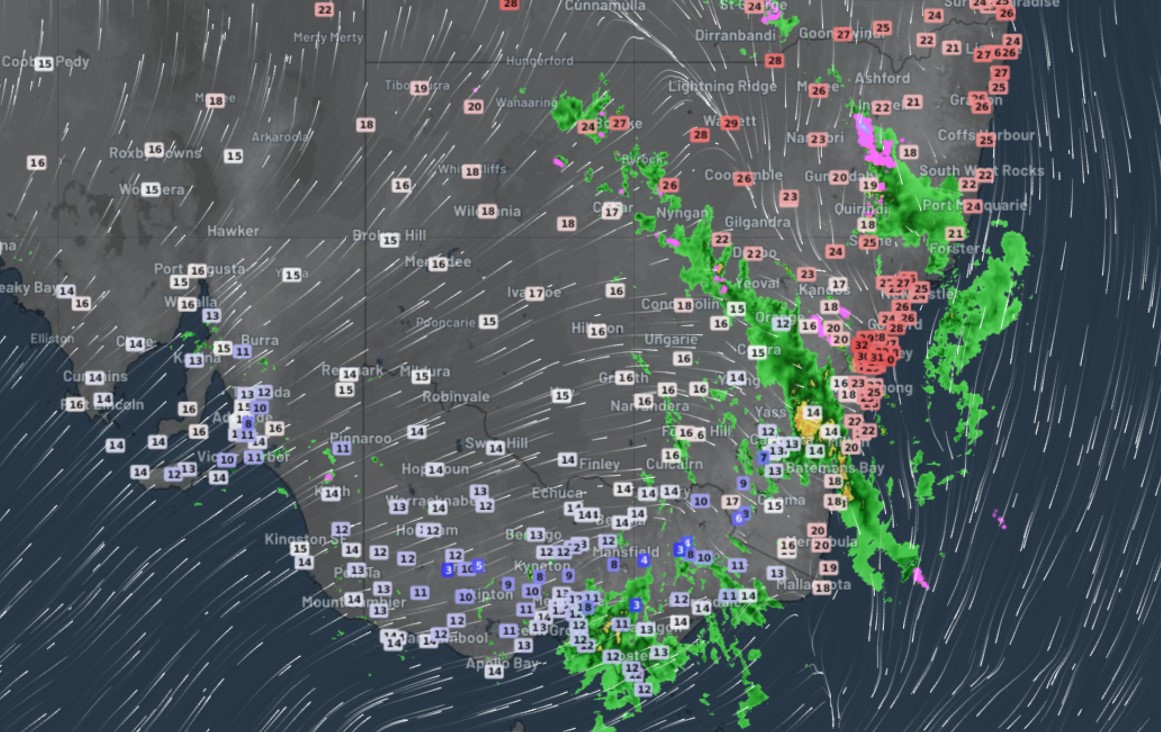
Sydney started Monday with its warmest morning of summer 2022 to date by a large margin.

  • The city reached 29.6°C just before 10 am.
  • Temps topped 32°C in numerous areas between 9 and 10 am, from Sydney Airport to Penrith.

Indeed, as the live temp map captured earlier on Monday morning shows, Sydney was the hottest place in the whole of southeastern Australia.
But around 10 am, the first storms started moving in, as a trough and cold front pushed towards the east coast.

As you can see on the radar loop, the system moved pretty rapidly across New South Wales, and the storms are now moving just as quickly across the Sydney area as we write this story.
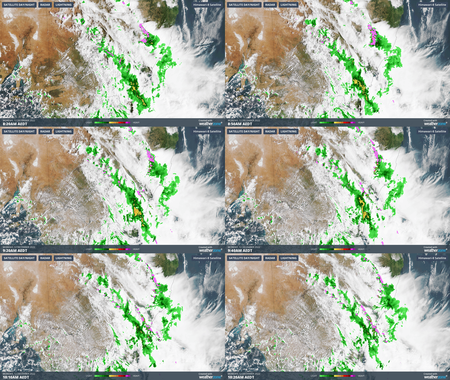
A whopping 21.6 mm of rain was recorded in just 14 minutes between 10:46 am and 11 am at Observatory Hill, while 95 km/h wind gusts were reported as storms ripped through.

Temps dropped to the low-20s or high-teens in most parts of the Sydney region after the first wave of storms passed.

Meanwhile this system delivered very heavy falls of rain on Sunday and overnight into Monday across parts of Victoria and New South Wales.

  • The heaviest falls in New South Wales were in the Snowy Mountains region, where Perisher saw 74 mm to 9 am – just a few days after it plummeted to a record-equalling summer low temp of -7°C.
  • Rain was recorded in every one of the Victorian forecast districts, which is quite unusual for a summer system. Again, the heaviest reading was in the mountains, with 42 mm at Mt Hotham.

The main focus of thunderstorm activity will shift to northeast NSW and southeast Queensland on Monday afternoon. Sydney can expect fine, mild weather from Tuesday through to Friday.

To find out more about the Total Lightning Network (WZTLN) and our thunderstorm forecasting services, please email us at apac.sales@dtn.com.


Latest news

Satisfy your weather obsession with these news headlines from around the nation, and the world.

Signs of a positive Indian Ocean Dipole, but it may not follow the textbook

Waters off Indonesia have cooled in recent weeks, an indication that a positive Indian Ocean Dipole (IOD) event could be developing. It’s an important climate driver for Australia, and it could shape rainfall and temperatures heading into summer, with flow-on effects for farmers, energy and other industries.  What is the Indian Ocean Dipole?  The IOD […]

1.3 million lightning strikes and a record September downpour: the storms testing WA’s Goldfields

Leonora, WA, had its wettest September day on record earlier this month. Three weeks later, more than 1.3 million lightning pulses were detected within 800 km of the town in 48 hours. Why is a stalled trough delivering storms to mining country, and what it could mean for operations?  The DTN Total Lightning Network detected […]

A very low wind power week, likely to continue

A stubborn blocking high over southern Australia will make for a very quiet week for wind generation and the pattern behind it isn’t a one-off.   It’s the seasonal signature of a super (very strong) El Niño combined with a positive Southern Annular Mode (SAM), and both the historical record and the current seasonal forecast suggest it’s likely to keep recurring through spring before a potential switch from November.  The setup right […]

Fastest strengthening El Niño on record: Impacts on Australian monsoon timing and wet season planning

Australia’s Mining and Resources sectors are bracing for a wet season shaped by one of the most rapidly developing El Niño events on record.    Looking back at how the strongest El Niño events in Australian history have played out, it becomes apparent that mining operations in Australia should be planning for a later monsoon […]

