Prosper in a dynamic world
Search

Satellite captures Moon’s shadow during solar eclipse

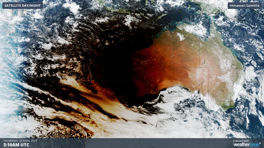
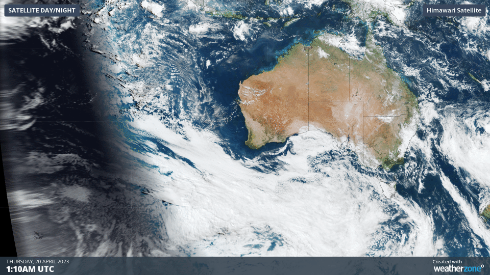
A satellite just captured the shadow of the Moon darting across the Indian Ocean and glancing northwestern Australia during today’s total solar eclipse.

More than 20,000 people converged on Exmouth in the far northwest corner of WA on Thursday to witness a total solar eclipse. This rare spectacle occurs when the moon passes between Earth and the Sun, causing the Moon to briefly cast a shadow on the Earth’s surface.

Exmouth and the surrounding Ningaloo Coast region was the only place on the Australian mainland to witness Thursday’s solar eclipse in its entirety. Every other part of the country only saw a partial eclipse, where the moon only covered a portion of the sun.

But while the view of the eclipse from Earth was limited to a thin sliver of land and ocean, the Himawari-9 satellite, sitting 36,000 km above Earth’s surface, captured an impressive top-down view of the phenomenon for all to see.

The video below shows the shadow of the Moon passing across Earth’s surface on Thursday, initially moving over the Indian Ocean before skimming WA and then continuing towards the Timor Sea and Indonesia.

Impressively, the temperature dropped by several degrees during the darknes of the eclipse. Carnarvon Airport cooled by 3.4ºC between 10:23am and 11:30am local time.

Below are a few more images of the event captured by the Weatherzone community in WA.

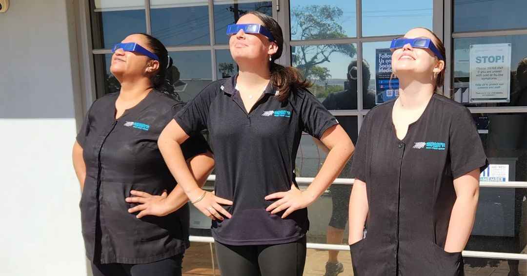
Image: Safety first in Wonthella, WA. Source: @impactn.massage.clinic / Instagram

Satellite captures Moon's shadow during solar eclipse

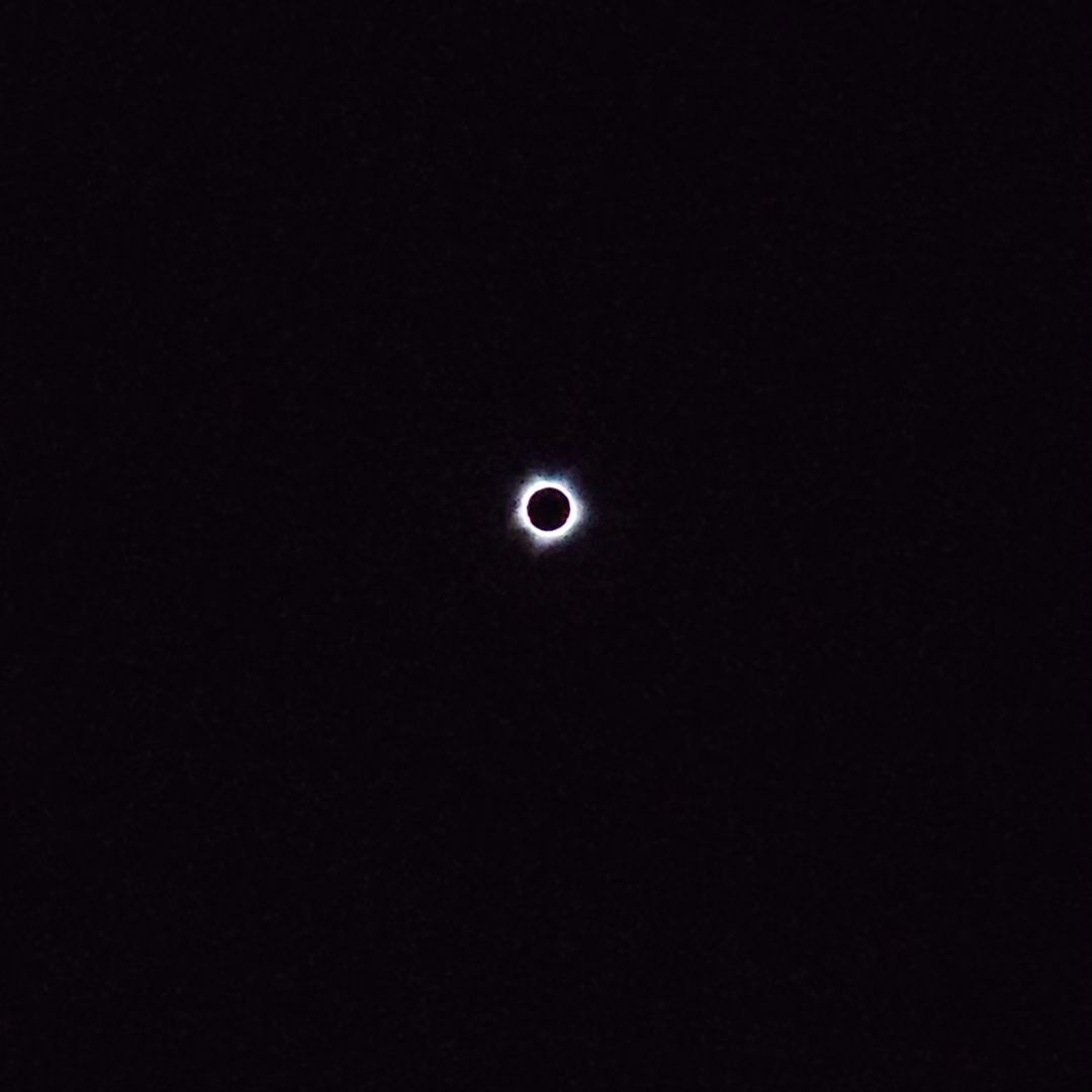
Image: Total solar eclipse as seen from Barrow Island, WA. Source: @thomas__fry / Instagram

Satellite captures Moon's shadow during solar eclipse

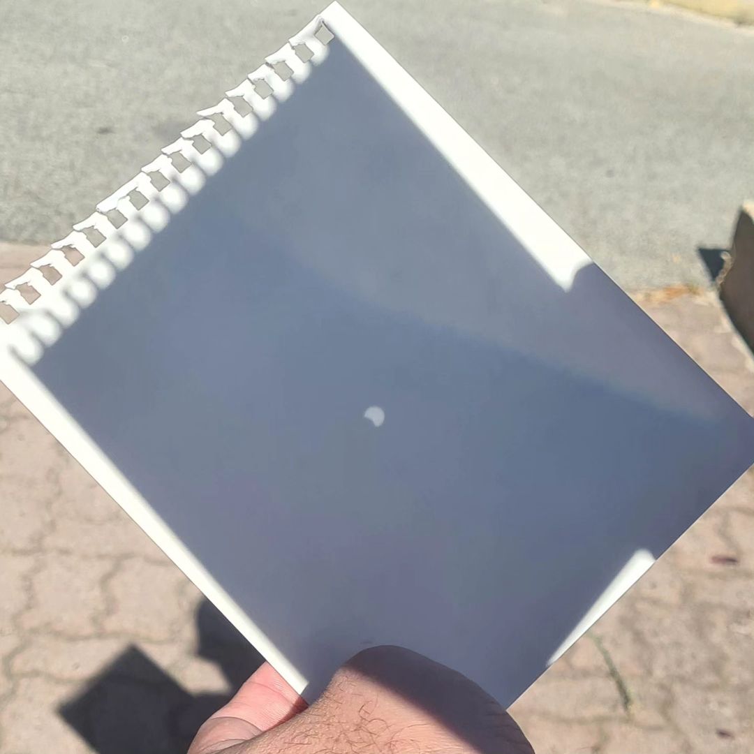
Image: View of Thursday’s partial solar eclipse through a pinhole projector, from Perth. Source: @dardsagainsthumanity / Instagram

Latest news

Satisfy your weather obsession with these news headlines from around the nation, and the world.

How does DTN help businesses monitor bushfire induced pyrocumulonimbus thunderstorms that ignite more fires?

Intense heat from bushfires during elevated fire danger days can trigger fire-induced pyrocumulonimbus thunderstorms that ignite additional fires. In early January 2026, an extreme heatwave sweeping over southeastern Australia brought catastrophic fire danger to Victoria. Intensely hot bush and grass fires spread erratically and quickly in hot, dry and gusty winds, with pyrocumulonimbus generating lightning, […]

Active seas to the north and east of Australia disrupting port and maritime operations

Seas to the north and east of Australia are experiencing periods of increased activity this week, leading to disruptions to port, maritime and offshore operations. Intense and hazardous Tasman Sea Ocean conditions across NSW’s South Coast rapidly deteriorated last Friday as a deep feed of easterly winds whipped up large and dangerous seas. The Batemans […]

Transport, emergency and energy industries flooded across Greater Sydney with weekend deluges

Transport, emergency, energy and port industries in eastern NSW and Sydney were impacted by significant flash flooding with intense and heavy rainfall this weekend. Rainfall rates between 80 and 140mm in one to three hours were registered across parts of Sydney’s Northern Beaches and Central Coast on Saturday afternoon and evening. In some areas, these […]

DTN Dangerous Thunderstorm Alerts in action with severe thunderstorms disrupting Perth industries

Severe thunderstorms impacted southwest WA and the Perth region on Sunday, December 14, 2025, triggering Dangerous Thunderstorm Alerts (DTA) by DTN for industries and businesses in the region. DTN operates Dangerous Thunderstorm Alerts (DTA) which alert businesses and industries to thunderstorms based on intensity and movement. These alerts provide advanced notice of thunderstorms moving into […]