It has been a thundery start to Thursday in NSW as a rain and storm-bearing trough crosses the state, prompting flood warnings in some areas.
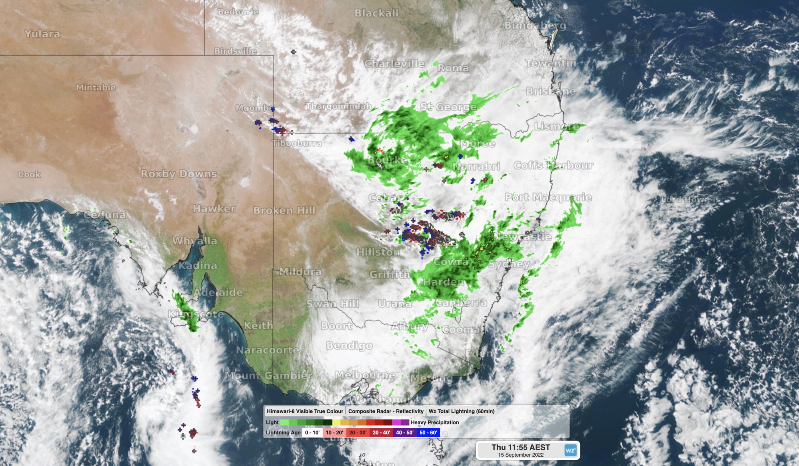
While most thunderstorms in Australia occur during the afternoon and early evening, an unstable atmosphere and abundant moisture gave rise to a flurry of early-morning storms in western NSW on Thursday.
The animation below shows lightning strikes occurring before and after sunrise on Thursday, with thunderstorms becoming more active on the western edge of a rainband as the morning progressed.
Rain and thunderstorms will continue to spread over NSW into Thursday afternoon and night as the low pressure trough moves further east.
Thunderstorm activity will continue to occur on the western side of the rain and cloudband, most likely over the state’s central western and north western districts.
Some of Thursday’s thunderstorms are likely to become severe in western NSW, with damaging winds, large hail and heavy rain all possible. Isolated supercell thunderstorms are also risk in the afternoon and early evening in Central West.
While storms are less likely on and east of the ranges with this system, a decent amount of rain will still spread over the eastern half of the state during the next 12 to 24 hours.
Moderate rainfall with totals ranging from 10 to 40 mm are likely over the western slopes and ranges, and parts of the coast, by Friday morning. Some could see heavier falls, with 24-hour totals exceeding 50mm.

Image: Forecast accumulated rain during the 48 hours ending at 10pm AEST on Friday, September 16, according to the ECMWF-HRES model.
This rain will be falling into already wet catchments following recent rainfall, which has prompted a flood watch and numerous flood warnings across the state.
This rain will also affect southern QLD and northern VIC where flood warnings have also been issued.
Flood and severe thunderstorm warnings will be updated during the next 24 hours with the most up-to-date information on this evolving system.
How can we help your business prepare for severe thunderstorms?
Weatherzone owns and operates the Weatherzone Total Lightning Detection Network, one of the most advanced networks of its kind in the world. The capability to detect strike accuracies down to 100m, supports dangerous thunderstorm alerting, which is imperative to outdoor operations and infrastructure.
Dangerous thunderstorm tracking and alerts are issued for severe storms when the total lightning network detects high rates of lightning, giving your business a heads up of potential damaging winds, heavy rain and large hail which could be associated with these dangerous thunderstorms.
Weatherzone is trusted by clients across the globe to improve safety, optimise efficiency and provide early warnings of thunderstorm and heavy rainfall risk. For more information, please contact us at apac.sales@dtn.com.


