Queensland’s central and northern coasts have been hammered with over 700mm of rain falling over the past 5 days, and the deluge is still not done yet.
So far, Proserpine has been one of the wettest locations, notching up a staggering 620mm in the five days since Wednesday. This included its wettest 48 hours in 32 years over the weekend, with 483mm recorded in the gauge.
Huge totals have also been reported at Mount Jukes (704mm), Hamilton Island (595mm), and Mackay Racecourse (497mm).
The region is experiencing falls to rival those from Tropical Cyclone Debbie in 2017, with 392mm at Jubillee Pocket and 372mm at Peter Faust Dam in the 24 hours to 9am on Monday. Further heavy falls continued on Monday, with a particularly severe thunderstorm dropping 102mm at Herman Road in just one hour this afternoon.
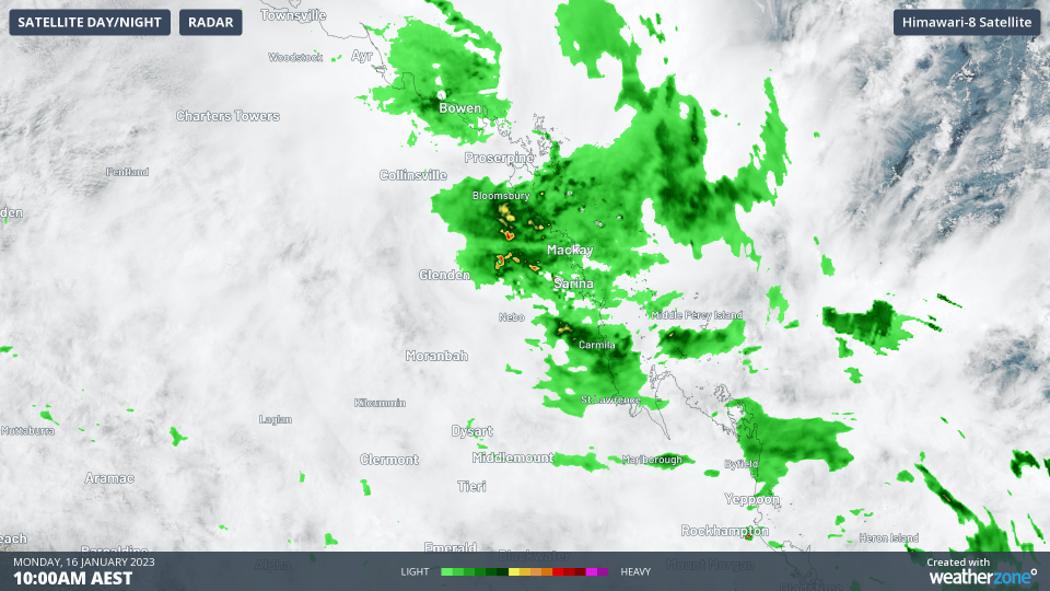
GIF: Satellite and rainfall over the Central Coast region on Monday
The rainfall deluge was caused by a trough that developed off the Mackay Coast on Wednesday 11th night last week, triggering a series of thunderstorms and rainbands over the region. Over the weekend, the trough deepened and broadened up the Townsville Coast, supported by strong northwesterly winds, drawing in tropical moisture from the Pacific Ocean.
This system is going nowhere quickly and is continuing to batter the Mackay and Townsville Coasts. Widespread rain of 100-250mm is forecast on Monday and Tuesday, with some areas possibly seeing another 300-500mm on top of what has already fallen. This will likely tip some gauges over the 1000mm or one metre mark for the past week.
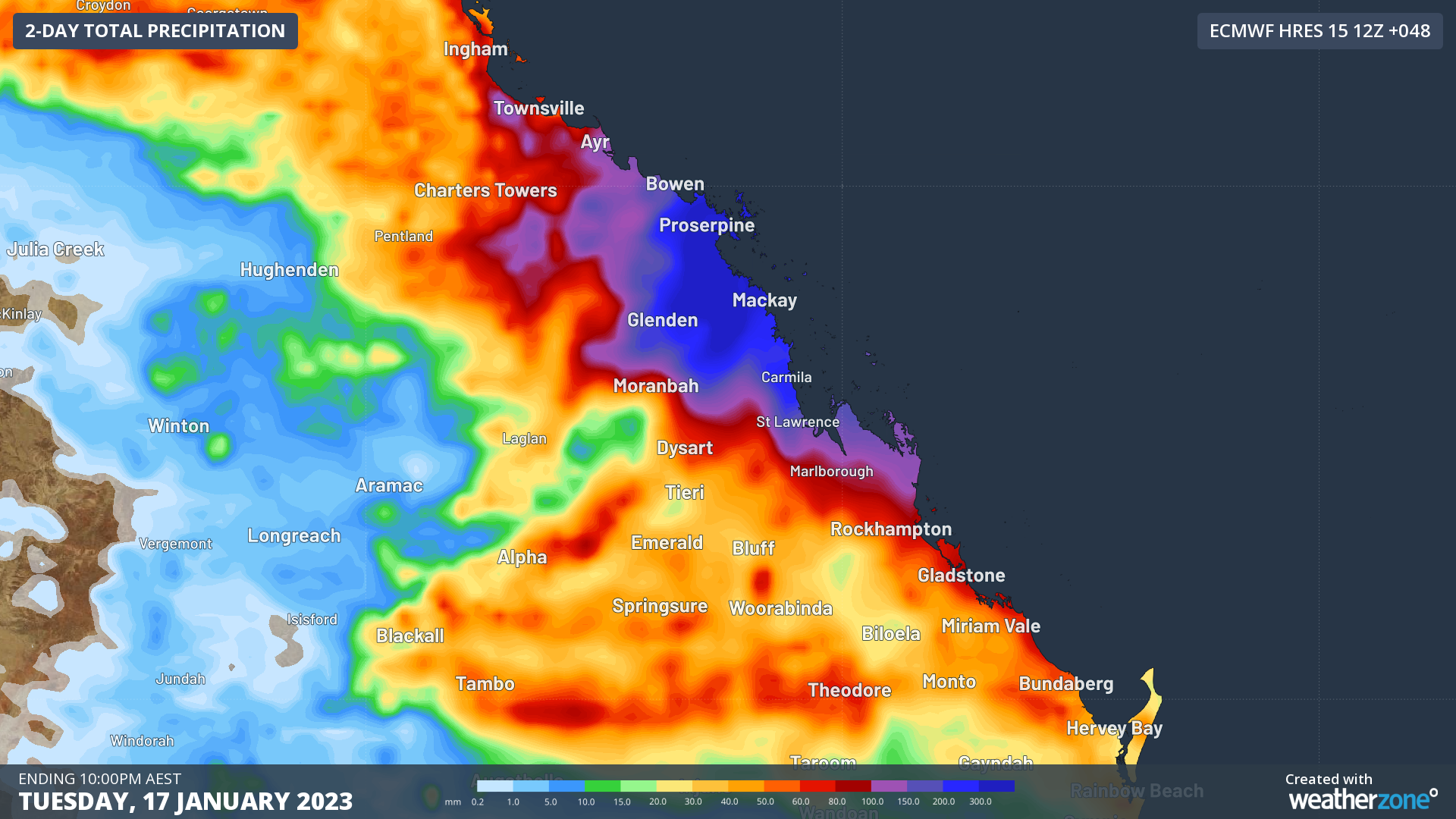
Image: Forecast 48 hour rainfall to 10pm Tuesday from ECWMF. Dark blue colours indicate falls exceeding 300mm.
One benefit the region has is deep rivers and tall banks that drain into the sea rather quickly when compared to inland rivers and those in the south. While still dangerous, flood levels have only reached moderate levels as of Monday afternoon at Bakers Creek just to the south of Mackay, and Cattle Creek, a subsidiary to the Pioneer River that flows through Mackay.
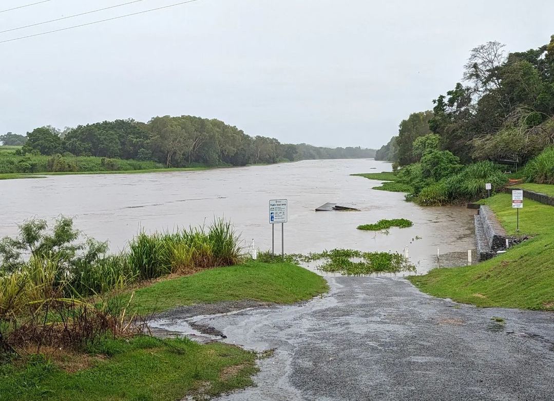
Image: The swollen Pioneer River @shane.davies966/Instagram
A severe weather warning for heavy-to-locally-intense rainfall is still current for the Central Coast/Whitsundays, Herbert/Lower Burdekin and Central Highlands/Coalfields districts. Severe thunderstorm warnings have also been issued at times for particularly intense thunderstorms, so stay up to date with the latest warnings here.
DTN APAC provides forewarning of severe flooding events like these to our customers through our regular forecasts and alerting services, and direct communication from our meteorologist team. To find out more, please email us at apac.sales@dtn.com.


