The Madden-Julian Oscillation and the monsoon are starting their second approach of the season towards Australia, along with their elevated risk of tropical cyclone development.
The Madden-Julian Oscillation (MJO) is an eastward moving pulse of tropical activity that travels the Indian and Pacific Oceans. It affects Australia the greatest between November and April, but occasionally can have impacts during other times of the year. The MJO has eight defined regions or phases it could fall in, but they can be grouped into three main categories: active, inactive, and indiscernible.
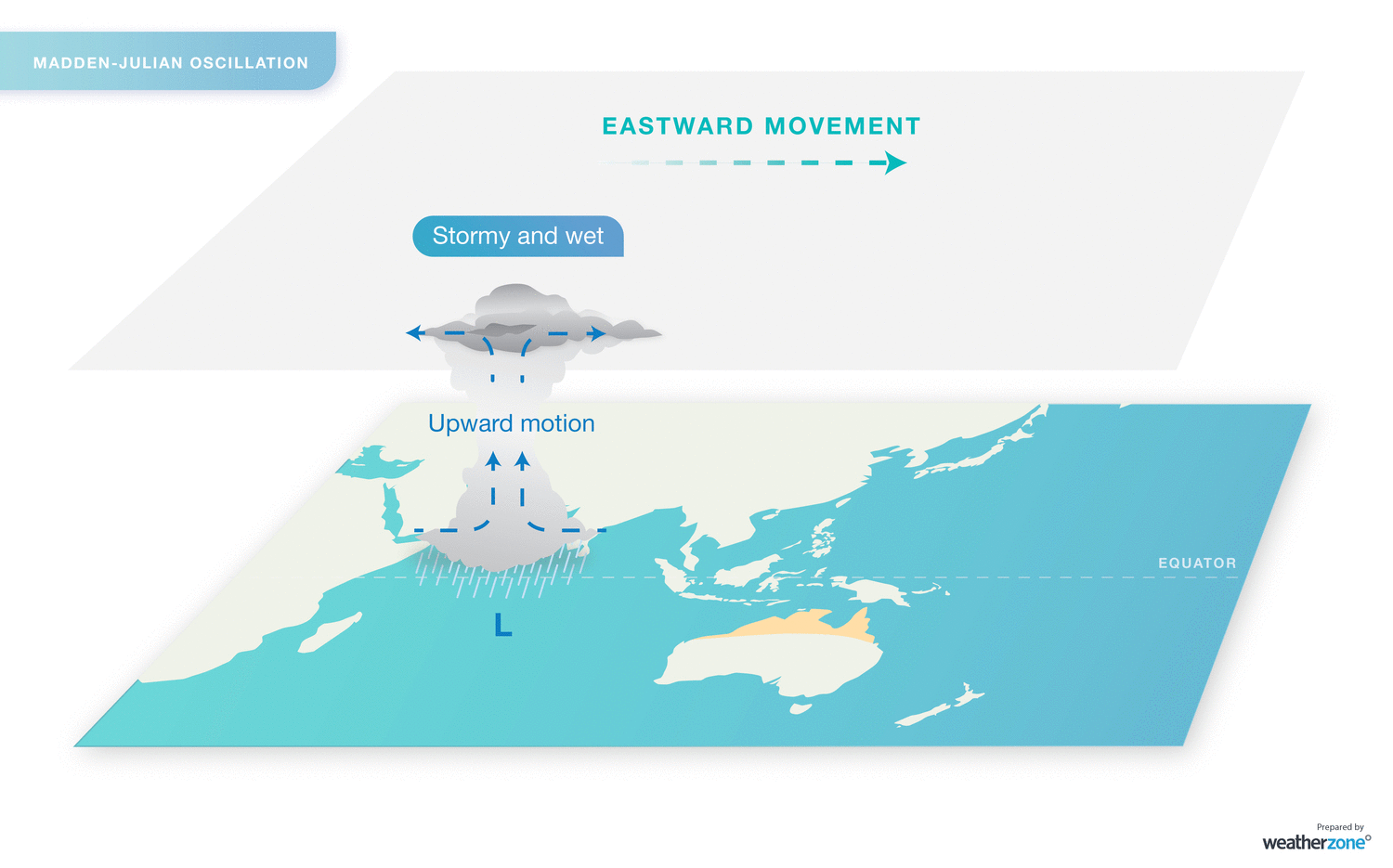
Image: The progression of the MJO. Phase 1 starts near Africa and progressively moves east with phase 8 in the eastern Pacific.
- During an active phase for Australia (phases 4, 5, 6 and 7), the MJO typically draws the monsoon further south to the mainland. The monsoon produces frequent rain and storm events that become the norm for several weeks over northern Australia, as well as a higher-than-normal chance of tropical cyclones developing.
- During an inactive phase (phases 8, 1, 2 and 3), the monsoon retreats further north, allowing heat and humidity to build up over northern Australia (hence why it’s often called the ‘build-up’). Isolated afternoon thunderstorms are common during this period, but sometimes areas will dry up completely.
- An indiscernible phase means that the MJO is weak and is not having a significant impact on global weather. For Australia, this usually looks like build-up conditions but can lead to the odd tropical cyclone or localised monsoon onset.
Over the past fortnight, the MJO strengthened from an indiscernible phase (lined up with the heavy tropical rain in Queensland in mid-January) into a stronger inactive phase. This will be felt over the next week as the Pilbara will have a break in its thunderstorm activity, with very little precipitation expected.
In the coming fortnight, the MJO is expected to move from phase 3 (inactive) into phases 4 and 5 (active). Like with a typical active phase, the monsoon will be starting to move further south towards Australia, while also increasing the chances of tropical cyclones in our waters. Australia’s region of responsibility extends from 90ºE to 160ºE and below 10ºS.
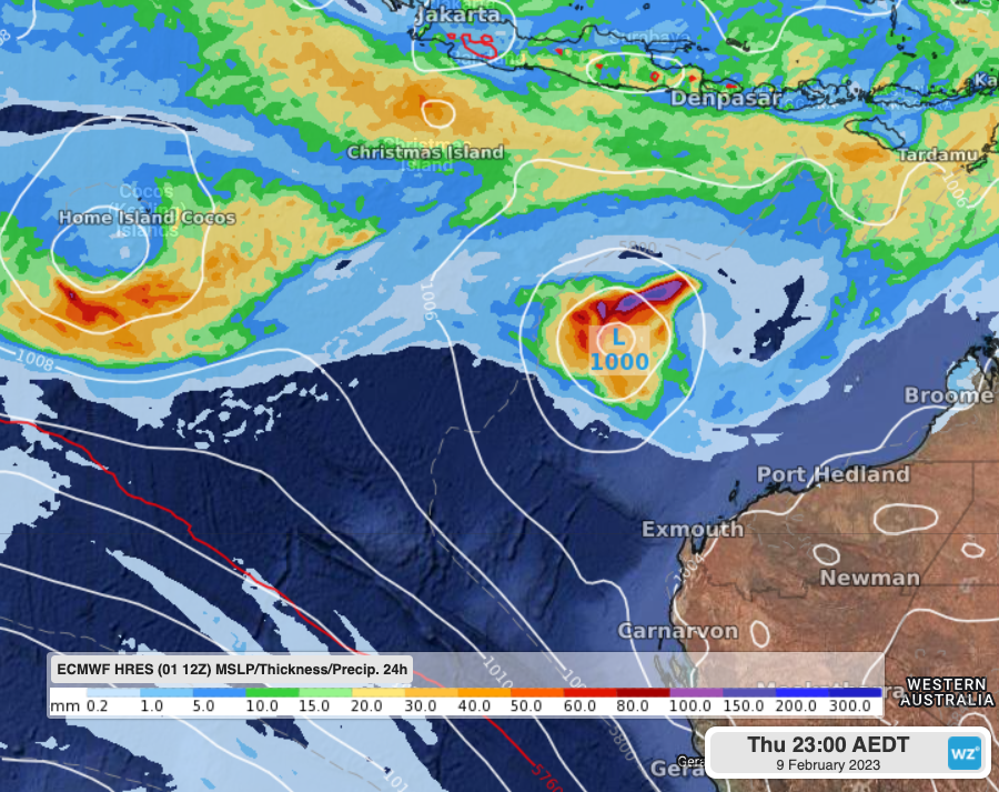
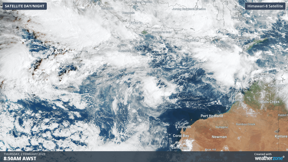
Image: A pair of tropical lows that could become tropical cyclones during the week. Both should be tracking west.
Fortunately, tropical cyclones are not currently expected to make landfall over the Australian mainland during this week but could impact Christmas Island and the Cocos (Keeling) Islands. However, from next week and likely for the remaining weeks of February, Australia will be at a heightened risk of tropical cyclones developing that can impact communities in the north.
Keep an eye on our warnings and tropical cyclone advisories pages for any tropical lows that look like developing in Australian waters.
DTN APAC offers a suite of services to help your business prepare for the hazards of the northern Australian wet season. From seasonal briefings for summer and the looming tropical cyclone season, a weekly update highlighting the phase of the MJO and what that means for your state, to detailed forecasts tailored to your needs and assets, Weatherzone can support your business. All these services are delivered by our team of highly trained meteorologists who operate 365 days a year. To find out more, please visit our website or email us at apac.sales@dtn.com.


