A hybrid cyclone looks set to form off the east coast of Victoria on Tuesday, producing heavy rain. But what is a hybrid cyclone and how difficult are they to forecast?
The sequence of satellite images below shows two distinct low pressure systems affecting Australia on Monday. One low can be seen near the junction of the NSW, Vic and SA borders. The other low is centred over the western Tasman Sea, off the north coast of NSW.
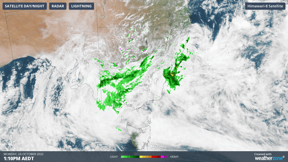
Both low pressure systems have caused heavy rain over Australia during the last couple of days.
The western-most low dumped 95.6 mm of rain on Renmark during the 24 hours to 9am on Monday, which was Renmark’s highest daily rainfall on record.
During the same 24-hour period, Alstonville in northeast NSW was inundated by 233 mm as the Tasman Sea low drove heavy rain into the region. Nearby, Ballina’s 126.4mm was equivalent to more than a month’s worth of rain falling in a single day.
Now, these two lows are on course to clash into each other and combine to form a dynamic and dangerous system called a hybrid cyclone.
What is a hybrid cyclone?
Low pressure systems that affect Australia can usually be classified as either warm-core or cold-core cyclones.
Cold-core cyclones (also called cold-core lows) typically originate from the belt of westerly winds circulating our planet’s poles and are commonly associated with cold fronts and upper troughs. These low pressure systems receive their strength from the difference in the cold and warm air, and tend to produce heavier falls during the day, when the sun is warming the ground, leading to more instability. Cut-off lows that cause rain, snow and damaging winds in Australia are an example of cold-core lows.
Warm-core cyclones (also called warm-core lows) typically originate in the tropics. These lows gain their strength through the release of energy as water vapour condenses into a liquid (known as latent heat). These systems tend to produce more widespread heavy falls, with a peak overnight as the tops of the clouds cool down. Tropical Lows and Tropical Cyclones are both types of warm-core cyclones.
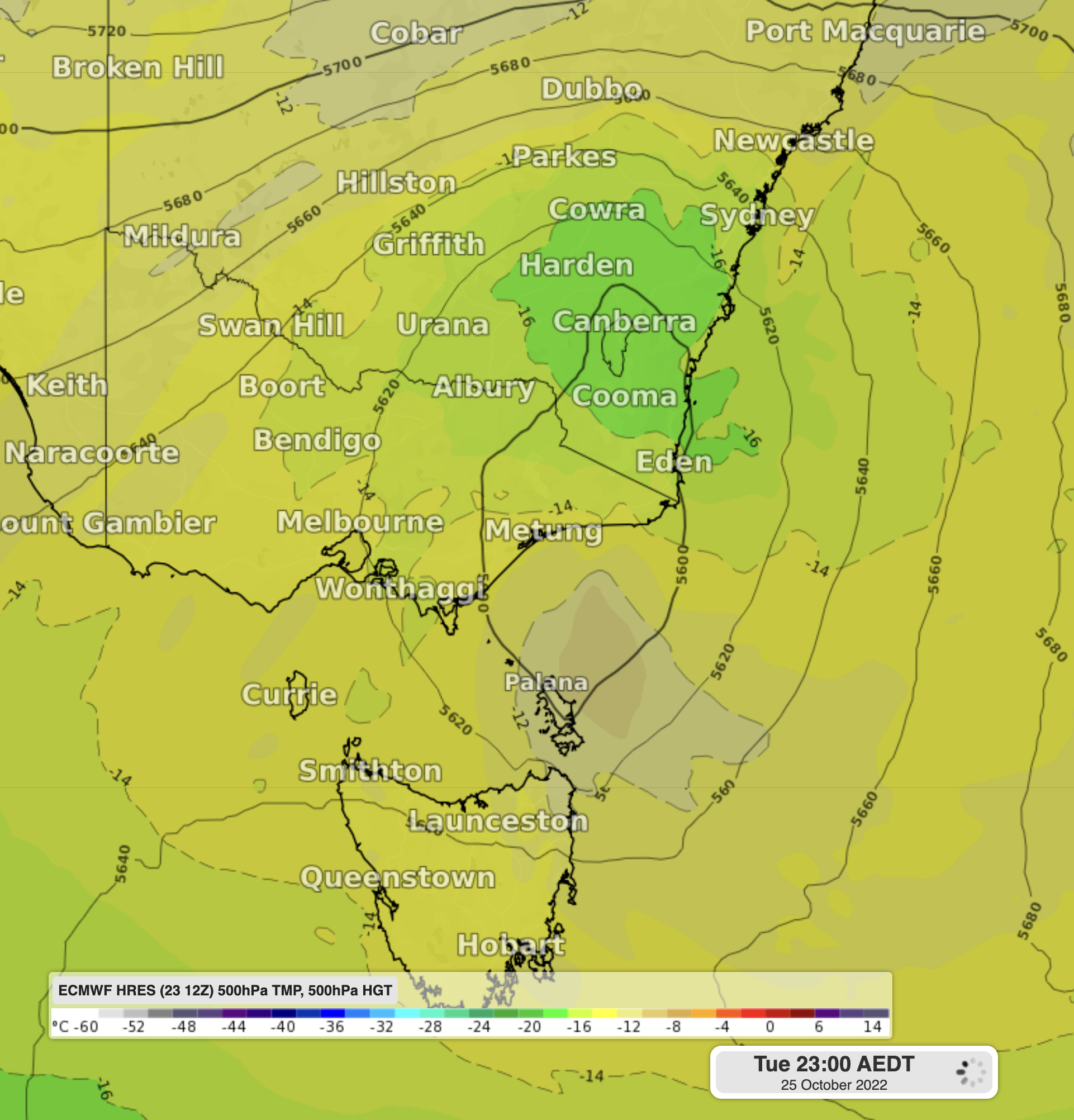
In the sequence of satellite images shown near the start of this article, the low passing over southeastern Australia is a cold-core low and the low sitting off the NSW coast is a warm-core low.
On Tuesday, the cold-core low will move over Victoria and interact with the warm-core low coming down the east coast, causing them to fuse into a unique system called a hybrid low or hybrid cyclone.
As the name suggests, a hybrid cyclone refers to a low pressure system that has both warm and cold air in its core. This mix of air leads to a mix of energy sources, which can allow hybrid cyclones to intensify quite rapidly. These dynamic systems are well-known sources of severe weather and have caused large tornado outbreaks in the United States.
Hybrid cyclones are often caused when one type of low pressure system transitions into the other (e.g. warm to cold core). However, this system is different, as it is being caused by two already-established systems combining. This will cause the cores to try and balance out each other’s core temperatures, resulting in an unstable and dynamically evolving system.
Movie: Forecast temperatures at 500hPa, showing the interaction of the warm (brown) and cold core (green) cyclones forming into a hybrid cyclone.
The good news with this hybrid low is that it will be centred offshore, so tornadoes on land are far less likely than in the US and the most intense weather should occur over water. However, this system may still bring heavy rain to parts of the NSW South Coast, Victoria’s Gippsland region and the east coast of Tasmania between Monday and Thursday.
The dynamic nature of these hybrid cyclone makes it easy for computer models to underestimate rainfall and wind strength. So, while current computer models forecast a widespread 60-100mm, these systems can sometimes produce up to twice as much as forecast. It is possible that some areas between southeast NSW and eastern Tasmania could see falls in the range of 100-200mm over the next few days.
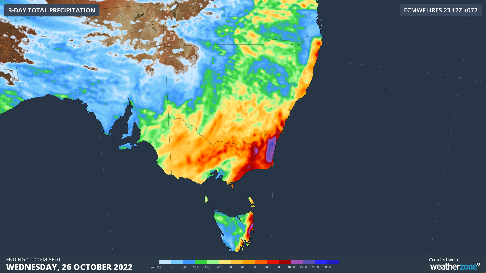
Image: Forecast accumulated rain between Monday and Wednesday this week, according to the ECMWF-HRES model.
Weatherzone Business can provide access to our team of highly trained meteorologists, allowing you to receive the best possible forecasts, even when automated forecasts may not be capturing the whole situation. This includes ad-hoc briefings via phone or video chat, so that you can receive the information you need as clearly and promptly as you need it. To find out more please contact us at apac.sales@dtn.com.


