Prosper in a dynamic world
Search

Heatwaves and heavy rain in Australia this week

A late-summer heatwave will touch part of every state and territory in Australia this week as heavy tropical rain causes flooding in parts of Qld and the NT.

A relatively stagnant weather pattern will cause two distinct types of weather in Australia this week. In the north there will be lots of cloud and rain near an active monsoon trough. Further south, there will be plenty of sunshine allowing hot air to build over the continent.

The map below shows how much rain one computer model is predicting over northeastern Australia this week. This deluge will be caused by a tropical low meandering over the Gulf of Carpentaria before moving over land with the monsoon trough later in the week.
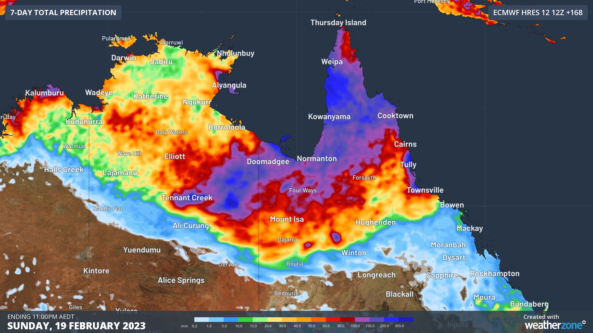
Image: Forecast accumulated rainfall during the week ending on Sunday, February 19, 2023, according to the ECMWF-HRES model.

While northern Australia is accustomed to wet weather at this time of year, this week’s soaking could deliver enough rain to cause areas of flooding that may affect roads and communities in Qld and the NT.

But while Australia’s northeastern tropics will be covered in cloud for most of this week, clearer skies in most other parts of the country will bring a surge of summer heat.

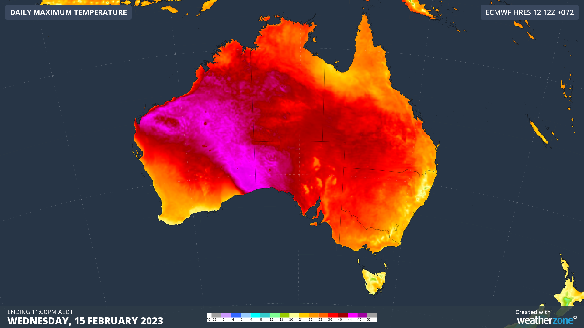
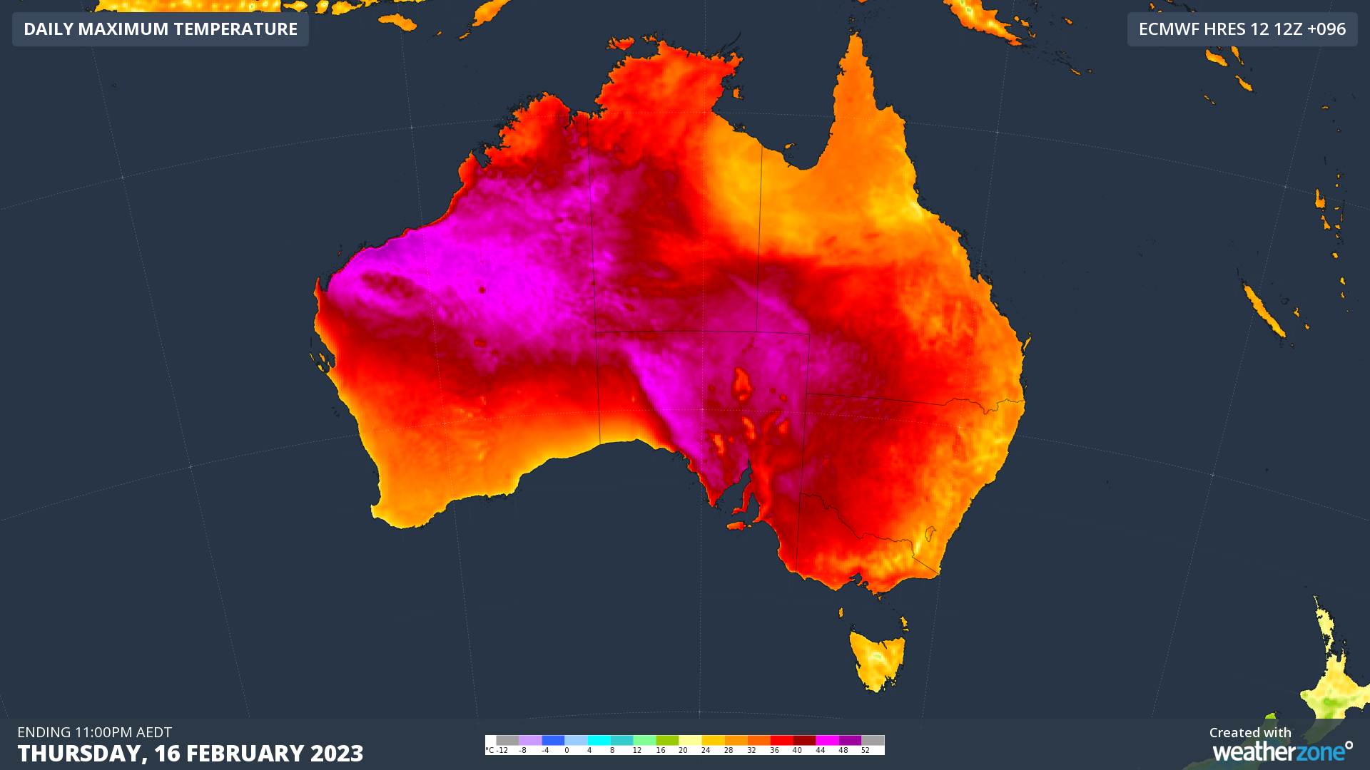
The maps below show the predicted maximum temperatures across Australia during the first four days of this week. This intense heat will persist through the back end of the week as well, causing heatwave conditions in parts of every state and territory over the next seven days, including several capital cities.
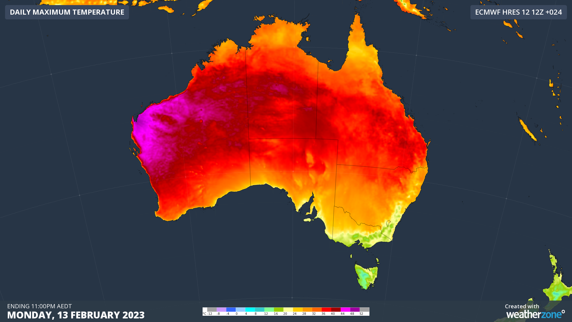
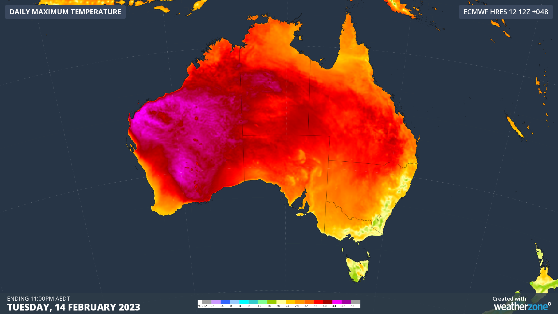
Images: Forecast daily maximum temperature between Monday and Thursday this week, according to the ECMWF-HRES model.

With a mix of dangerous weather on the cards across Australia this week, be sure to stay up to date with the latest forecasts and warnings in your area. To find out more about our weather services, please visit our business website or email us at apac.sales@dtn.com.


Latest news

Satisfy your weather obsession with these news headlines from around the nation, and the world.

Habagat and successive typhoons trigger widespread flooding in the Philippines

Three consecutive weeks of enhanced southwest monsoon (Habagat) and back-to-back typhoons have flooded Luzon and the Visayas, grounding flights, triggering distribution power outages, cutting off transport corridors, and raising landslide risk across mining-dense provinces like Benguet and the Cordillera. The disruption is far from over with PAGASA expecting the monsoon to remain in place until […]

Australia’s Spring 2026 Bushfire Outlook: Increased Risk Across Seven States and Territories

Fire agencies, land managers and businesses are being urged to prepare as the AFAC spring seasonal bushfire outlook, released on August 19, 2026, warns of elevated bushfire risk across Australia this season. The outlook identifies above-average fire danger across seven states and territories, with conditions driven by a combination of elevated fuel loads, an El Niño […]

Businesses under pressure: how this powerful high will affect Australian industries

A very strong high pressure system centred over Tasmania will impact southern and eastern Australia’s weather over the coming days. How strong is this high pressure system? Mean Sea Level Pressure (MSLP) has already reached 1039.3 hPa at Ouse, Tasmania on Sunday morning, and is forecast to peak at 1041 or 1042 hPa on Monday […]

Northwest Cloudband looms despite sunny and dry outlook

A thick cloudband will stretch thousands of kilometres next week from the warm tropical waters off northwest Australia to southeastern Australia, bringing rain and low solar output despite a sunny, dry seasonal outlook.   The cloudy week may come as a surprise given the warm, dry, and sunny climate drivers currently in play – a very strong El Niño and a […]