
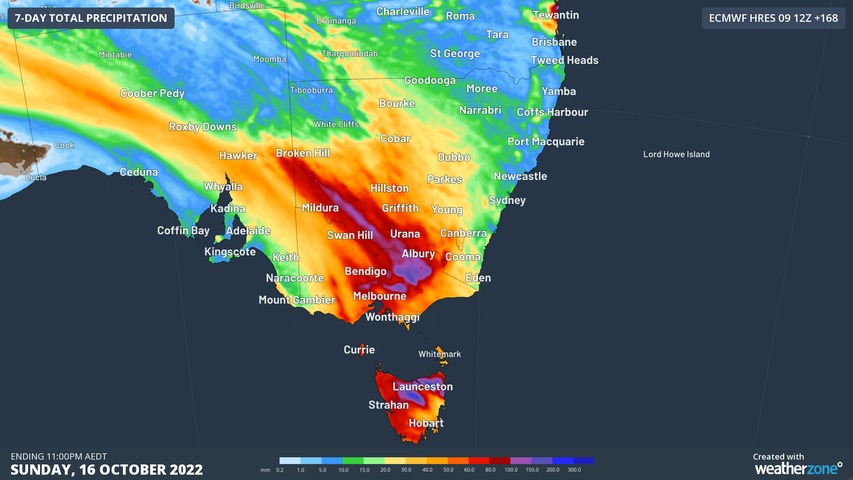
A heavy rainband will soak already sodden states in southeastern Australia during the middle of this week, with flooding likely in parts of Victoria and Tasmania.
A cold front and associated low pressure trough interacting with a stream of tropical moisture will cause a band of thick cloud and rain to spread across southeastern Australia between Wednesday and Friday.
Rain will start to increase over parts of SA, Vic, Tas and southwest NSW on Wednesday as a northwest cloudband becomes established along the front and trough.
This rain will intensify and spread further east on Thursday into Friday, as a cold pool of upper-level air travelling up from the Bight causes the atmosphere to destabilise.
This system will cause three days of rain and some thunderstorms over a broad area of southeastern Australia, impacting parts of SA, Tas, Vic, NSW, the ACT and southern Qld.
However, the heaviest falls are likely to occur on Thursday into early Friday morning over parts of central and eastern Vic and northern Tas, where some places could see 100 to 200 mm within 24 hours. Severe thunderstorms are also possible in western NSW and southwest Qld on Thursday.
The map below shows how much rain one computer model is predicting this week, with most of this falling between Wednesday and Friday.
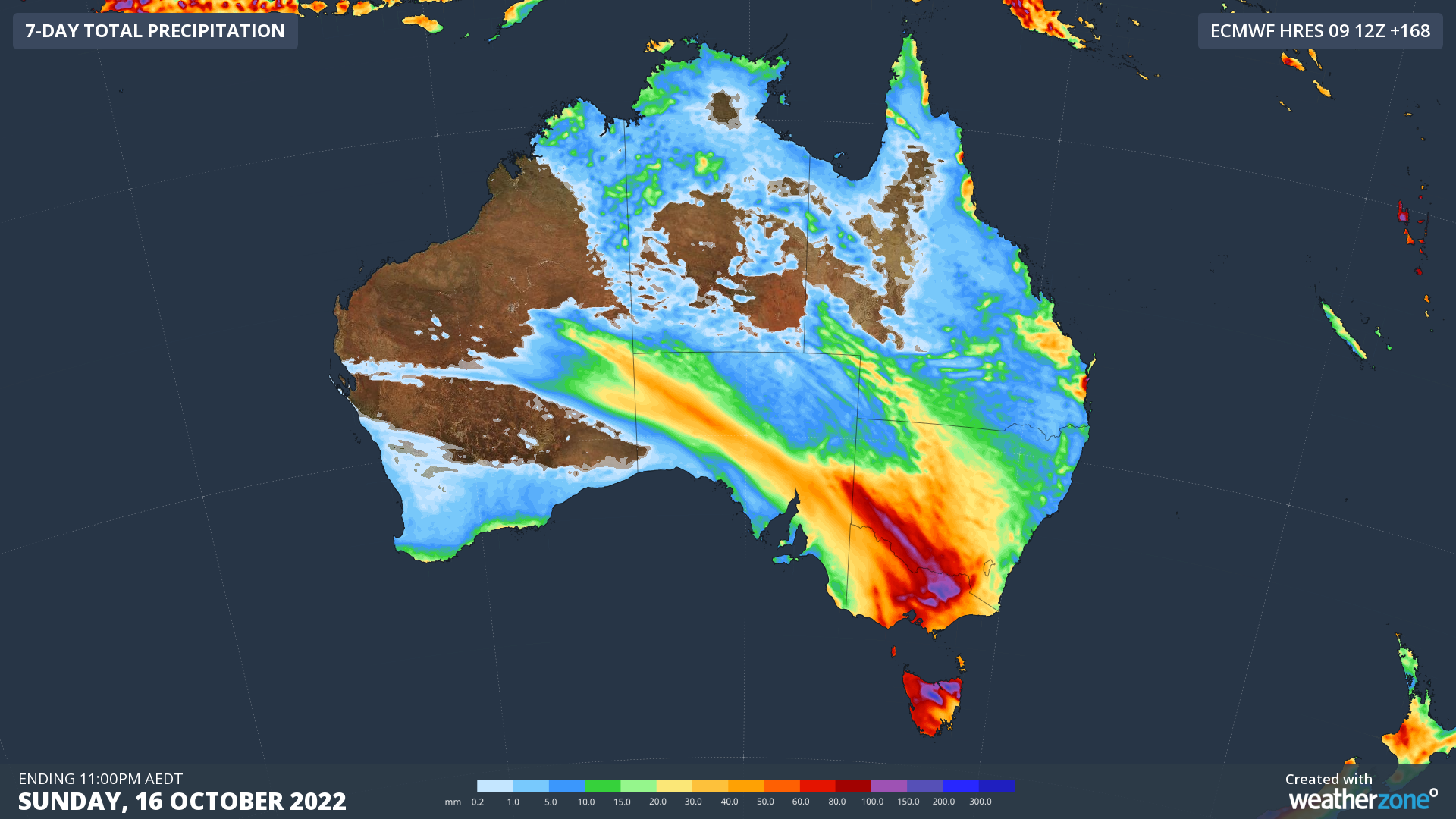
Image: Forecast accumulated rain over Australia this week according to the ECMWF-HRES model.
There is still some uncertainty regarding exactly where and how much rain will fall, although all of the main global forecast models are anticipating heavy rain in parts of Tas and Vic in the middle of this week.
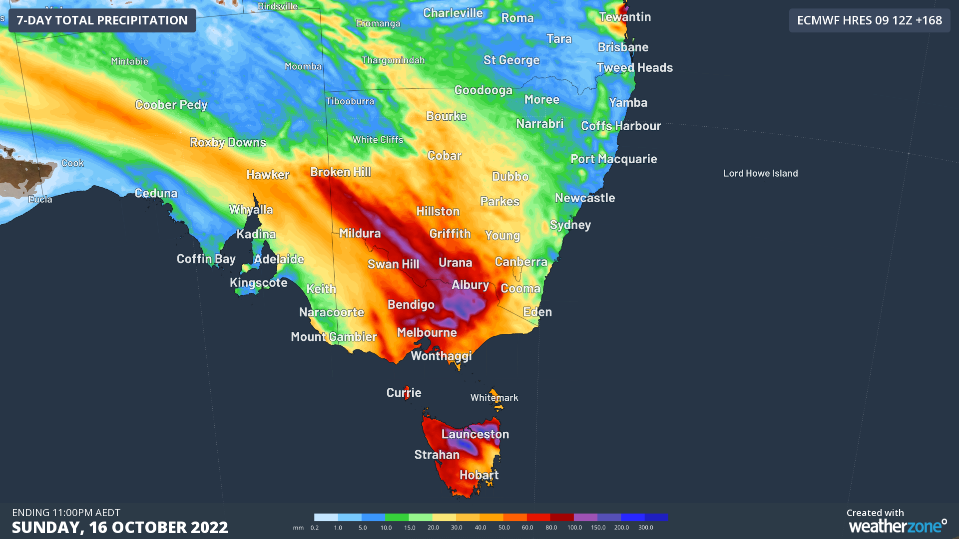
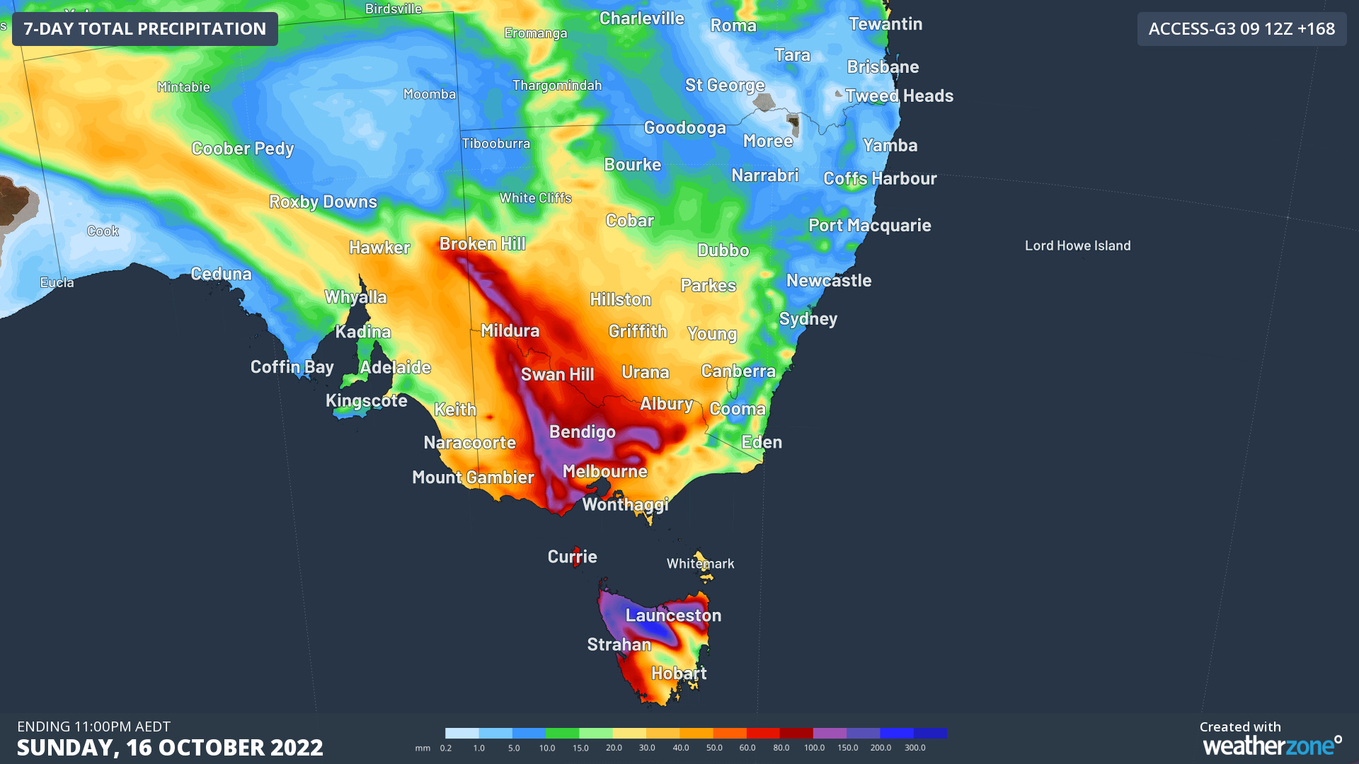
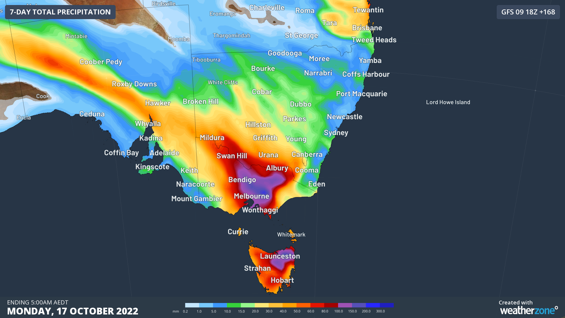
Images: Forecast accumulated rain this week, according to the ECMWF (top), ACCESS-G (middle) and GFS (bottom) models.
With river catchments already saturated from recent rainfall, this week’s rain is likely to cause flooding in several states, particularly Vic and Tas. Be sure to check the latest forecasts and warnings in your area over the coming week. For more information on Weatherzone’s heavy rainfall and alerting, please contact us at apac.sales@dtn.com.




