
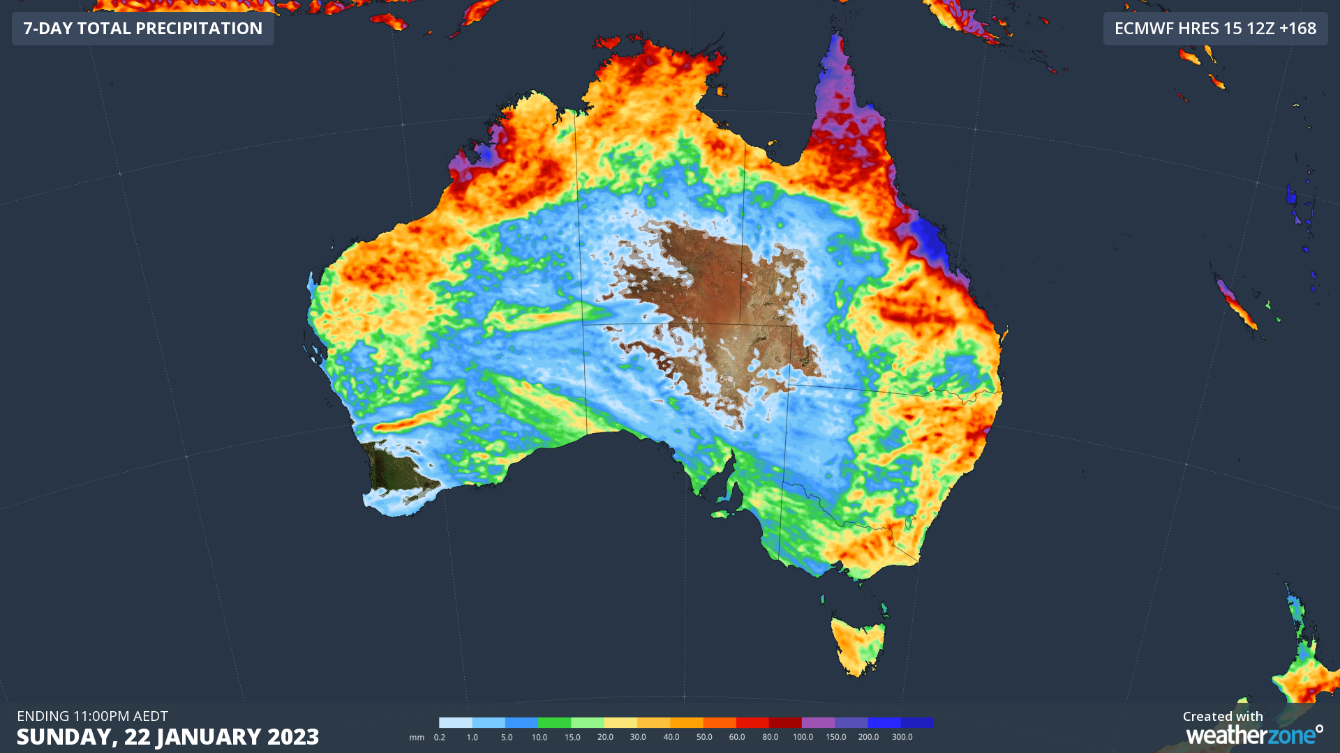
Australia is in for a dynamic mix of summer weather this week, with flooding rain continuing in Queensland, dangerous thunderstorms to replace intense heat in the south, and an increasing risk of tropical cyclone development in the Coral Sea.
Rain in every state
The map below paints a clear picture of how this week will unfold, with rain likely in part of every state and territory and a few pockets of heavy rain in Qld and WA.
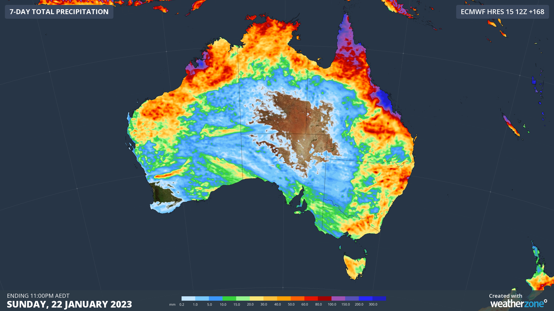
Image: Forecast accumulated precipitation during the 7 days ending at 11pm AEDT on Sunday, January 22, 2023.
One of the standout areas on the map above is central eastern Qld, where more than 500 mm of rain has already fallen over the past few days and another 500 mm could fall in the first half of this week. The map below shows the rain predicted by one model over just the next three days (Monday to Wednesday).
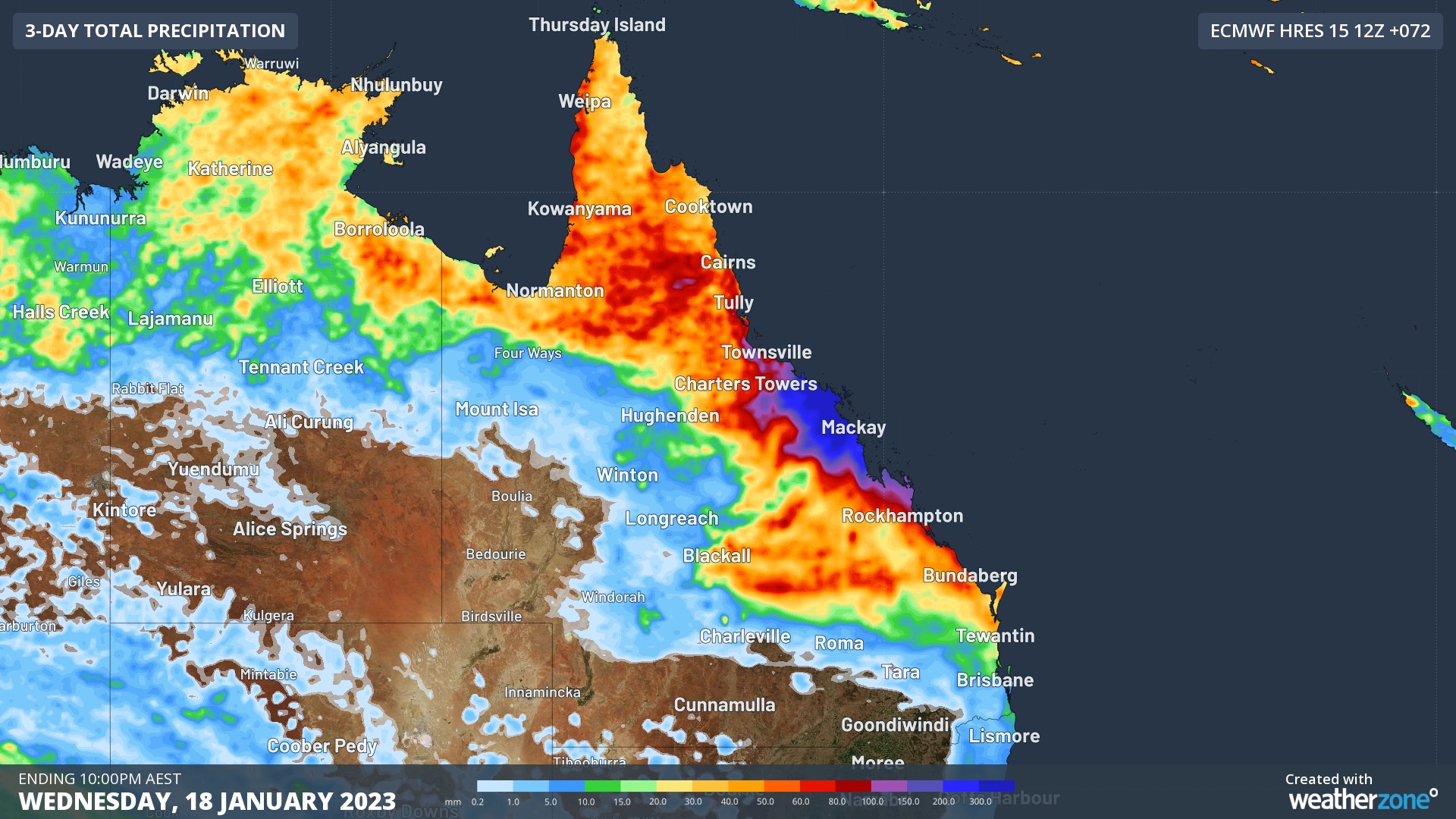
Image: Forecast accumulated precipitation during the 3 days ending at 10pm AEST on Wednesday, January 18, 2023.
Even in central eastern Qld, where rivers can cope with huge inflows from intense rainfall, collecting more than one metre of rain within a week is dangerous. This prolonged period of heavy rain will cause flash and riverine flooding that will be dangerous for people and infrastructure in the region. Numerous flood warnings, flood watches and severe weather warnings have been issued for this system.
Hot in the south
Looking further south, the start of this week will be hot and sweaty in large areas of southern and southeastern Australia, as hot air is drawn down from the Interior ahead of an approaching cold front.
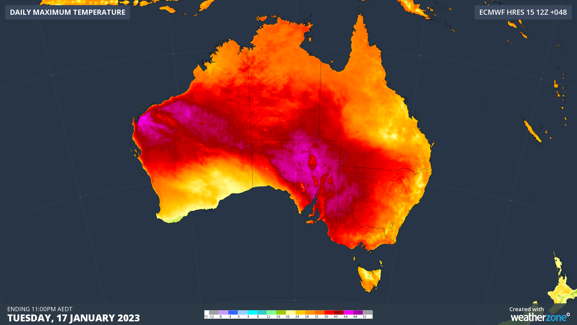
Image: Forecast maximum surface air temperature on Tuesday, January 17, according to the ECMWF-HRES model.
Temperatures are likely to reach the mid-to-high thirties in Adelaide and Melbourne on Tuesday and could also hit the low-thirties in Hobart, Canberra and Sydney on Tuesday or Wednesday. This week could feature Sydney’s first day over 30ºC since February 2021, which would end the city’s second longest stretch without a 30ºC day in records dating back to 1859.
Stormy change in the south and southeast
Southern Australia’s hot start to the week will take a stormy turn when a cold front and associated trough bring clouds, rain and thunderstorms through the middle of the week.
Rain and storms could affect parts of WA, SA, Vic, Tas, NSW, the ACT and southern Qld between Tuesday and Friday, with severe thunderstorms possible in several states.
Tuesday afternoon and night will be particularly dangerous in parts of SA, Vic and southwest NSW, when some models suggest a squall line may develop ahead of the approaching front. As this system moves further north and east, dangerous storms could also move into Canberra on Wednesday and Sydney Wednesday night.
Staying active in the tropics
Rain and thunderstorms will continue over northern parts of Qld, the NT and WA during the first half of this week as a broad low pressure trough lingers over northern Australia. This rain and storm activity will become more widespread over WA in the middle of the week as tropical moisture feeds into a deepening trough near the nation’s west coast.
There are also early signs that one or more tropical lows could develop over Coral Sea towards the end of this week. While it’s too early to know how any of these lows will behave just yet, there is an increased risk of tropical cyclone development in and around the Coral Sea from about Thursday onwards.
DTN APAC provides a variety of weather of forecasting alerting (including all those mentioned in this article) to help your business prepare for extreme weather and know when it is safe. To find out more about our products and services, please email us at apac.sales@dtn.com.




