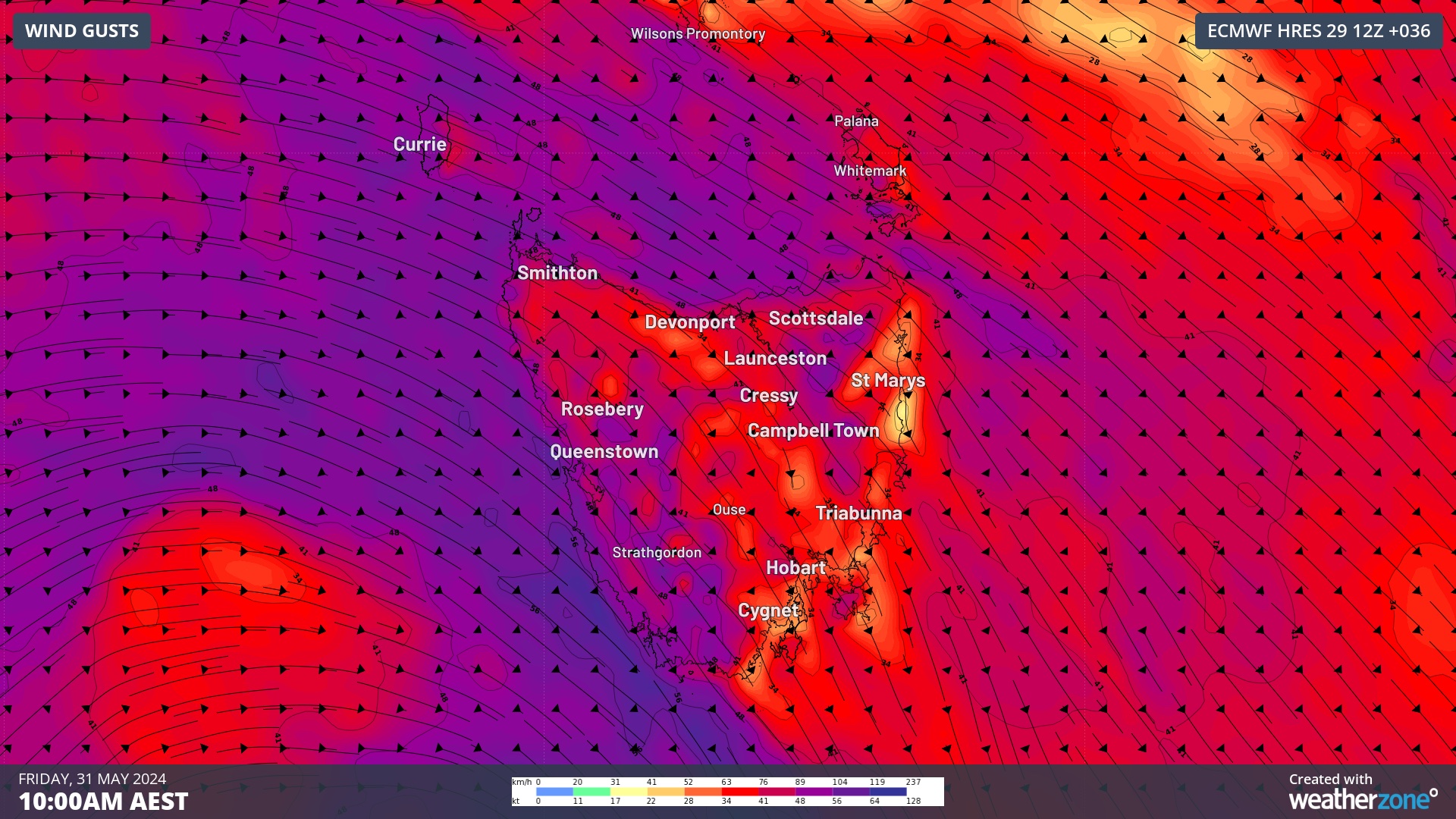
A severe weather warning has been issued for damaging winds across all 11 weather districts in Tasmania on Friday, with dangerous gusts also likely in parts of Victoria, NSW and the ACT over the next two days.
A strong cold front will cross southeastern Australia on Thursday and Friday, with an associated low pressure system passing to the south of Tasmania on Friday. This front and low will cause a burst of damaging winds, heavy rain and a substantial drop in temperature.
North to northwesterly winds will strengthen over southeastern Australia on Thursday ahead of the approaching cold front. Wind will then tend more westerly on Friday under the influence of the low pressure system passing to the south of Tas.
Damaging wind gusts are likely to develop over elevated areas of southern NSW, the ACT and Vic from Thursday into Friday. Damaging gusts are also possible in every district in Tas on Friday as the low barrels past the state.
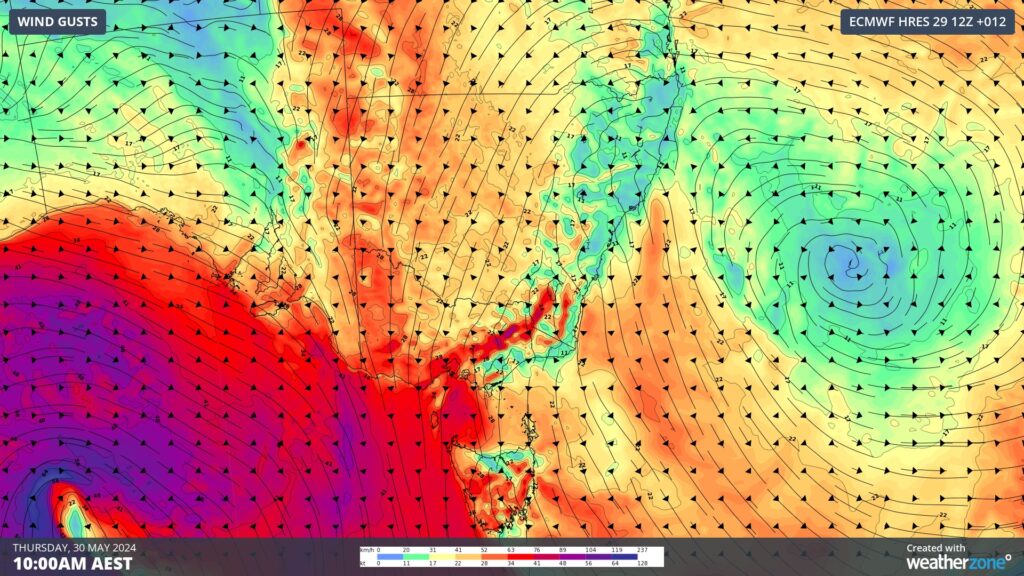
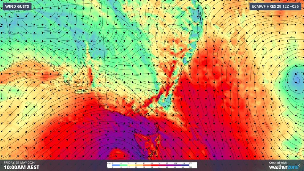
Images: Forecast wind gusts at 10am AEST on Thursday (top) and Friday (bottom) according to the ECMWF-HRES model.
As of 2pm AEST on Thursday, gusts had already exceeded 100 km/h in Vic and NSW, including:
- 122 km/h at Mount William at 7:41am
- 115 km/h at Thredbo Top Station at 12:11pm
- 109 km/h at Mount Hotham at 9:57am
- 106 km/h at Mount Buller at 7:55am
In addition to the wind, a large northwest cloudband associated with this system will produce widespread rain over southeastern Australia from Thursday into the weekend.
The map below shows how much rain one computer model is predicting across Australia’s southeast between Thursday and Saturday combined.
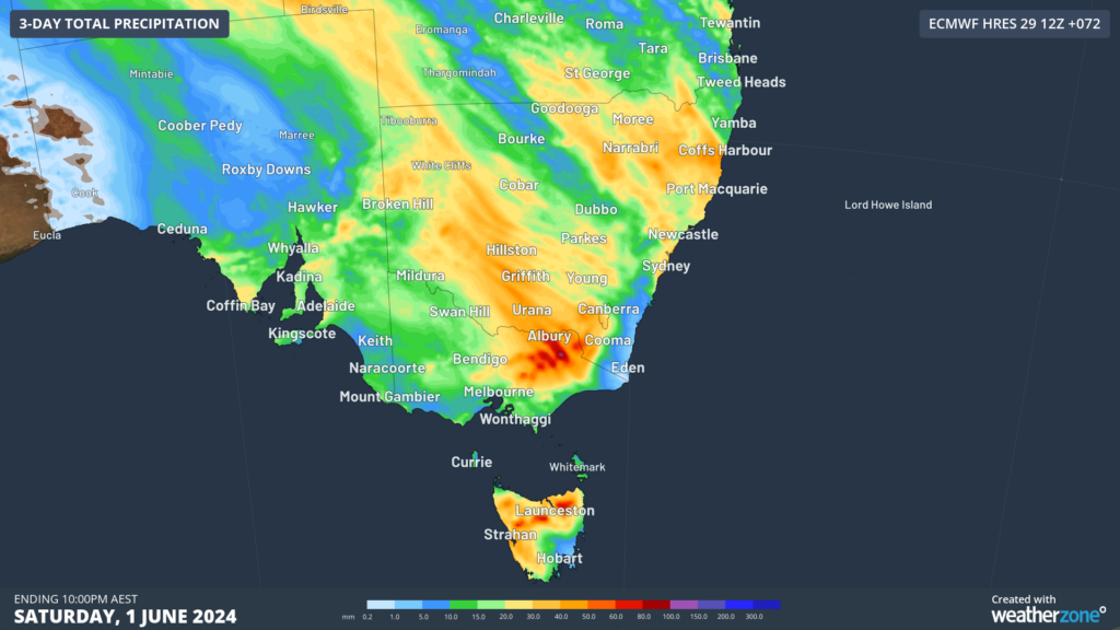
Image: Forecast accumulated rain from Thursday May 30 to Saturday June 1, according to the ECMWF-HRES model.
The heaviest rain over the next 48 hours is expected to fall over the ranges in northeast Vic, where six-hourly totals may reach 60 to 80 mm on Thursday evening into Friday morning.
There is also potential a separate low pressure system to cause heavy rain, damaging winds and damaging surf somewhere in eastern NSW, eastern Vic or eastern Tas from this weekend into early next week. However, it’s too early to know where and how strong this low pressure system will be.
More accurate information about this low and its impacts will be available from Saturday onwards. Be sure to keep up to date with the latest forecasts, warnings and Weatherzone news stories for updated information on the weekend and early next week.


