
Southeastern Australia is basking in another day of balmy autumnal weather, but this will end abruptly with winter arriving a day early.
This dramatic temperature contrast is being caused by a strong cold front which is expected to march across southeastern Australia during the next 48 hours.
The image below shows the cold front and associated thick cloud band sweeping across SA on Thursday afternoon. The satellite image above also shows a large region of speckled cloud in the Bight and Southern Ocean behind this cold front.
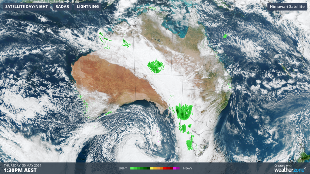
Image: Himawari-9 satellite image at 1:30pm AEST on Thursday, May 30
This broad area of speckled cloud is a tell-tale sign that a large mass of cold polar air has broken away from the Antarctic region and is venturing into the relatively warm mid-latitudes.
Ahead of this cold front the eastern states have been experiencing pleasant autumnal conditions, as warm northerly winds flow over the region. While behind the cold front, the southeast will experience cool wintry weather, which will feel cooler with strong winds.
These northerly winds caused Melbourne’s overnight temperature to be warmer than Brisbane’s on Thursday night. Melbourne only cooled to 15.5°C, while Brisbane dipped to 15.2°C.
After a warmer than average night, Melbourne’s daytime temperature will climb to about 21°C on Thursday afternoon. Meanwhile the mercury in Sydney and Brisbane should reach about 24°C.
As of 1:40pm Hobart’s temperature has reached 21.1°C, which is its warmest day this late in the financial year for 139 years.
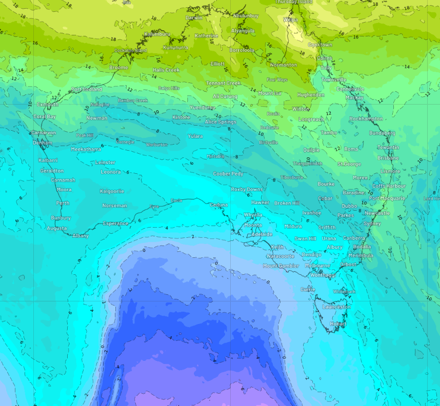
The image below shows the forecast air temperatures around 1.5km above sea level on Friday afternoon, revealing how warm air in the middle of the week will be replaced with a much colder wintry air mass from Friday.
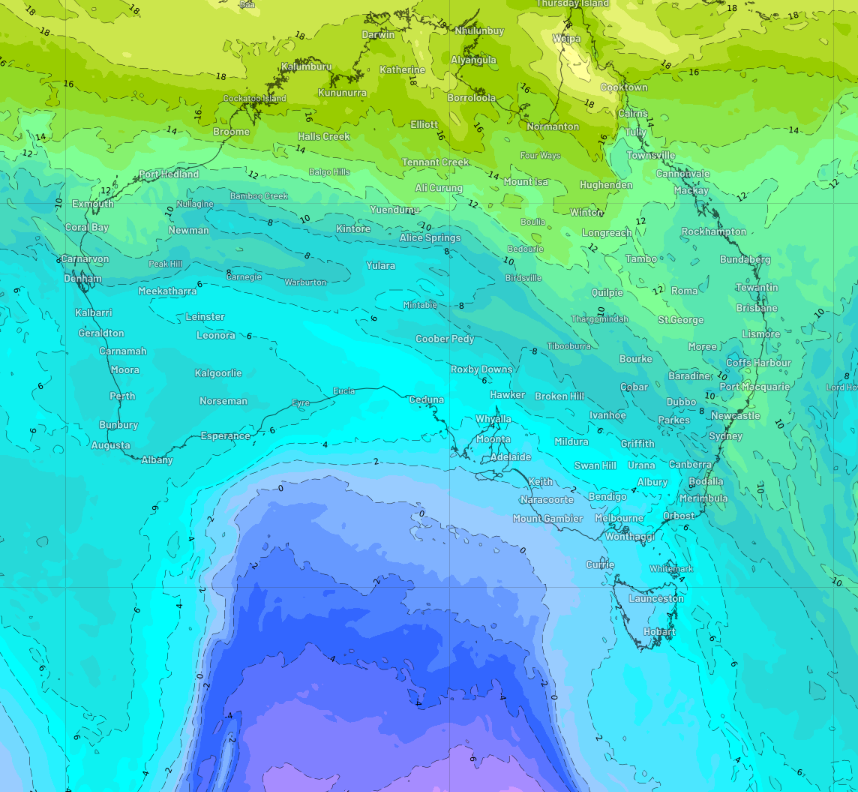
Image: 850 hPa temperature forecast at 1pm AEST on Friday, May 31, according to ECMWF
This Antarctic air will cause temperatures to plummet to 2-5°C below average for several days across much of the southeast.
- Adelaide should see a run of 4 days with temperatures only reaching 16-17°C, before temperatures plummet further mid next week as another cold airmass moves through.
- Melbourne’s maximum temperatures will drop to around 14-16°C for at least six days from Friday.
- Hobart’s daytime temperature will only reach 13-15°C from Saturday.
- Sydney’s maximum temperatures will drop from the mid 20s to the high teens from Sunday.
Most capital cities should experience some very cool nights as the cool air mass creeps across the states.
- Adelaide’s minimum temperatures will be around 5°C below average for three nights beginning Friday.
- Melbourne’s overnight temperature will drop to around 7°C on Friday and Saturday night.
- Saturday night should be particularly cold for Hobart with the temperature dropping to around 5°C.
- Frost is forecast in Canberra Friday night, chilling to around 0°C.
- Sydney and Brisbane will see some cool overnight temperatures early to mid-next week, with the temperature forecast to drop to 10°C.
This cool air mass will be accompanied by strong winds which will make these temperatures feel much cooler. As of 2pm AEST on Thursday, damaging wind warnings are current for parts of Vic, Tas, NSW and the ACT. Please keep an eye out for the latest warnings.
Weatherzone Business has grown to become the outright leader within the Australian energy market, serving wind, solar, hydro, trading, utilities and network companies.
You can’t control the weather, but you can gain precision insights to optimise your response. What lights us up is providing your energy business with tailored weather information to reduce your risk and keep you moving ahead of the curve.
Our services cover all aspects – from wind and solar generation to demand forecasts, wholesale markets to retail so, no matter where your company sits, we have solutions for you. We have worked closely with market participants to create products that meet the evolving needs of the sector, aiming to increase safety and profitability for our customers.
Benefit from the timely delivery of accurate weather information, allowing informed and effective decision-making. To find out more, please contact us.




