

A rare meteorological phenomenon caused parts of southeastern Australia to shiver through their lowest May temperatures in years over the last 24 hours.
The satellite images below show a low pressure system spinning over the Tasman Sea on Monday morning. Over the past 24 hours, this low and an associated cold front caused a wintry mix of rain, snow, hail, blustery winds and large waves in parts of southeastern Australia.
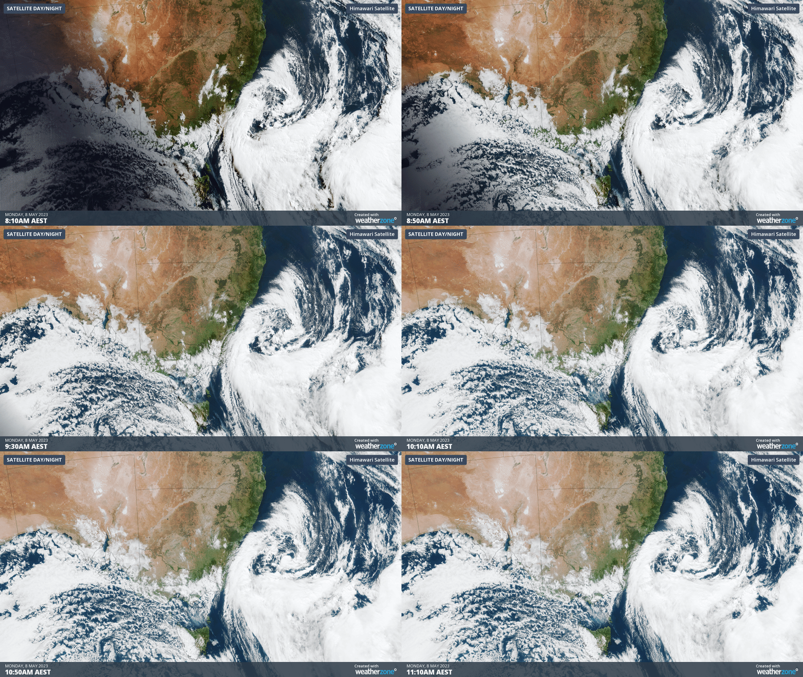
While low pressure systems over the Tasman Sea are not uncommon at this time of year, this one caused a unique set of conditions that resulted in unusually low temperatures, and snow levels, for this early in autumn.

Image: Is it winter already? Alpacas caught out in the cold at Michelago, NSW on Sunday, May 7. Source: @k_farm_aus / Instagram
The combination of cold southerly winds near the surface and abundant moisture in the middle and low levels of the atmosphere allowed a phenomenon known as the ‘melting effect’ to occur above parts of eastern Vic, eastern NSW and the ACT on Sunday.
The melting effect occurs when snow falls into a layer of saturated air that is above 0ºC, which causes the falling snow to melt into liquid drops of rain, without evaporating. If this process is allowed to persist in the absence of evaporation, the surrounding atmosphere becomes progressively cooler, causing the snow level to gradually become lower.

Image: Snow on the Bogong High Plains, Vic on Sunday. Source: @mtbeautytransfers / Instagram
As predicted late last week by Jess Miskelly, the melting effect caused snow to reach low levels in eastern Vic, southern NSW and the ACT on Sunday, with reports of snow to around 600 to 700 metre above sea level. There was also a good dusting of snow on the Oberon Plateau in central NSW.
While Canberra didn’t see any snowflakes in the city on Sunday, there was plenty of snow on the ranges to the west of the city and Belconnen copped a thick accumulation of small hail.


Images: Small hail blanketing the ground in Belconnen, ACT on Sunday. Source: @nicflowers1111 / Instagram (top image) and @canberrathroughthelens / Instagram (bottom image)
Canberra’s highest temperature on Sunday was 7.8ºC around lunchtime, which is the city’s lowest May maximum temperature in 23 years. Rain then cooled the city to 4ºC by 3pm.
Further north, Sydney experienced a rapid temperature drop on Sunday night as cold rain poured over the city. The minimum temperature of 7.1ºC at 10:36pm on Sunday was Sydney’s equal lowest May temperature since 1999, and its lowest temperature this early in autumn for 85 years.
Even Brisbane saw a bit of small hail as the cold front swept across southeast Qld late on Sunday afternoon.
Looking ahead, calmer weather will return to southeastern Australia from Monday into Tuesday as the low pressure system moves offshore into the Tasman Sea. However, the return of clear skies and lighter winds will cause frigid overnight temperatures, with frost likely to affect large areas of Qld, NSW and the ACT on Tuesday morning.
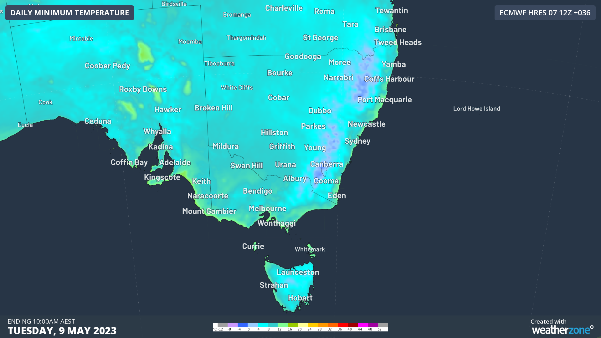
Image: Forecast minimum temperatures for Monday night into Tuesday morning, according to the ECMWF model.
To find out about DTN APAC and our temperature forecasts, please visit our website or email us at apac.sales@dtn.com.




