Severe Tropical Cyclone Darian has become Australia’s earliest category 5 system in December since Tropical Cyclone Lawrence in 2009, with wind gusts up to 285km/h.
Darian has been steadily intensifying over the last few days, but thanks to some slightly warmer water (a tropical cyclone’s fuel source), it pushed up the scale from category 4 to a category 5 this morning.
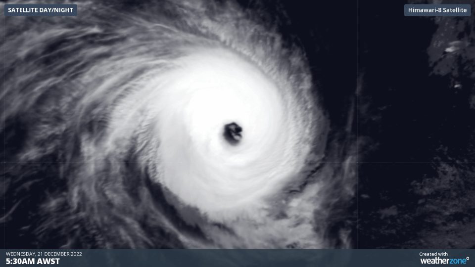
As seen in the satellite image below, Darian has an aesthetically pleasing radial symmetry, with a broad and clear eye at its centre.

 Image: Severe Tropical Cyclone Darian seen from infrared (top) and visual (bottom) from Himiwari-9. Note there is some low cloud in the eye that appears dark in the infrared but is white in the visible.
This symmetry is thanks to an intensification process known as an eyewall replacement cycle. This occurs when the centre eye gets surrounded by a larger eye that eventually takes over. For several hours while this process happens, the tropical cyclone will temporarily lose a lot of strength and become stretched and wonky. However, after the process has finished the tropical cyclone is larger, stronger and more symmetrical.
The last category 5 tropical cyclone recorded in Australia’s area of responsibility this early in the season was Severe Tropical Cyclone Lawrence in 2009. Unlike Darian, Lawrence developed very close to the Australian coast, making landfall near Eighty Mile Beach in Western Australia on 21st December 2009. Mandora recorded a wind gust to 211 km/h during landfall, but it likely produced gusts of 285km/h at its peak.
Fortunately, Darian is near the western edge of Australia’s area of responsibility and is well away from the Australian mainland, and the Cocos (Keeling) Islands. It is expected to move west of 90E and out of the Australian area of responsibility later on Wednesday night.
You can find the track and latest advice information of Darian and any future tropical cyclone here. To find out more about our tropical cyclone forecast and alerting services, please email us at apac.sales@dtn.com.


