
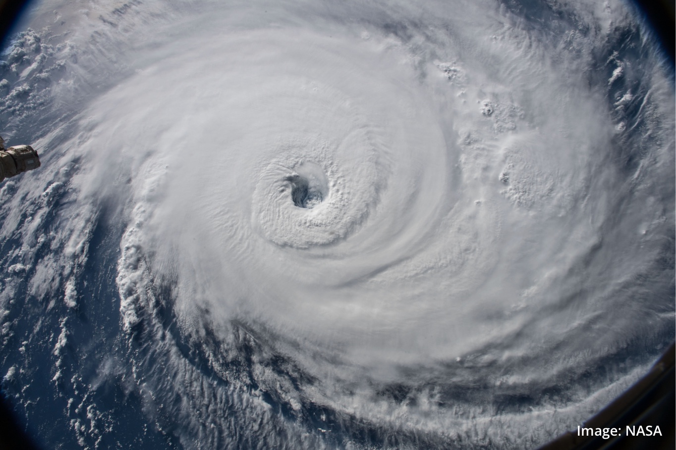
The 2022-23 Australian tropical cyclone season has officially started, and all signs point towards an above average cyclone season in the Australian region over the next six months.
The Australian cyclone season runs from November to April. During this six-month period, we usually see around 9 to 10 tropical cyclones forming inside Australia’s area of responsibility and about four of those make landfall.
This season, several broad-scale climate drivers will influence the behaviour of tropical cyclones near Australia:
- La Niña is expected to linger until early 2023, which should maintain above-average sea surface temperatures near northern Australia. Australia typically sees more tropical cyclone activity and an earlier first coastal crossing during La Niña periods.
- A negative Indian Ocean Dipole (IOD) will also persist in November and possibly extend into early December. Warmer-than-average water to the northwest of Australia during negative IOD periods increases the likelihood of early-season tropical cyclones.
- Sea Surface Temperatures are well above average for this time of year, particularly off the NT and Qld coasts, with some parts as much as 3.5ºC above normal. This makes an earlier start to the tropical season more likely and makes severe tropical cyclones a higher chance.
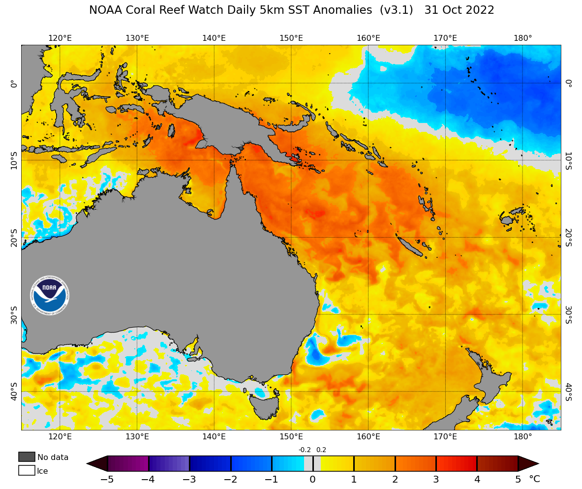
Image: Sea surface temperature anomalies near northern and eastern Australia on October 31, 2022. Source: NOAA Coral Reef Watch.
With these climate drivers and warm ocean temperatures in play, Australia is likely to see a near or above average number of tropical cyclones during the 2022-23 season. La Niña can also make the first coastal crossing happen earlier than usual. The season’s first landfall typically occurs around mid-December under La Niña, which is a few weeks earlier than normal.
Weatherzone is predicting around 12 tropical cyclones in the Australian region during the 2022-23 season, with an above-average number of cyclones in the Eastern and Western regions and a near-average number in the Northern Region.
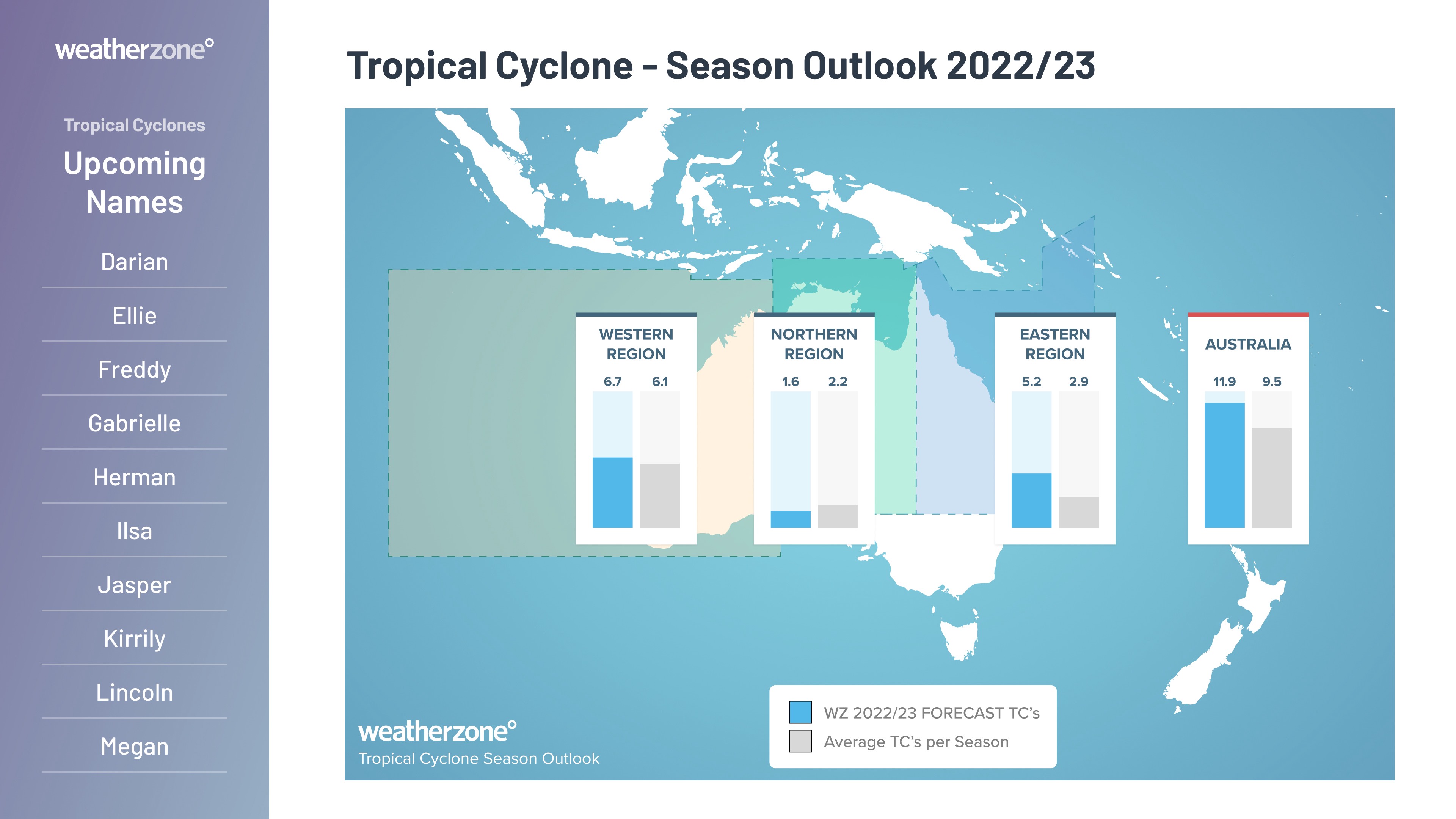
Image: Tropical cyclone season outlook for 2022-23. Note that the predicted number of tropical cyclones shown for each individual region includes both the systems that form inside that region and systems that move into that region.
No two seasons are the same
It’s important to point out that there can be a lot of year-to-year variability in tropical cyclone activity near Australia.
In the past four tropical cyclone seasons we have seen 8 to 9 tropical cyclones in the Australian region between April and November. But in 2017-18 there were 11 and in 2015-16 there were only three.
There has also been a noticeable downward trend in tropical cyclone numbers in the Australian region in recent decades. This applies to both severe and non-severe tropical cyclones.
The average number of tropical cyclones per season in the Australian region during the 30-year period from 1981-2010 was about 11.
The average number of tropical cyclones per season in the Australian region during the 30-year period from 1991-2020 was around 9.
Weatherzone Services
DTN APAC provides tropical cyclone forecasts at every level to provide your business with the most forewarning of impacts. These occur at 4 levels:
- Tropical Cyclone season outlook – a fly through of what to expect for the upcoming season
- Weekly Tropical Note – a look at the Madden-Julian Oscillation and its impacts on Australia over the next 3-4 weeks.
- Daily Tropical Cyclone Forecast – The chance of a tropical cyclone being active in one of Australia’s 3 regions in the next week.
- Detailed Tropical Cyclone Advisories – A personalised forecast on how and when a particular system will impact your assets
These forecasts are always aligned with the Bureau of Meteorology’s official warnings and forecast where available. To hear more about our Tropical Cyclone services, please email us at apac.sales@dtn.com.




