An active pulse of the Madden-Julian Oscillation will increase the risk of tropical cyclones and thunderstorms in the Australian region over the coming week.
The Madden-Julian Oscillation (MJO) refers to a pulse of increased tropical cloud, rainfall and thunderstorm activity that moves through our planet’s atmosphere, from west to east, near the equator. The MJO alternates between active and inactive phases and typically passes to the north of Australia once every 30 to 60 days on average.
.gif)
An active phase of the MJO is currently entering the Maritime Continent, which is the large region to the north of Australia encompassing the Philippines, Malaysia, Indonesia, Papua New Guinea and the surrounding seas.
The Maritime Continent is home to some of the warmest seas on Earth, and when they combine with an active MJO pulse, it can produce prolific thunderstorm activity.
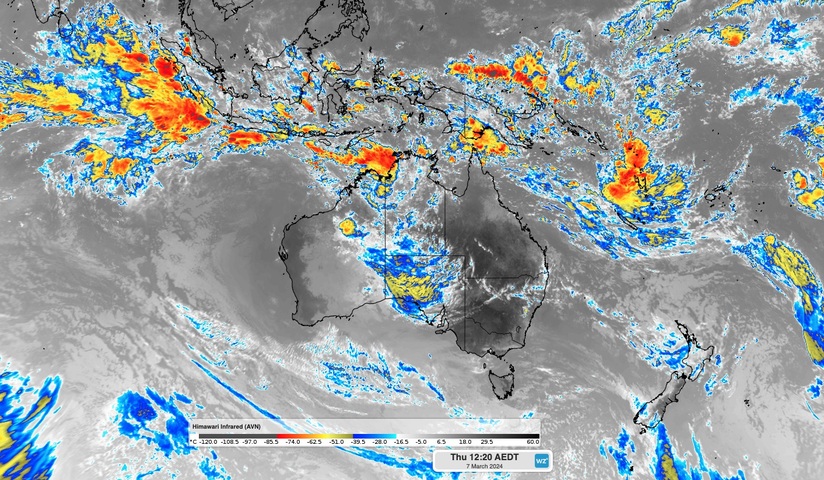
Thunderstorm activity has already started to erupt to the north and northwest of Australia under the influence of the current MJO pulse and a developing monsoon. The enhanced infrared satellite images below show widespread storm activity extending from northern Australia up to the Maritime Continent and out into the tropical Indian Ocean on Thursday morning.
An active pulse of the Madden-Julian Oscillation will increase the risk of #tropicalcyclones and #thunderstorms in the Australian region over the coming week.
More at https://t.co/FPhuh6yPrL pic.twitter.com/LV2h8qxIgg
— Weatherzone (@weatherzone) March 7, 2024
Video: Enhanced infrared Himawari-9 satellite images.
The increased storm activity over the Australian region this week is delivering some much-needed rainfall and heat relief in WA, following the state’s hottest summer on record.
The active MJO will also increase the likelihood that tropical cyclone could develop over Australian waters over the coming week. This is because the storms associated with the MJO can act as a breeding ground for the tropical low pressure systems that are necessary for tropical cyclone development.
Unsurprisingly, numerous forecast models are predicting the development of tropical lows or tropical cyclones in the Australian region over the coming week.
The map below shows the forecast accumulated 24-hour rainfall and mean sea level pressure on Tuesday, February 12, with one or more areas of low pressure being predicted off the northwest coast of Australia early next week.
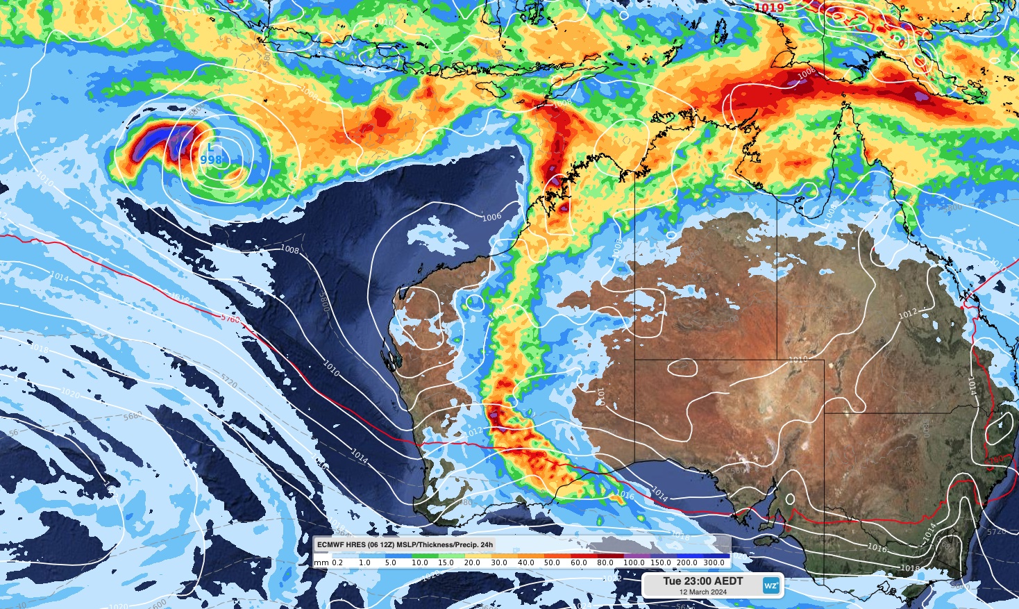
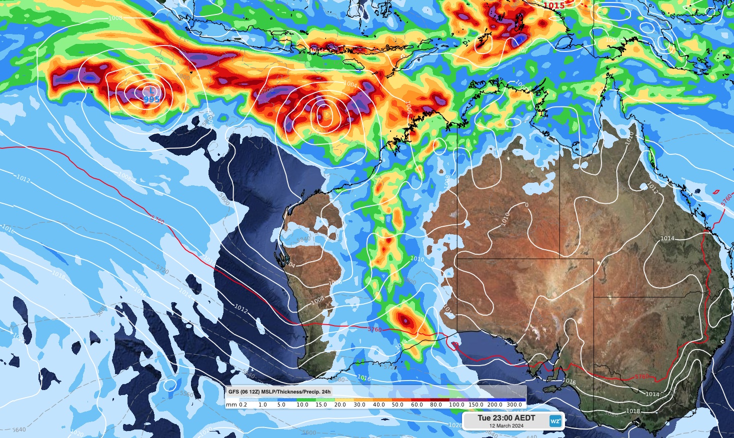
Images: Forecast 24-hour accumulated rainfall and mean sea level pressure at 11pm AEDT on Tuesday, February 12, according to the ECMWF (top) and GFS (bottom) models.
The Bureau of Meteorology’s 7-day tropical cyclone outlook also indicated the increasing likelihood of tropical cyclone activity to the northwest of Australia next week.
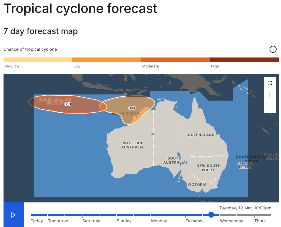
Image: The Bureau of Meteorology’s tropical cyclone outlook for Tuesday, March 12, issued at 10:45 am AEST on Thursday, March 7. A more recent outlook may be available. Source: Bureau of Meteorology
Other forecast sources are also picking up on the increased tropical cyclone potential in the Australian region next week, including the ECMWF ensemble forecast system shown below.
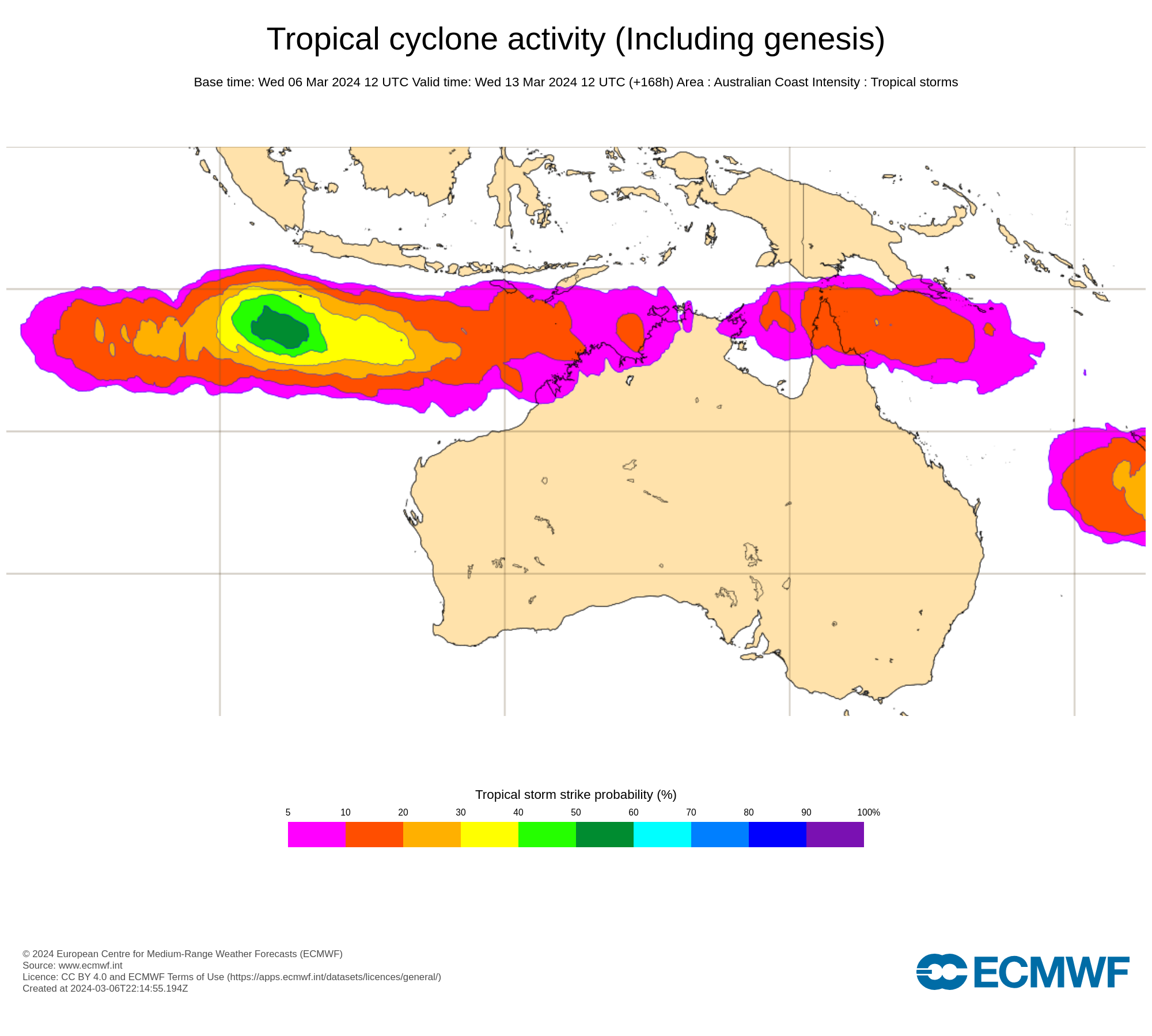
Image: Tropical cyclone strike probability for Wednesday, March 13, 2024. The colours on this map show the probability that a tropical cyclone will pass within a 300 km radius from a given location and within a time window of 48 hours.
It’s too early to know if and where tropical cyclones will form inside the Australian region over the coming 7 to 10 days. However, anyone living in northern Australia should pay close attention to the latest tropical cyclone advisories and weather warnings over the next couple of weeks.
The next three tropical cyclones to be named inside Australia’s area of responsibility will be called Megan, Neville and Olga.
DTN APAC has a suite of tropical cyclones services we provide to deliver our clients with as much forewarning of tropical cyclones as we can. We have 4 levels of forecasts timeframes:
- Tropical cyclone seasonal outlooks
- Weekly tropical update
- Daily 7-day tropical cyclone forecast
- Detailed tropical cyclone impacts (issued every 1-6 hours aligning with offical advisories)
Through these products you can have as much preparation as possible for tropical cyclones and their impacts. To find out more, please visit our website or email us at apac.sales@dtn.com.


