Australia is in for yet another wet week with heavy rainfall, severe storms and gusty winds set to impact most of the country.
A series of low pressure troughs will drag down moist tropical air from the Indian Ocean over the coming week, bringing days of flooding rain to the already sodden landscape.
The map below shows thick cloud and rain sweeping over central Australia on Tuesday morning, as a low swirls over the South Australian coast.

This system will deliver rain and storms throughout the NT, western Qld, NSW, northern Vic and SA during Tuesday and Wednesday.
The map below shows widespread falls of 20-40mm in these areas, with isolated falls of 60-80mm during the next 48 hours.

Image: Accumulated 48-hour rainfall forecast to 11pm Wednesday, October 5.
Some of the heaviest falls are expected over the Murry-Darling Basin where most rivers are already at the moderate flood level, with some areas experiencing major flooding.
After a brief reprieve a cold front will clip southwestern WA from Wednesday. This front will link up with more moisture from the north over SA on Thursday and continue to build into the weekend as it crosses eastern Australia.
Flooding rains once again look to fall over Friday, Saturday and Sunday over much of NSW, Vic and into northern Tas. Widespread falls of 30-60mm are expected, though some locations could see more than 80mm. Severe storms and gusty winds will follow the heaviest rain, particularly over SA and western Qld and NSW.

Image: 24 hour accumulated rainfall to 11am Sunday, October 9.
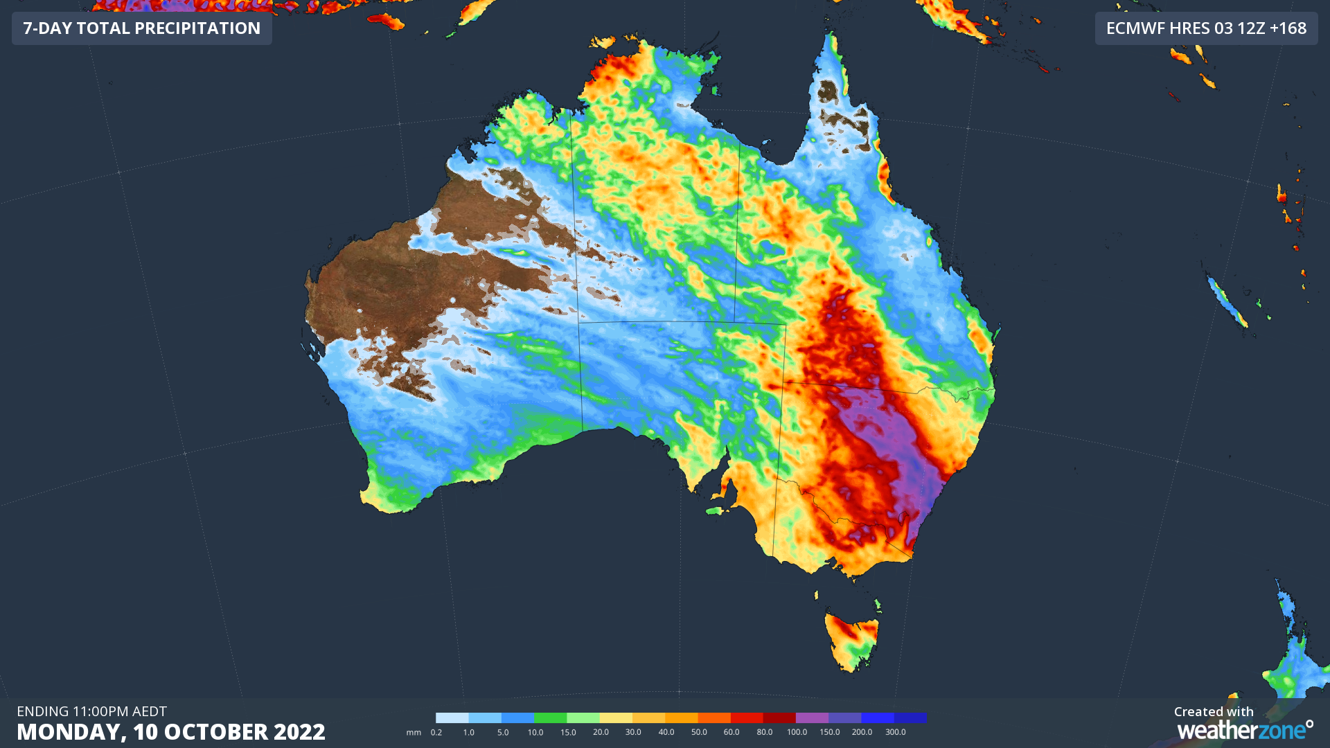
The largest rainfall totals are expected in southwest Qld, NSW, northern VIC, northern Tas and eastern SA, where some areas could exceed 100mm over the coming week.
This multi day deluge comes as moisture-laden air streams in from the north, with the negative Indian Ocean Dipole and La Niña both in full effect.

Over the coming week, rainfall is likely to lead to flood watches and warnings, as well as warnings for severe thunderstorms. Stay up to date with the latest warnings here.
For more information on Weatherzone’s heavy rainfall forecasting and alerting, please contact us at apac.sales@dtn.com.


