Prosper in a dynamic world
Search

Another deluge continues Sydney’s record wet year


An exceptionally wet start to July that produced 1.5 months’ rain in just four days has continued Sydney’s wettest year-to-date on record.

A stream of moisture-laden air feeding into a coastal trough and East Coast Low produced a lengthy spell of heavy rain over central eastern NSW during the last four days.

This multi-day soaking was further enhanced by moisture evaporating off a pool of abnormally warm water sitting off the southern half of the NSW coastline.

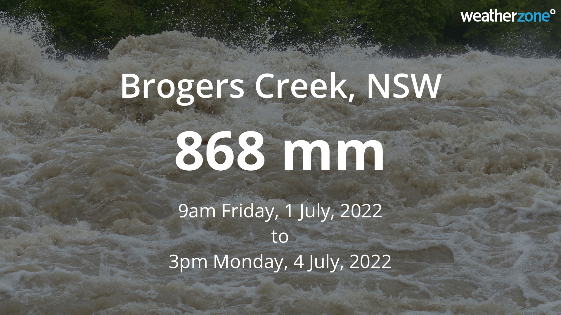
These features all combined to deliver some huge rainfall totals over the last four days, including a whopping 868 mm in 78 hours at Brogers in the Kangaroo Valley.

Further north, Sydney’s Observatory Hill weather station amassed 148.6 mm of rain during the four days ending at 9am on Monday. This is more than 1.5 times the city’s July monthly average of 96mm, and a huge turnaround from Sydney’s driest June since 1986.

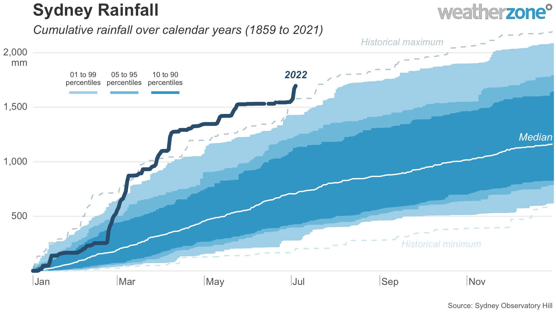
In any other year, this early-July deluge may have stood out as unusual. Not in 2022.

The 148.6mm that fell in the last four days brings Sydney’s running annual total for 2022 up to 1696mm. This is the city’s wettest year-to-date in records dating back to 1859, beating 1569mm to the same date in 1890. Impressively, this is already Sydney’s wettest year since 1990, despite only being four days into July.

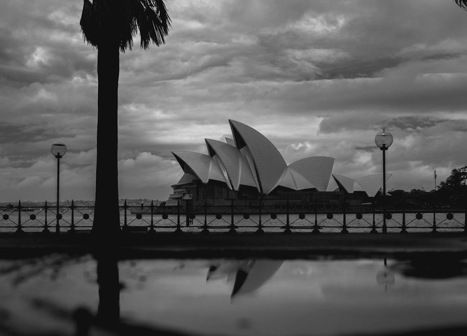
Unfortunately, this latest deluge has caused the third major flood event of the year in western Sydney, as water from a saturated landscape flows into already full rivers and dams.

The latest warnings for this ongoing flood event in NSW can be found at https://www.weatherzone.com.au/warnings. For more information, please contact us at apac.sales@dtn.com.

Latest news

Satisfy your weather obsession with these news headlines from around the nation, and the world.

DTN Dangerous Thunderstorm Alerts in action with severe thunderstorms disrupting Perth industries

Severe thunderstorms impacted southwest WA and the Perth region on Sunday, December 14, 2025, triggering Dangerous Thunderstorm Alerts (DTA) by DTN for industries and businesses in the region. DTN operates Dangerous Thunderstorm Alerts (DTA) which alert businesses and industries to thunderstorms based on intensity and movement. These alerts provide advanced notice of thunderstorms moving into […]

How Australian East Coast port and maritime operations could be disrupted by tropical cyclones over the next two weeks

Port and maritime operations across Australia’s East Coast could be disrupted by increased tropical cyclone activity in the Coral Sea and southwest Pacific Ocean over the next two weeks. Meteorologists reference a large selection of Numerical Weather Prediction (NWP) models to forecast weather. A number of these NWP models are forecasting the development of tropical […]

Extreme fire danger and severe heatwave conditions spreading across SA, Victoria and NSW

Hot, dry and windy weather causing elevated fire danger and severe heatwave conditions are sweeping across southeastern Australia over the next three days, driving high energy demand and disruption to operations. Clear skies associated a large and slow-moving high pressure system have allowed hot air to build up over parts of northern, western and central […]

Heightened bushfire risk during the 2025-26 summer for WA, Victoria and NSW in latest AFAC Outlook

The Australian and New Zealand Council for fire and emergency services (AFAC) identified western and southern WA, Victoria and inland NSW as key regions that are at risk of heightened bushfire risk this summer. Parts of Australia have experienced severe soil moisture and rainfall deficiencies over the past months and years, while high fuel loads […]