
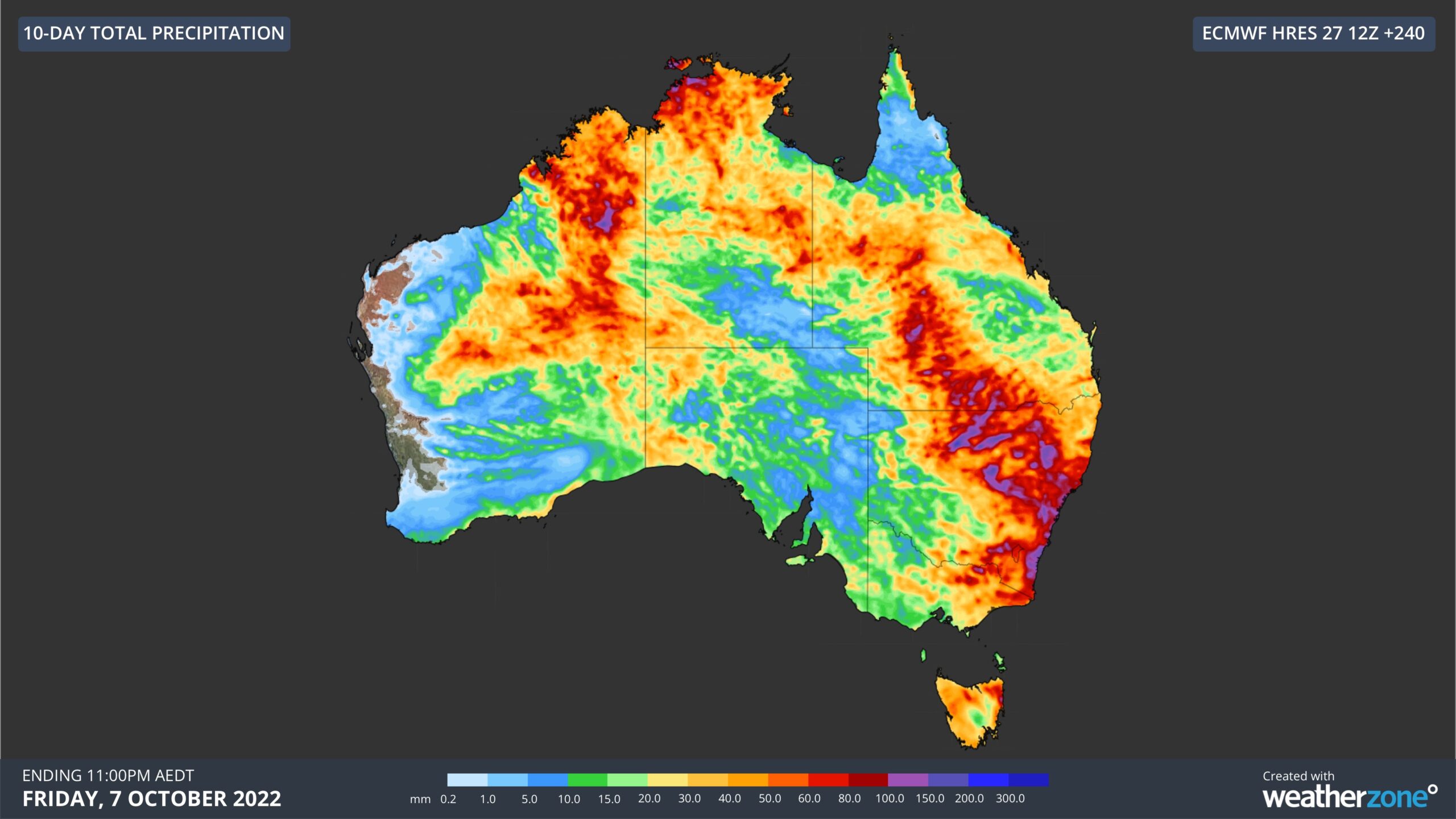
Heavy rain, thunderstorms and flooding will spread across Australia during the next 10 days, soaking part of every state and territory in the process.
Over the past few days, an upper-level cut-off low has caused showers and severe thunderstorms over parts of southeastern Australia, even spawning a funnel cloud near Deniliquin in southern NSW.
Now, another cut-off low is about to lurch over northwestern Australia and kick off a prolonged period of rain and thunderstorms that will sweep across the country during the next 10 days.
The animation below shows how the jet stream will drag moisture across Australia from west to east over the next 10 days.
Video: Composite precipitable water (coloured shading) and 300 hPa jet stream wind (white lines) during the next 10 days, according to the ACCESS-G model.
Rain and thunderstorms will initially increase over northern districts of WA and the NT on Thursday and Friday as the cut-off low interacts with a mass of tropical moisture.
This unseasonable rain will break the dry in parts of WA and the NT and may be heavy enough to cause flooding in some areas, possible affecting transport networks.
The map below shows how much rain one computer model is predicting over northwestern Australia during the next seven days. For WA, most of this rain will fall between Friday and Sunday.
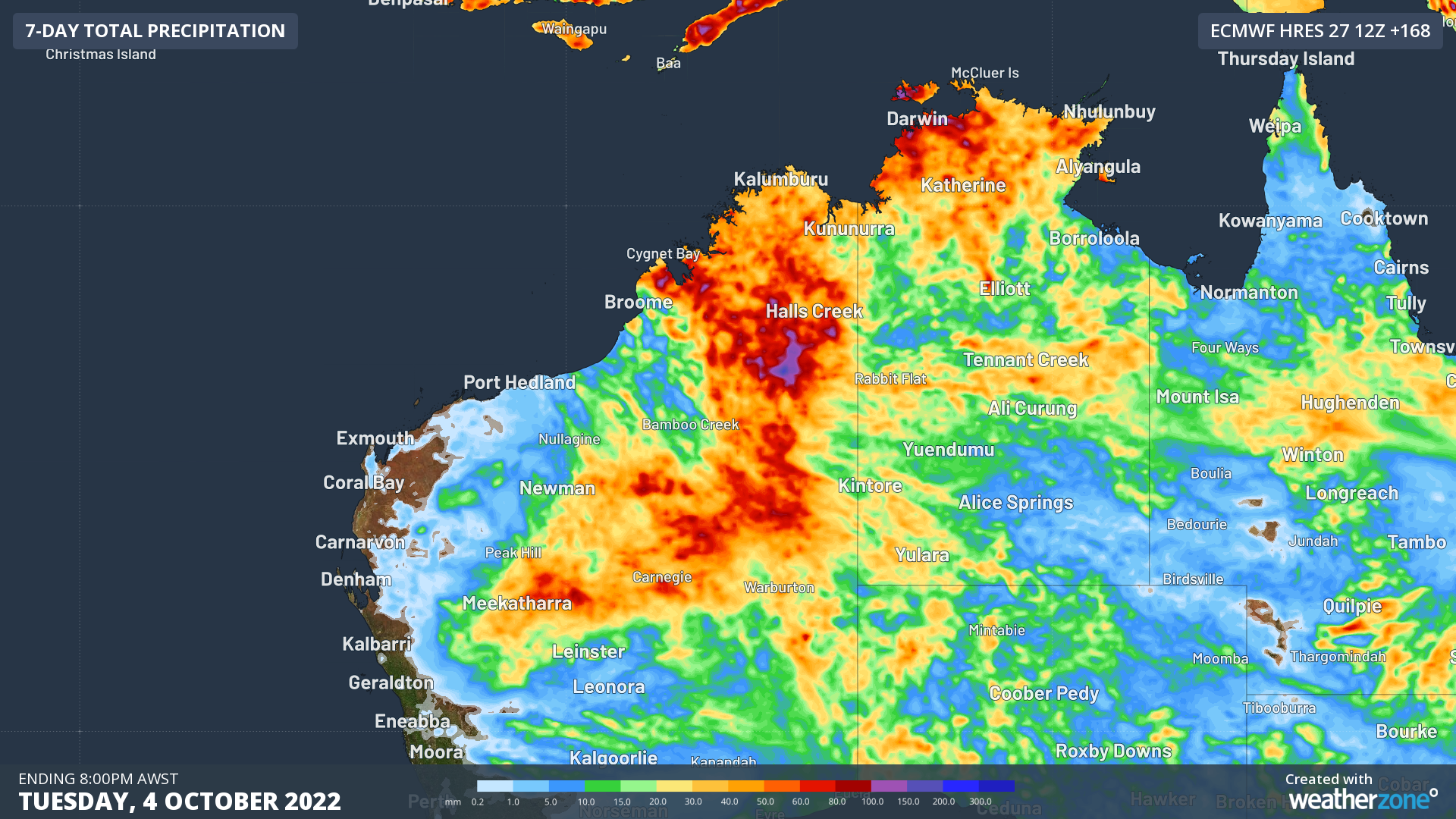
Image: Forecast accumulated rain during the 7 days ending at 8am AWST on Tuesday, October 4, according to the ECMWF-HRES model.
Over the weekend and early next week, rain and thunderstorms will spread into central Australia and SA as the jet stream carries tropical moisture further east and south, forming a northwest cloudband.
Widespread rain and thunderstorms will then continue to move across Australia’s eastern and southeastern states mid-to-late next week under the thick northwest cloudband. This slow-moving band of rain and storms is likely to cause more heavy rainfall in already saturated and flooded catchments in and around the Murray-Darling Basin.
The map below shows one computer model’s predicted accumulated rainfall during the next 10 days, with more than 30 mm of rain anticipated in part of every state and territory. This model also suggest that falls of 50 to 100 mm are a good chance in parts of WA, the NT, QLD, NSW and VIC between now and late next week.
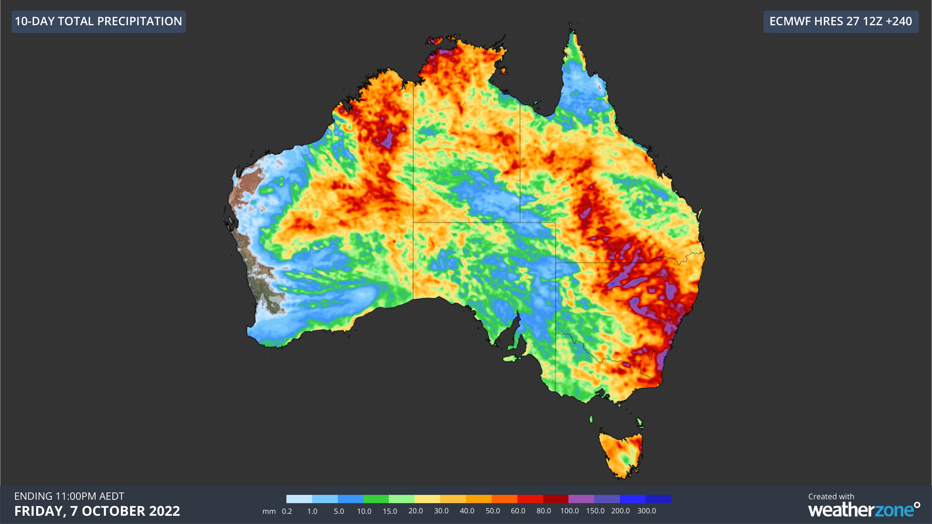
Image: Forecast accumulated rain during the 10 days ending at 11pm AEDT on Friday, October 7, according to the ECMWF-HRES model.
It is important to note that there is some uncertainty regarding exactly where and how much rain will fall across Australia during the next 10 days. However, there is good agreement between forecast models that this will be a significant rainfall event for Australia and part of every state and territory is likely to be affected.
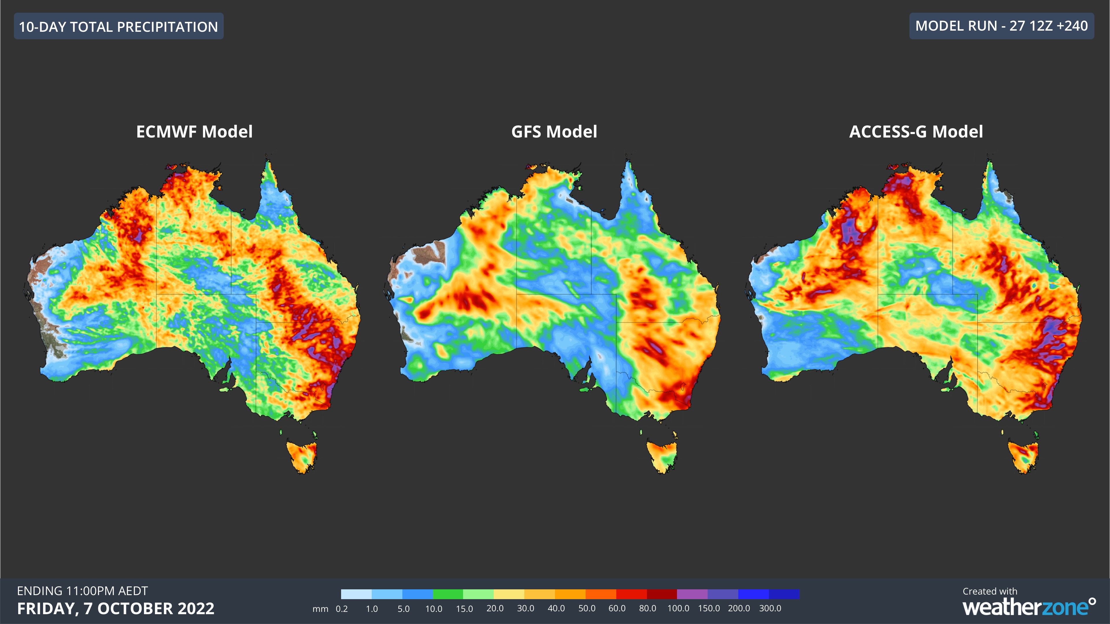
Image: Forecast accumulated rain during the 10 days ending at 11pm AEDT on Friday, October 7, according to the ECMWF-HRES model (left), GFS model (centre) and ACCESS-G model (right).
Numerous severe weather, thunderstorm and flood warnings are likely to be issued across Australia during the next 1 to 2 weeks as this event unfolds. Be sure to check the latest warnings for the most up-to-date information. For more information on Weatherzone’s rainfall, cloud and thunderstorm forecasting please contact us at apac.sales@dtn.com.




