The remnants of Tropical Cyclone Jasper could hang around northern Australia into next week, with some models suggesting it could re-intensify near the Top End. So, what can we expect to see from Ex-Tropical Cyclone Jasper next week?
Tropical cyclone Jasper hit the north Queensland tropical coast on Wednesday evening as a category two system and rapidly weakened into a tropical low as it moved over land. Jasper caused major flooding in the Cairns region, with 179mm falling in 24 hours to 9am Thursday, December 15.

Image: Flooding in Cairns post Tropical cyclone Jasper on Thursday, December 14, Source: @livcole85
The satellite image below shows a mass of clouds encircling Jasper over the Cape York Peninsula on Friday morning.
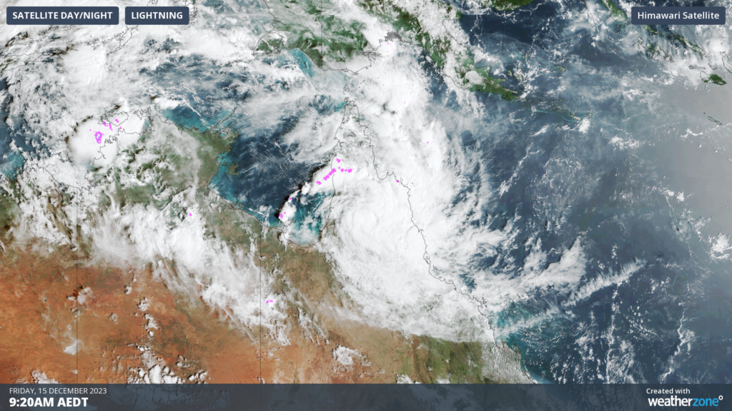
Image: Himawari-9 Satellite image at 9:20am on Friday, December 15
Jasper will move into the Gulf of Carpentaria on Saturday, where it has the potential to regain strength over the balmy surface water in the Gulf. However, conditions don’t look too favorable for the system to gain much strength, with the Bureau only giving it a low chance of re-developing into a cyclone on the weekend.
If Jasper remains over water either in the Gulf or the Arafura Sea next week, it could regain some power and redevelop into a tropical cyclone. At this stage, there is a large amount of uncertainty regarding Ex-Tropical Cyclone Jasper’s movement and strength next week, so it’s difficult to know if it will reach tropical cyclone strength once again. The Bureau of Meteorology gives a 25 to 30% chance (moderate risk) that Jasper will re-intensify into a tropical cyclone from Tuesday.
If Jasper does become a tropical cyclone again next week, it will be still named Jasper and will count as one cyclone in the Australian region for the 2023-24 season.
The European Centre for Medium-Range Weather Forecasts (ECMWF) model shows a wide range of possibilities later next week, with tropical cyclone strike probabilities greater than 20 percent around East Arnhem Land in the NT.
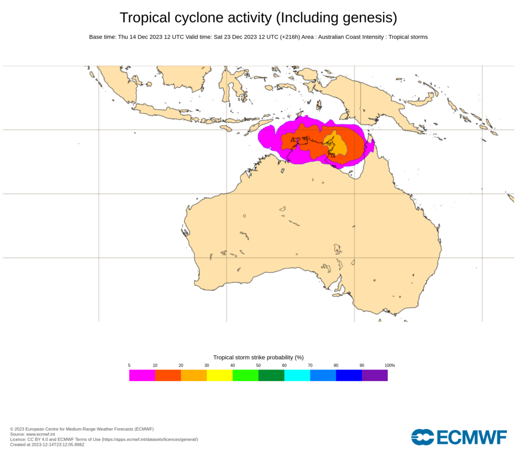
Image: ECMWF strike probability for 10pm AEST on Saturday, December 23. The strike probability is the probability that a tropical cyclone will pass within a 300 km radius from a given location and within a time window of 48 hours. Source: ECMWF
The U.S. Global Ensemble Forecast System (GEFS) model also shows a range of possible locations for Jasper next week, ranging from the Gulf, Arafura Sea and the Top End, with some ensemble members suggesting Jasper could even take a U-turn and move over Far North Queensland again.
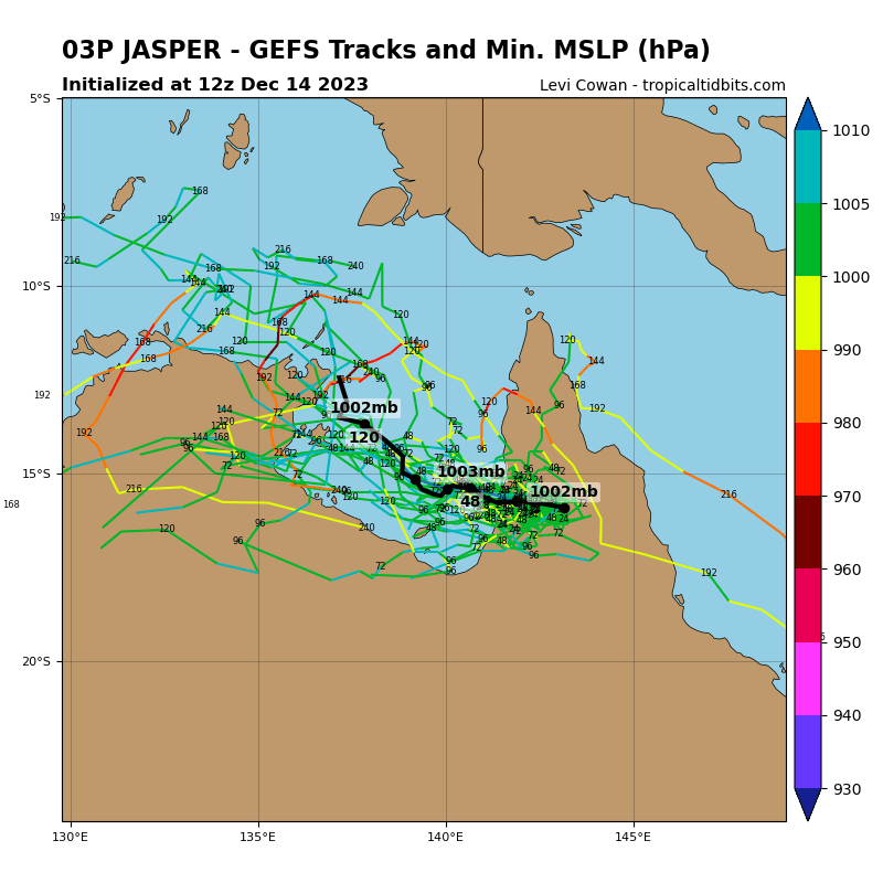
Image: GEFS ensemble member tracks for Tropical Cyclone Jasper. Source: TropicalTidbits.com
It is too early to know exactly where and how strong Jasper will be next week. At this stage, anyone in the Top End or Northern Queensland should keep a close eye on the latest cyclone advisories during the next 7 to 10 days. For more information on our cyclone forecasts and warning services please contact us at apac.sales@dtn.com.


