
A pair of tropical cyclones may form to the northwest of Australia next week, with the potential for one to come close to the Pilbara and Kimberley coasts.
Northern Australia faces an increased risk of heavy rain and tropical cyclone activity in the coming week thanks to the interaction of two huge atmospheric waves near Australia.
In response to these tropical waves, two tropical lows are forecast to form in the Indian Ocean to the northwest of Australia in the next few days.
The first tropical low (04U) will form near west Java in the coming days and the Bureau of Meteorology has given it a moderate risk of developing into a tropical cyclone on Sunday. The system will move southwest towards the Cocos (Keeling) Islands next week, increasing showers and thunderstorm activity in the region. The cyclone at this stage will stay well away from Australia’s mainland.
The second tropical low is expected to form over the Timor Sea or south of Indonesia in the coming days and has a moderate risk of developing into a tropical cyclone on Monday, December 9 as it moves over favorably warm oceans.
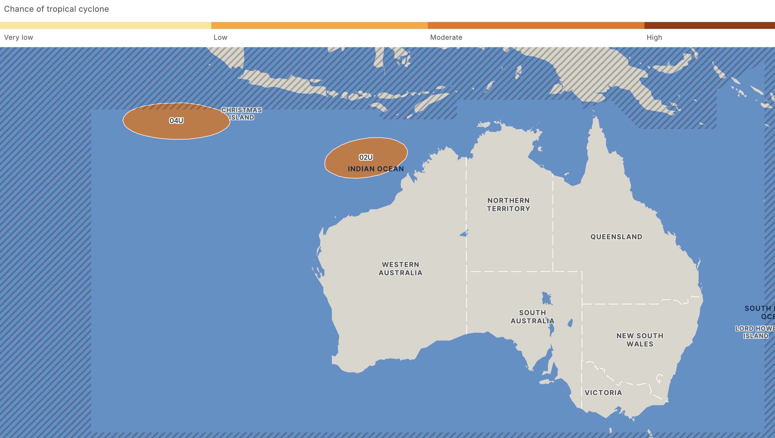
Image: Chance of a tropical cyclone at 8pm WST on Monday, December 9. Source: Bureau of Meteorology
According to the Bureau, this system could move west southwest towards the waters off WA’s Pilbara district early to mid-next week.
Some other international forecast organisations also show a strong possibility of tropical cyclone development near WA early to mid-next week. The image below shows the likelihood of tropical cyclone activity within a 48-hour window of Wednesday night, according to the European Centre for Medium-Range Weather Forecasts (ECMWF),
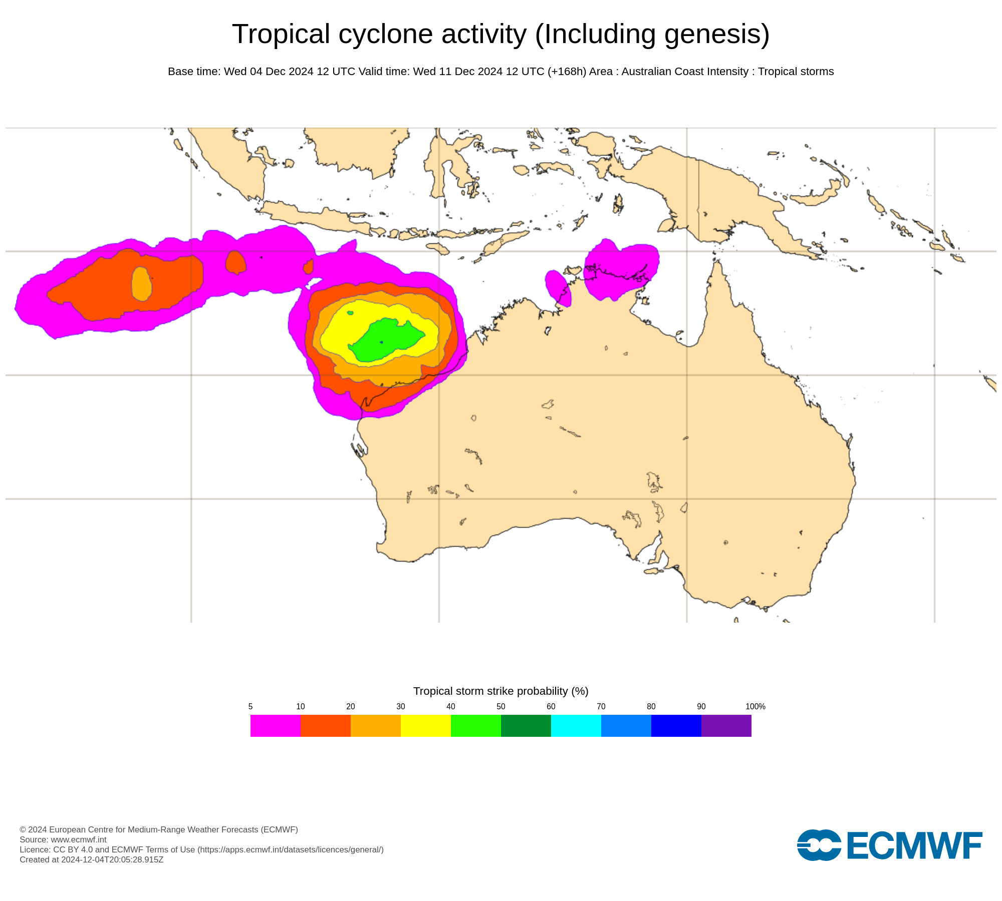
Image: Probability that a tropical cyclone will pass within a 300 km radius of a given location within a 48-hour time window centred on Wednesday night, December 11. Source: ECMWF
The image above shows that there 10 to 30 percent chance of the cyclone passing within 300km of the Pilbara and Kimberley coasts mid next week.
Depending on how close the system moves to the coast, the Pilbara and Kimberley could see an increase in wind, rain and thunderstorm activity next week.
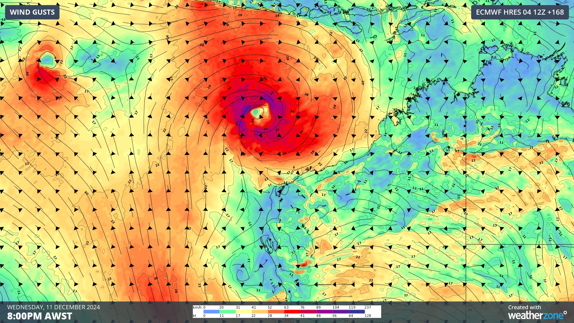
Image: Instantaneous wind gust forecast for 9pm AWST on Wednesday, December 11, according to ECMWF
We will be monitoring the potential impacts of this system to the Pilbara and Kimberley communities and businesses in the coming days.
As the climate delivers increasingly severe weather events, their potential to impact your business operations grows.
DTN APAC, specialises in industry-leading forecast, alerting and threat analysis of tropical cyclones, offering you expert, customised solutions when the weather turns wild.
Providing rapid-update forecast information, we alert you to any low-pressure system gaining power within your region and, unlike other providers, can track its development out to 7 days. This gives you the time to prepare and safeguard your staff, sites and assets.
You will have the most precise weather intelligence charting rainfall, wind speeds and potential storm surges to help you make critical decisions quickly. Whether it’s adjusting key work schedules, protecting your staff or securing your site, we have the alerting capability to keep you steps ahead of the storm.
We will support you, 24/7, keeping you informed and making your critical decisions easier.
For more information please visit our website or email us at sales.apac@dtn.com.


