A tropical cyclone has formed to the north of WA and is expected to become a severe tropical cyclone before making landfall later this week, potentially impacting mining, port and offshore oil and gas operations in the region.
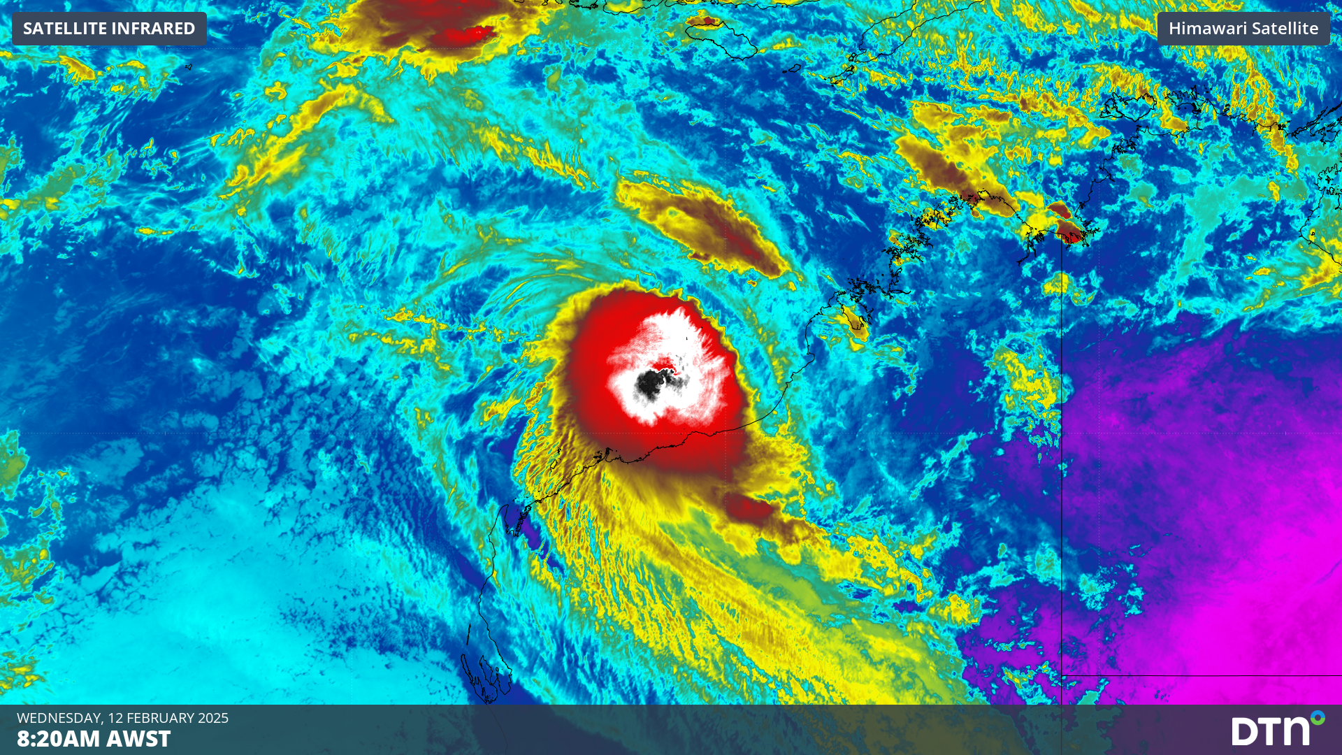
Tropical Cyclone Zelia formed early on Wednesday morning, becoming the 5th system to be named inside Australia’s area of responsibility so far this season.
At 5am AWST, Zelia was a category one tropical cyclone sitting roughly 200 km off the north coast of WA. However, has been some disagreement between forecast agencies regarding to exact position of Zelia on Wednesday morning, mainly due to northeasterly winds blowing deep convective clouds away from the cyclone’s centre, making its position difficult to determine.
Image: Day/night satellite images showing Tropical Cyclone Zelia to the north of WA on Wednesday morning.
Despite this confusion around its initial position, Zelia is likely to move slowly towards the south or southwest over the next couple of days. This slow journey southward will allow the cyclone to draw energy from a pool of very warm water where sea surface temperatures are above 31°C, causing Zelia to strengthen as it approaches the WA coast.
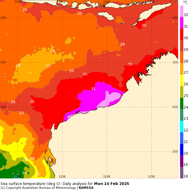
Image: Sea surface temperatures off the north coast of WA at the start of this week, showing a blob of very warm water near the coast. Source: Bureau of Meteorology
While there is still some uncertainty regarding Zelia’s future track and development, most forecast models agree that the system should become a severe tropical cyclone before crossing the coast. Landfall at this stage will most likely occur between late Thursday and Saturday somewhere between Karratha and Bidyadanga, most likely somewhere around Port Hedland to Pardoo.
If Zelia does cross the coast as a severe tropical cyclone, it will bring very destructive winds, heavy rain and a dangerous storm surge to parts of northern WA later this week.
The shifting climate is creating increasingly complex extreme weather risks, affecting businesses worldwide. We are here to help optimise your resilience.
Our Risk Communicators work closely with you to analyse how weather impacts your operations and communicate potential risks. We can then support your risk management planning, and provide situational awareness and post-event reporting when extreme weather events hit hard.
DTN APAC, a DTN company, is a diverse team, with global forecasting, product development and analytics expertise. Couple this with extensive industry experience spanning Aviation to Energy, and we are primed to assist you in strengthening your operational strategies when responding to weather disruption.
We consult with you to understand the nuances of your operations and your existing procedures and policies. We can then assist in creating communication structures, safety strategies and procedures to mitigate the risks that may impact your workforce, assets and uptime.
Rely on our insights to see you through complex situations, maximizing the safety of your staff and assets, and your uptime where possible. For more information contact us at sales.apac@dtn.com


