A tropical cyclone is likely to form off the north coast of WA in a matter of days, with signs that it could become a severe tropical cyclone next week.
A tropical low is currently developing over the Timor Sea to the north of Darwin. The circulation centre of this developing low can be clearly seen in the satellite images below, sitting just south of Indonesia’s Babar Islands on Friday morning.
Image: Visible true-colour satellite images showing cloud associated with a developing tropical low to the north of Darwin.
The tropical low is expected to move towards the southwest this weekend and early next week, likely gaining strength as it traverses the warm waters off WA’s north coast.
According to the Bureau of Meteorology’s forecast track map issued at 9:02am AWST on Friday, the low is expected to become a tropical cyclone on Saturday and continue to strengthen on Sunday and early next week, possibly becoming a category three severe tropical cyclone by Tuesday.
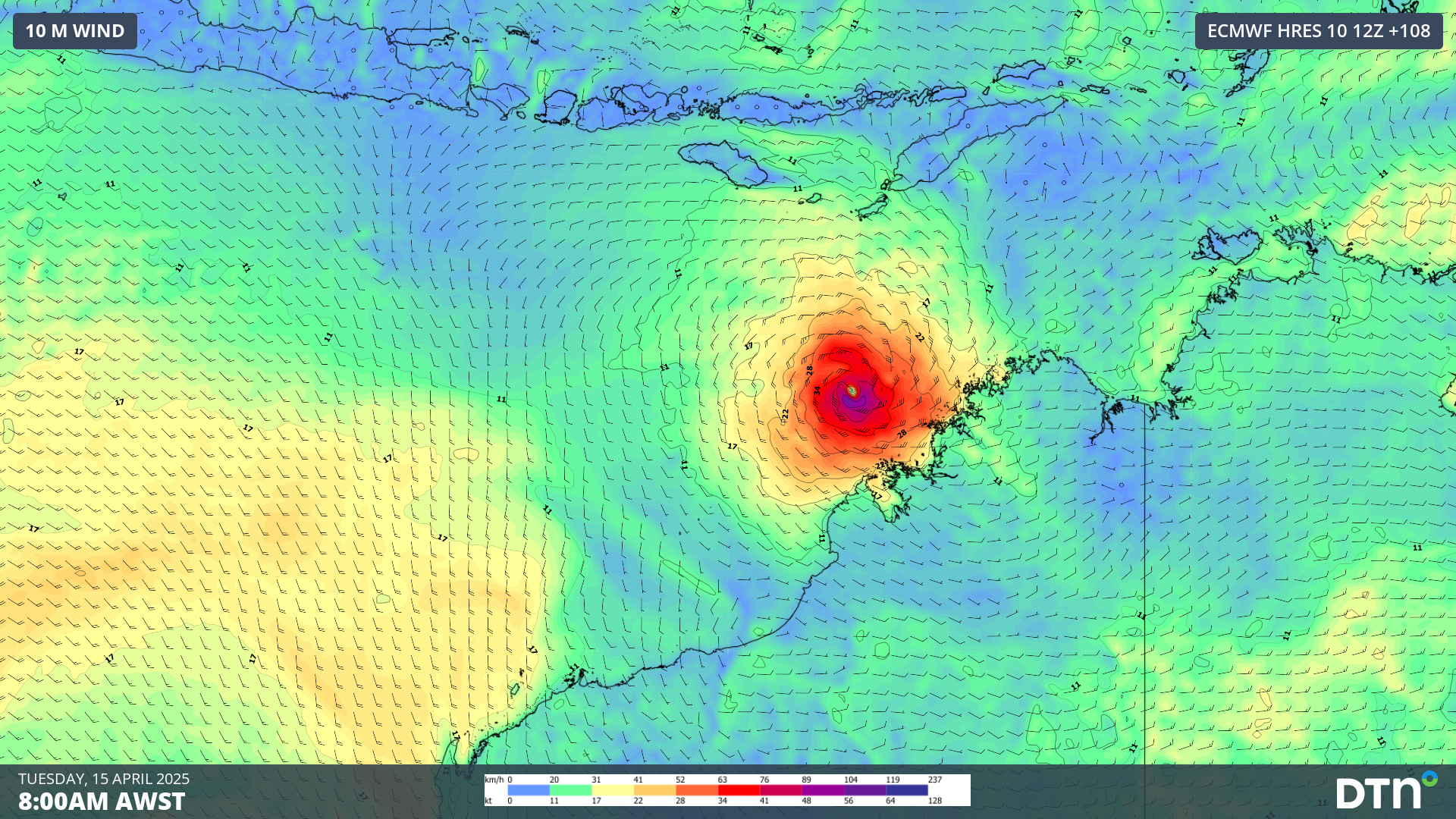
At this stage, the impending tropical cyclone is not likely to cross the coast and should stay to the north of WA between now and at least the middle of next week. However, it could still get close enough to the Kimberley coast to cause damaging winds, heavy rain and abnormally high tides this weekend and early next week.
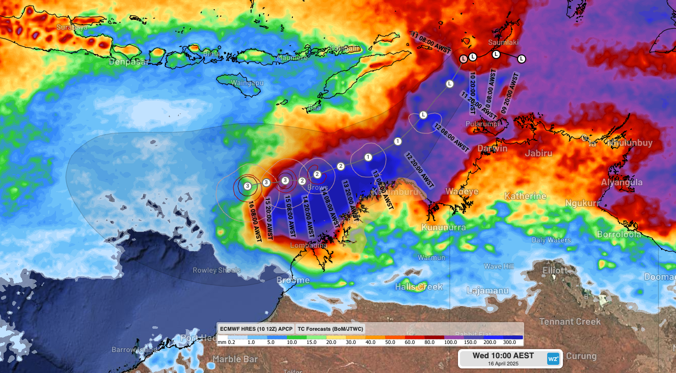
Image: Forecast track map issued at 9:02am AWST on Friday, April 11 (BoM forecast) and forecast accumulated rainfall up to 8am AWST on Wednesday, April 16 (ECMWF forecast).
Tropical cyclones are notoriously difficult systems to predict, particularly when they are still tropical lows and in the early stages of tropical cyclone development. Forecasts may change in the coming days as the system develops further and more reliable model guidance becomes available.
Unless another tropical cyclone forms in the Australian region before this one – which is unlikely at this stage – the impending cyclone will be named Errol.
Should this system reach category three strength, it will become the 8th severe tropical cyclone in the Australian region so far this season. This would be the highest number of severe tropical cyclones in a single season for 19 years.
How DTN APAC can help
As the climate delivers increasingly severe weather events, their potential to impact your business operations grows.
DTN APAC specialises in industry-leading forecast, alerting and threat analysis of tropical cyclones, offering you expert, customised solutions when the weather turns wild.
Providing rapid-update forecast information, we alert you to any low-pressure system gaining power within your region and, unlike other providers, can track its development out to 7 days. This gives you the time to prepare and safeguard your staff, sites and assets.
You will have the most precise weather intelligence charting rainfall, wind speeds and potential storm surges to help you make critical decisions quickly. Whether it’s adjusting key work schedules, protecting your staff or securing your site, we have the alerting capability to keep you steps ahead of the storm.
We will support you 24/7, keeping you informed and making your critical decisions easier.
To find out more about large range of products and services contact us at sales.apac@dtn.com


