Tropical moisture from Severe Tropical Cyclone Olga will bring rainfall to parts of the Pilbara and Gascoyne as it tracks parallel to their coastline this week.
The satellite image below shows Tropical Cyclone Olga sitting off the northwest shelf of WA and thick cloud extending 1700km into the NT.
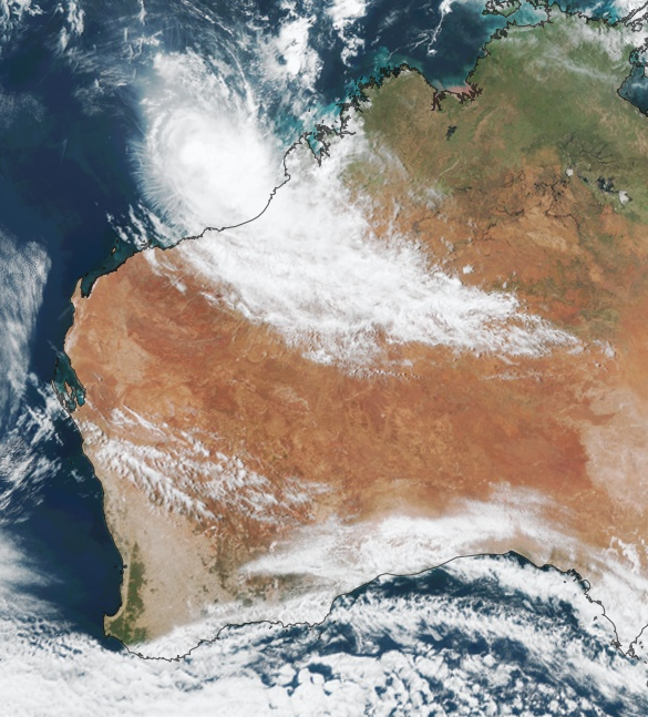
Image: Himawari-9 satellite image at 1:13pm on Monday, April 8
Tropical Cyclone Olga is located well to the northwest of Broome and has begun weakening in unfavourable environmental and atmospheric conditions. Olga should weaken to a tropical low during Tuesday and is expected to track parallel to the Pilbara and Gascoyne coasts in the next 72 hours.
While Olga is unlikely to directly impact WA, periods of heavy rainfall and strong winds could extend towards the Pilbara and Gascoyne as it passes by on Thursday and Friday.
The maps below show the rainfall forecast in the next six days across WA by two different computer models, with the largest totals expected in the Pilbara and Gascoyne districts.
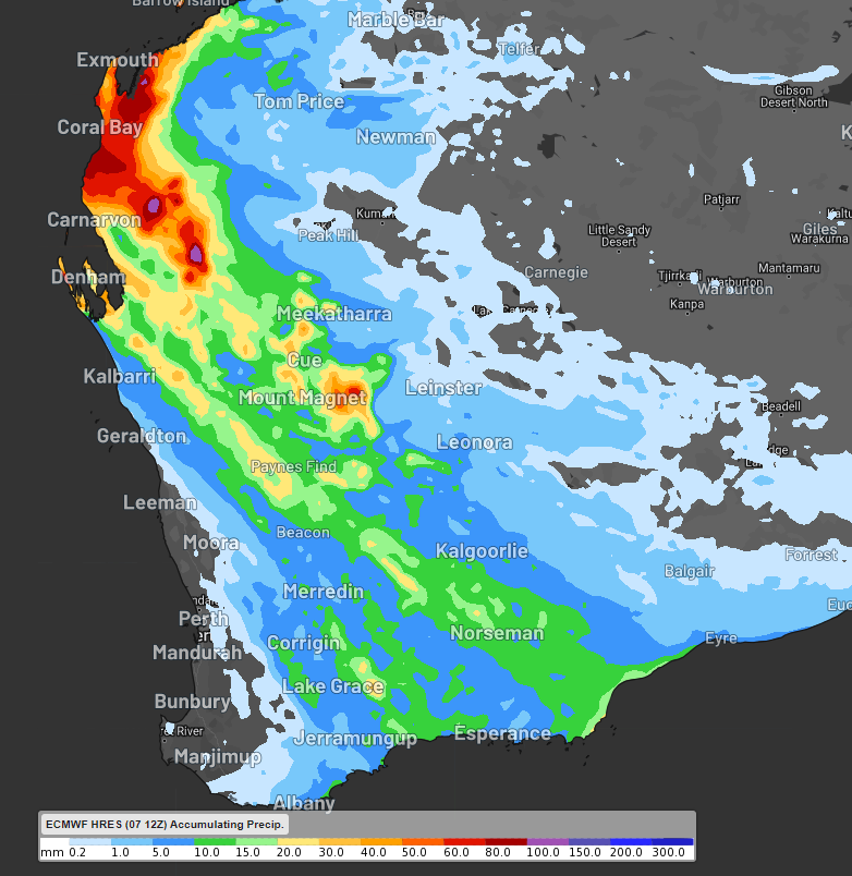
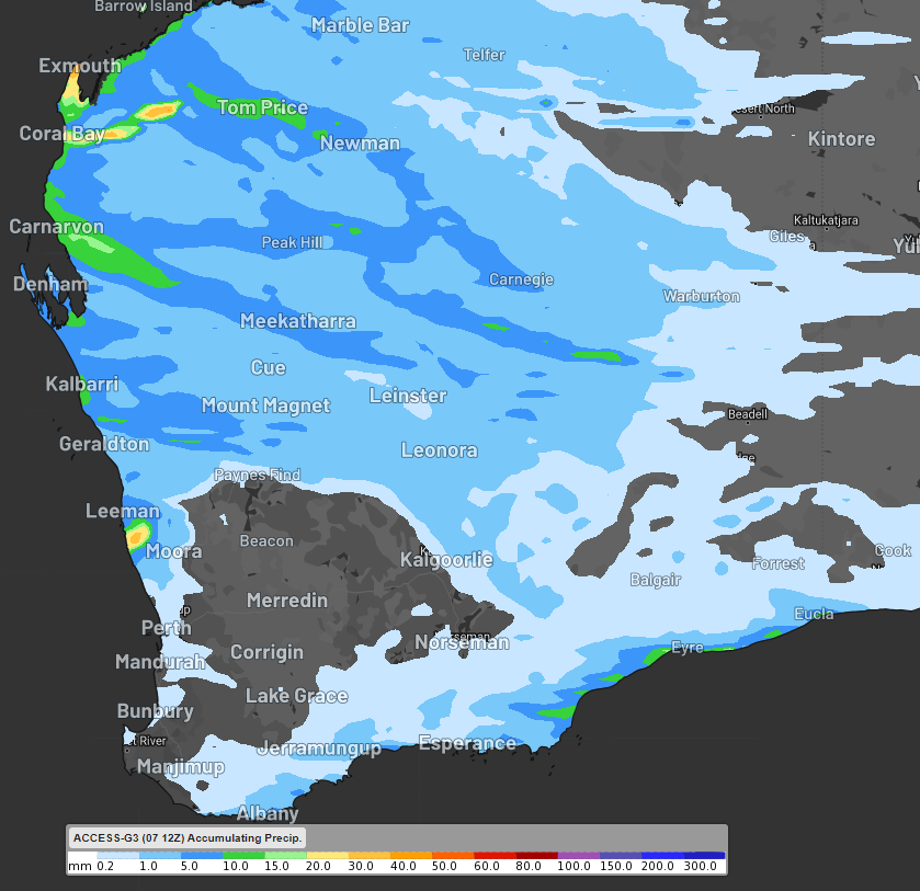
Images: Accumulated rainfall forecast to 8pm AWST on Saturday, April 13 according to ECMWF (top) and Access-G (bottom).
The maps above highlight that it’s uncertain how much rainfall will fall in the coming days, with the totals varying substantially between models.
However, the rainfall should begin in the Pilbara and Gascoyne districts on Wednesday, before extending into the Central Wheat Belt and towards Esperance over the weekend.
Unfortunately, both models agree that the southwest corner of WA, including Perth, will miss this week’s rain. This region is desperately dry, with some areas recording the lowest rainfall on record during the first three months of this year.
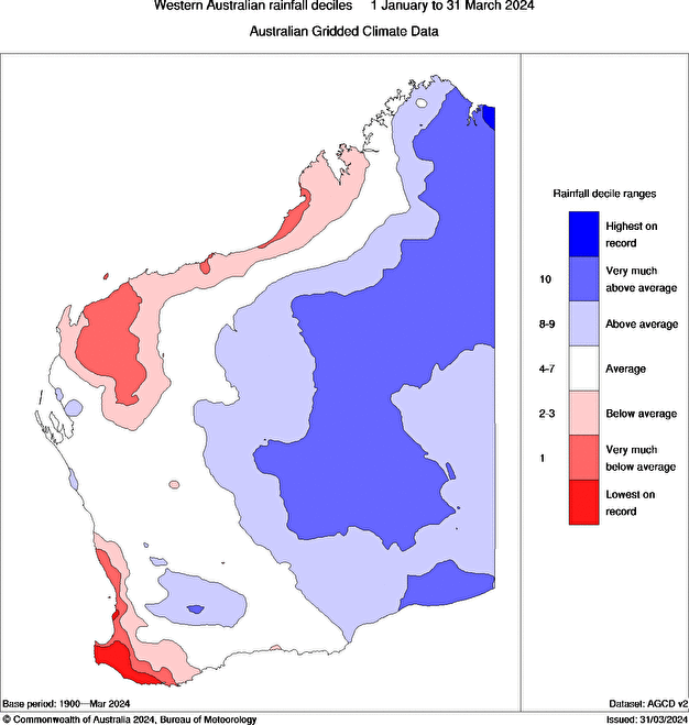
Image: WA rainfall deciles between January 1 and 31 March 2024
Some of this rainfall is falling in the Pilbara and Gascoyne which in some areas have had a dry beginning to the year, which could help replenish soil moisture in the region.
Miningzone is the proven and trusted turnkey solution –deployed at over 400 mines globally – offering you tailored forecasting and alerting systems to protect your valuable staff and assets.
Weatherzone’s integrated services are intuitive and user-friendly, providing you with the specific weather and blast data needed to gain a complete environmental picture.
You will have access to our lightning and severe weather tracking and alerts, EPA-approved blast dispersion modelling, thunderstorm tracking and high precision and site-specific forecasting, along with comprehensive reporting capacity.
Precise, market-leading data is delivered via multiple platforms including Weatherguard – our easy-to-use app – and can be fully integrated into your operational control or SCADA systems. For more information, please contact us at apac.sales@dtn.com.


