
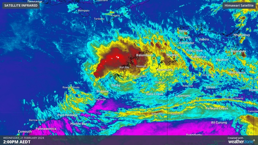
Ex-Tropical Cyclone Lincoln is about to move off the Kimberley coast and looks likely re-intensify into a tropical cyclone to the north of WA later this week.
Tropical Cyclone Lincoln made landfall on the south coast of the Gulf of Carpentaria last Friday. Since then, the system has been tracking across northern Australia as an ex-tropical cyclone, dumping heavy rain over parts of the NT and WA.
After spending five days travelling around 1,300 km across northern Australia, Lincoln will move off the Kimberley coast in WA on Wednesday. The system will then move further offshore while travelling towards the west and southwest over the next several days.
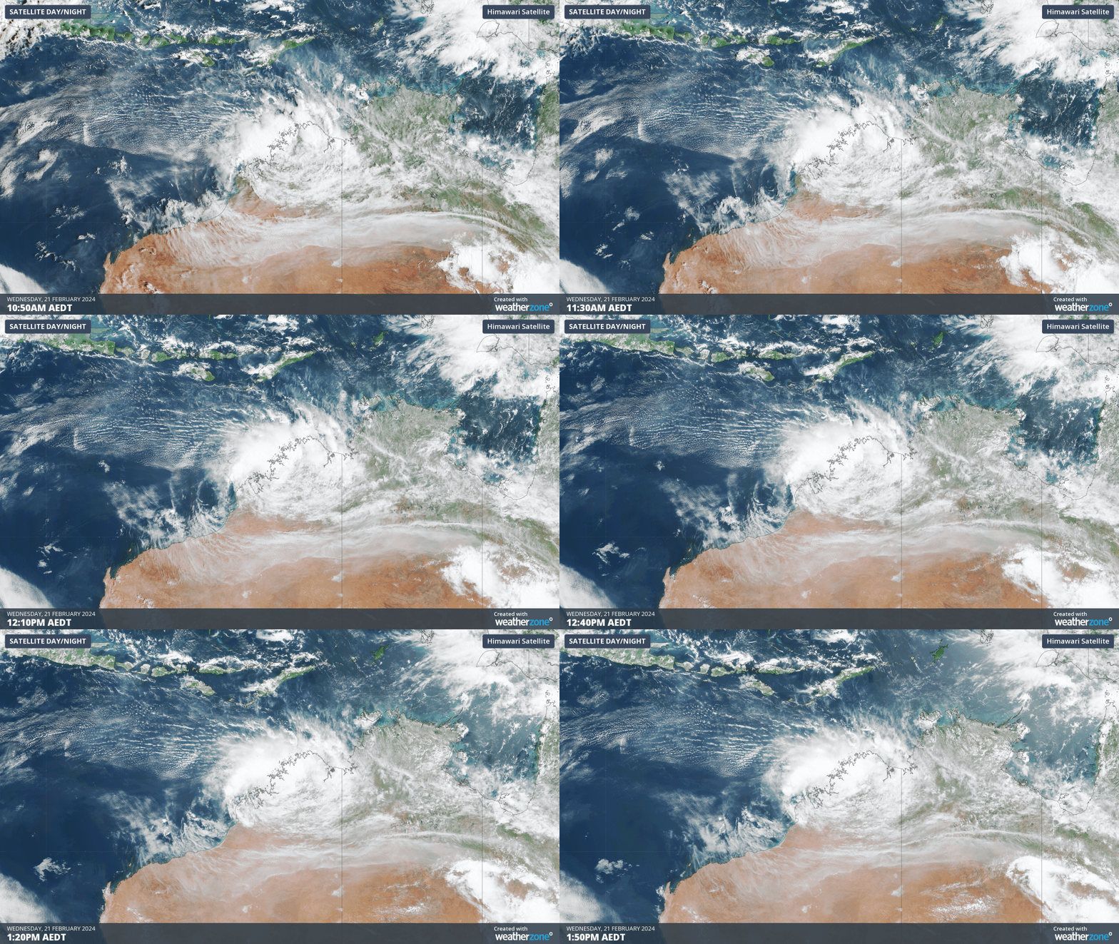
Image: Ex-Tropical Cyclone Lincoln location over the Kimberley district in WA on Wednesday, February 21.
Ex-Tropical Cyclone Lincoln is expected to draw energy off the warm waters to the north of WA, which should help the system gain some strength. This increases the likelihood that it will become a tropical cyclone once again.
According to the Bureau of Meteorology, there is a moderate chance that Lincoln will become a tropical cyclone from Thursday and a high chance from Friday.
While there is some model uncertainty regarding its future movement and strength, the Bureau’s forecast track currently anticipates Lincoln to turn towards the south on the weekend and approach the WA coast. This may allow Lincoln to make a second landfall along the Pilbara or Gascoyne coasts over the weekend.
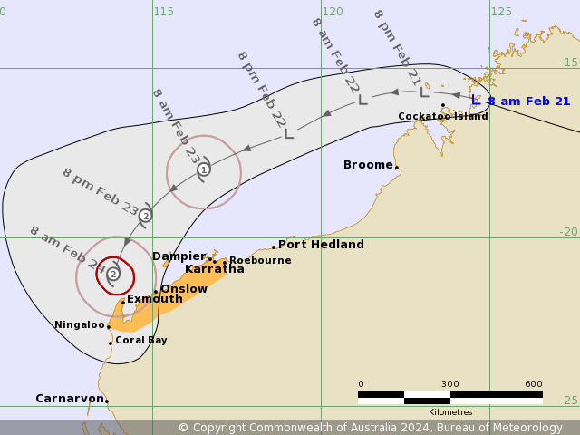
Image: Forecast track map issued by the Bureau of Meteorology at 9:11 am AWST on Wednesday, February 21. A more recent track map may be available. Source: Bureau of Meteorology
It’s too early to know exactly where Lincoln will go and how strong it till be towads the end of this week. However, with potential for a coastal crossing as a tropical cyclone, anyone living in northern or northwest WA should keep a close eye on the latest tropical cyclone advisories and warnings over the coming days.
As the climate delivers increasingly severe weather events, their potential to impact your business operations grows.
DTN APAC, specialises in industry-leading forecast, alerting and threat analysis of tropical cyclones, offering you expert, customised solutions when the weather turns wild.
Providing rapid-update forecast information, we alert you to any low-pressure system gaining power within your region and, unlike other providers, can track its development out to 7 days. This gives you the time to prepare and safeguard your staff, sites and assets.
You will have the most precise weather intelligence charting rainfall, wind speeds and potential storm surges to help you make critical decisions quickly. Whether it’s adjusting key work schedules, protecting your staff or securing your site, we have the alerting capability to keep you steps ahead of the storm.
We will support you, 24/7, keeping you informed and making your critical decisions easier. For more information, please contact us at apac.sales@dtn.com.




