
Queensland’s North Tropical Coast is preparing for severe weather later this week, with Tropical Cyclone Jasper expected to make landfall near or north of Cairns on Wednesday.
Jasper got a lot of attention late last week when it became the earliest category 4 tropical cyclone in Australian waters since 2005. However, the system has weakened substantially over the last 48 hours thanks to moderate wind shear and too much dry air feeding into its core.
At 10am AEST on Monday, December 11, Tropical Cyclone Jasper was a category one cyclone located about 500 km to the east of Cairns.
.gif)
This weakening trend has been good news for communities along Queensland’s North Tropical Coast and Tablelands, who are being warned to prepare for a coastal crossing later this week. Unfortunately, the danger hasn’t completely passed, with Jasper expected to intensify on Tuesday and Wednesday as it approaches the coast.
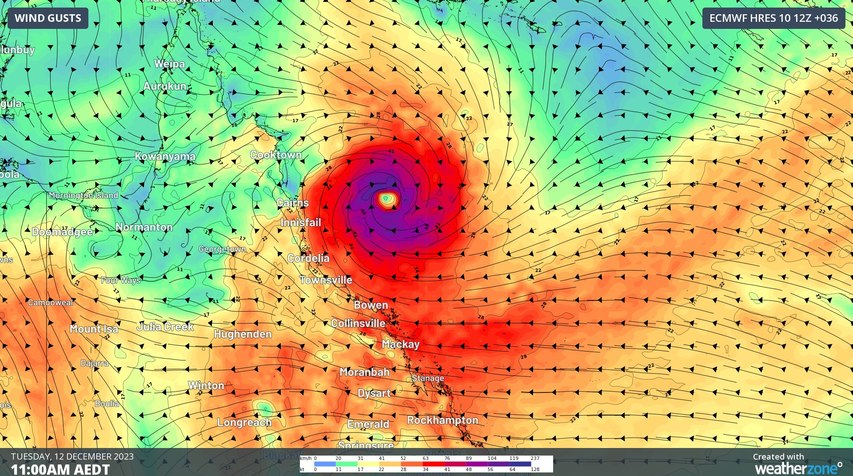
Jasper should keep tracking towards the west over the next two days and make landfall somewhere between Cooktown and Cardwell on Wednesday, most likely near or north of Cairns. At this stage, Jasper will most likely be a category 2 system when it reaches the coast.
When tropical cyclones make landfall on Australia’s east coast, the most severe weather usually occurs near and to the south of the cyclone’s core. This means a coastal crossing to the north of Cairns would put the city of around 160,000 at risk of dangerous cyclonic weather.
Landfalling category 2 tropical cyclones can cause:
- Mean wind speeds of 89 to 117?km/h, with gusts reaching 125–164?km/h.
- Minor house damage and significant damage to signs, trees, caravans, and some crops.
- Risk of power failure.
As of 11am AEST on Monday, a Cyclone Warning was in place for the coast and adjacent inland from Cooktown to Townsville, including Cairns, Innisfail, and Palm Island, but not Townsville. A Cyclone Watch was also in place from Cape Melville to Cooktown, extending inland to include Palmerville and Chillagoe.
Cyclone warnings alert for the risk of gale force winds within the next 24 hours, while cyclone watches alert for gales developing in 24-48 hours.
A separate severe weather warning is also in place for damaging wind gusts along the coastal fringe between Mackay and the area just south of Ayr today. These winds are not being directly caused by Jasper.
In addition to wind, heavy rainfall and a dangerous storm tide could affect northeast Qld as Jasper crosses the coast. This includes falls from the outer rain and storm bands on Monday and Tuesday, and rain closer to the centre of Jasper on Wednesday.
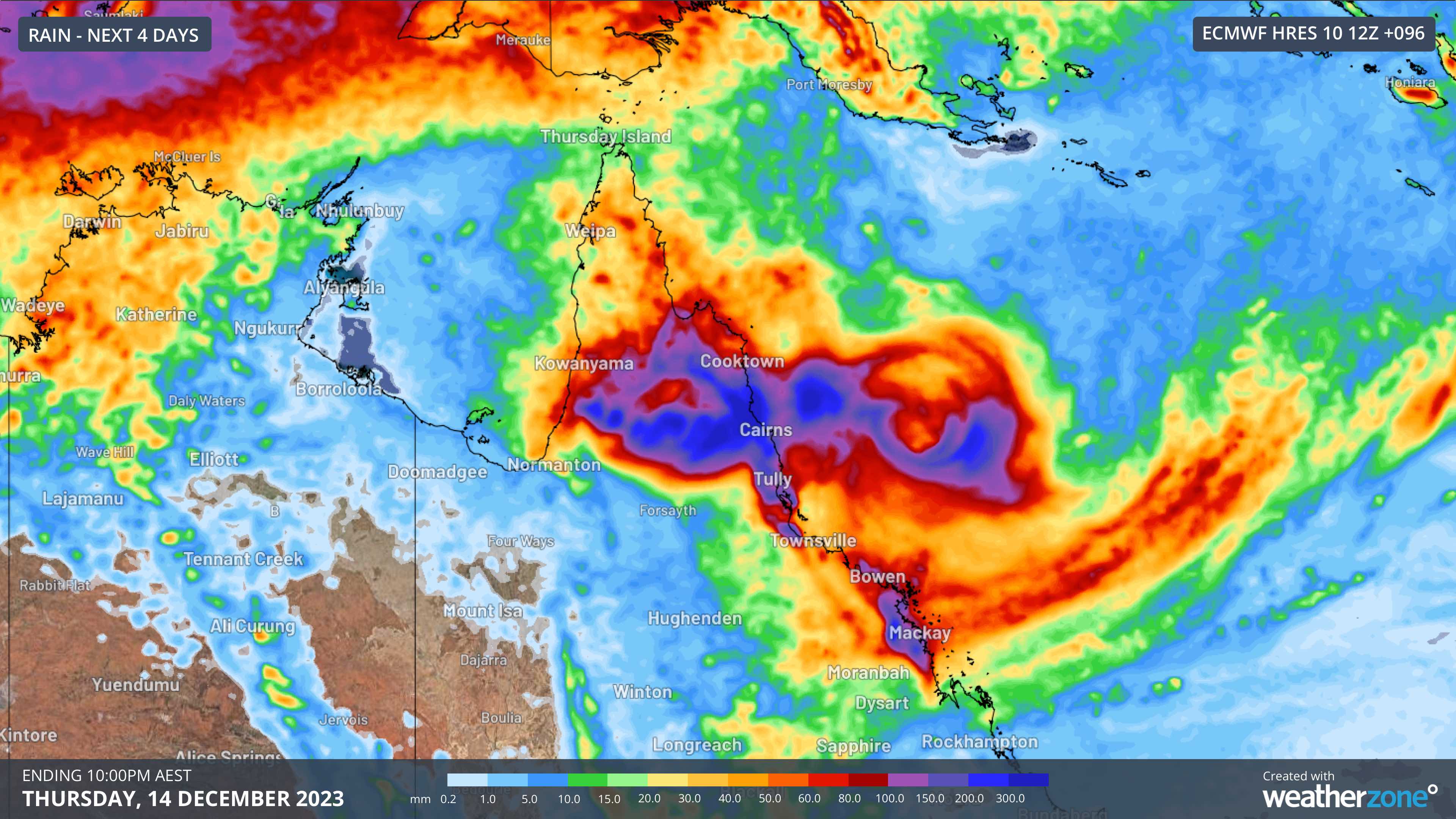
Image: Forecast accumulated rain during the 96 hours ending at 10pm AEST on Thursday, December 11, 2023, according to the ECMWF-HRES model.
A flood watch has been issued for the North Tropical Coast and parts of the Cape York Peninsula and Gulf Country. There is also a risk of flash flooding on Wednesday between Cape Flattery and Cardwell, where six-hourly rainfall totals could reach 100 to 150 mm and 250 mm in some spots.
There is still some uncertainty regarding the strength and location of Tropical Cyclone Jasper as it approaches and crosses the coast, so be sure to check the latest warnings and track maps for the most up-to-date information. For more information on Weatherzone’s tropical cyclone forecasts and warnings, please contact us at apac.sales@dtn.com.




