
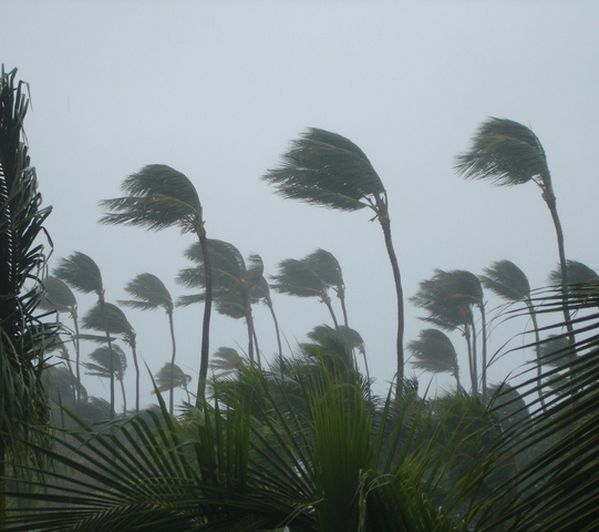
There are growing concerns that eastern Qld could be hit by a tropical cyclone next week, although it is still too early to know whether Tropical Cyclone Jasper will reach Australian shores, or where it will strike if it does.
Jasper became a tropical cyclone over the Solomon Sea late on Tuesday afternoon. As of 10am AEST on Wednesday, the system was a category two tropical cyclone located roughly 320 km west-southwest of Honiara and 1430 km east-northeast of Cairns.
Jasper is likely to move towards the south-southwest over the next few days while gaining strength. The Bureau of Meteorology expects Jasper to become a category 3 severe tropical cyclone tonight and possibly reach category 4 strength on Friday.
While tropical cyclones are notoriously difficult to predict beyond the next one or two days, Jasper will be guided by a strong upper-level ridge located to its south later this week. This ridge is likely to steer Jasper in a westerly direction towards the end of this week, allowing it to approach Australia.
Unfortunately, forecast models are not agreeing on when this steering ridge will break down, which makes it difficult to know where Jasper will move as it tracks closer to Australia early next week.
The Bureau of Meteorology’s latest technical bulletin for Jasper, issued at 5:05am AEST on Wednesday, outlines three possible scenarios for early next week:
- “Recent guidance is favouring the scenario where Jasper approaches the Queensland coast, between Cooktown and Mackay, on a westerly track as a tropical cyclone next week.”
- “Other potential outcomes are a more southerly track, consequently moving the system towards the Queensland coast south of Mackay,”
- “or a slow-moving system that remains over the Coral Sea beyond the next seven days.”
The Bureau of Meteorology’s 7-day tropical cyclone forecast map highlights the uncertainty in Jasper’s location early next week. According to the Bureau, Tropical Cyclone Jasper could be located somewhere inside the red shaded area on the map below at 10pm AEST on Tuesday next week.
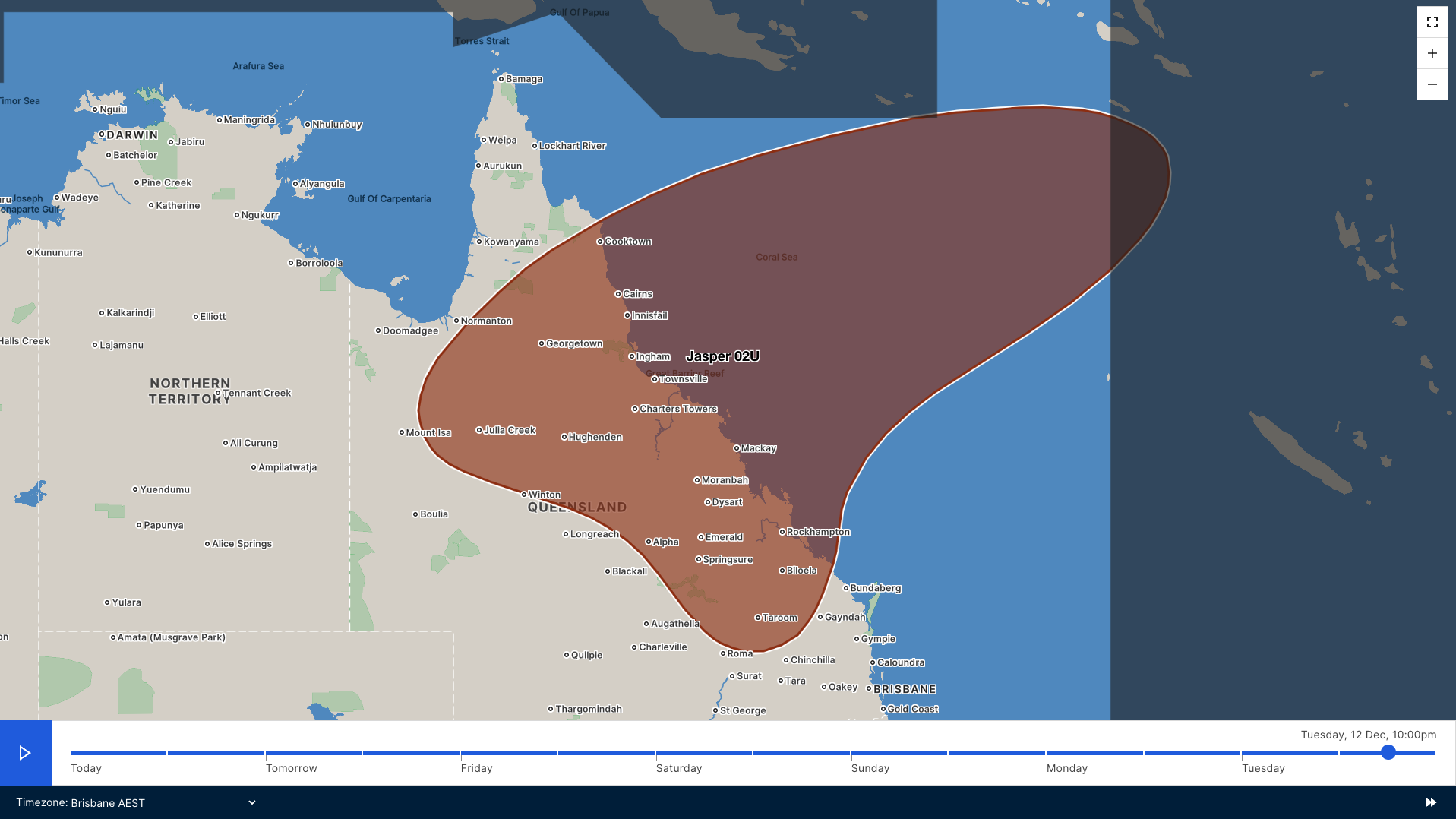
Image: Forecast Confidence Area (FCA) for 10pm AEST on Tuesday, December 12 for Tropical Cyclone Jasper. The FCA represents where the centre of the tropical weather system is likely to be located. There is an 80% chance that the centre of the system will be located within this area at the specified time. Source: Bureau of Meteorology
The European Centre for Medium-Range Weather Forecasts (ECMWF) also show a wide range of possibilities early next week, with tropical cyclone strike probabilities greater than 20 percent between about Cooktown and St Lawrence.
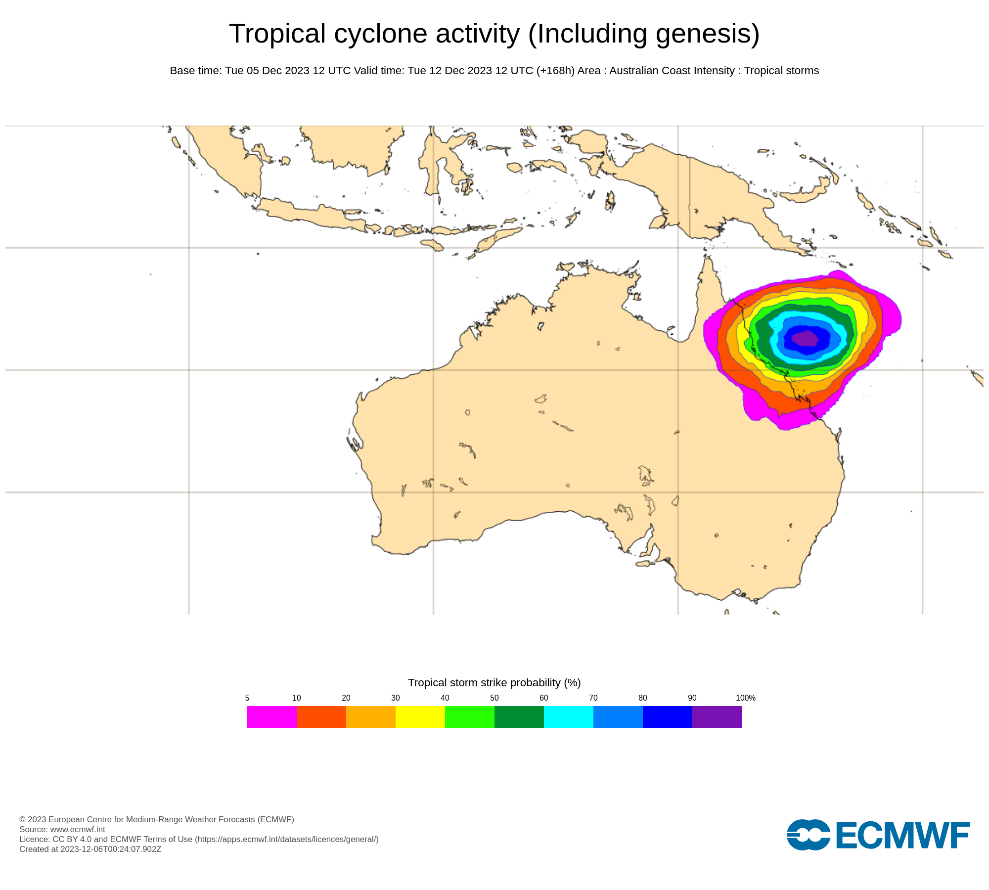
Image: ECMWF strike probability for 10pm AEST on Tuesday, December 12. The strike probability is the probability that a tropical cyclone will pass within a 300 km radius from a given location and within a time window of 48 hours. Source: ECMWF
The U.S. Global Ensemble Forecast System (GEFS) model also shows a range of possible landfall location stretching from Yeppoon up to Cape York Peninsula, along with the possibility that Jasper will remain offshore next week.
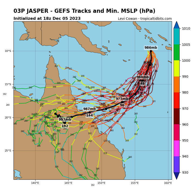
Image: GEFS ensemble member tracks for Tropical Cyclone Jasper. Source: TropicalTidbits.com
It is too early to know if Jasper will reach the Australian mainland next week, and where and how strong it will be if it does. At this stage, anyone in Queensland, particularly communities between Gladstone and Cooktown, should keep a close eye on the latest cyclone advisories during the next 7 to 10 days.
As the climate delivers increasingly severe weather events, their potential to impact your business operations grows.
DTN APAC, specialises in industry-leading forecast, alerting and threat analysis of tropical cyclones, offering you expert, customised solutions when the weather turns wild.
Providing rapid-update forecast information, we alert you to any low-pressure system gaining power within your region and, unlike other providers, can track its development out to 7 days. This gives you the time to prepare and safeguard your staff, sites and assets.
You will have the most precise weather intelligence charting rainfall, wind speeds and potential storm surges to help you make critical decisions quickly. Whether it’s adjusting key work schedules, protecting your staff or securing your site, we have the alerting capability to keep you steps ahead of the storm.
We will support you, 24/7, keeping you informed and making your critical decisions easier. For more information, please contact us at apac.sales@dtn.com.




