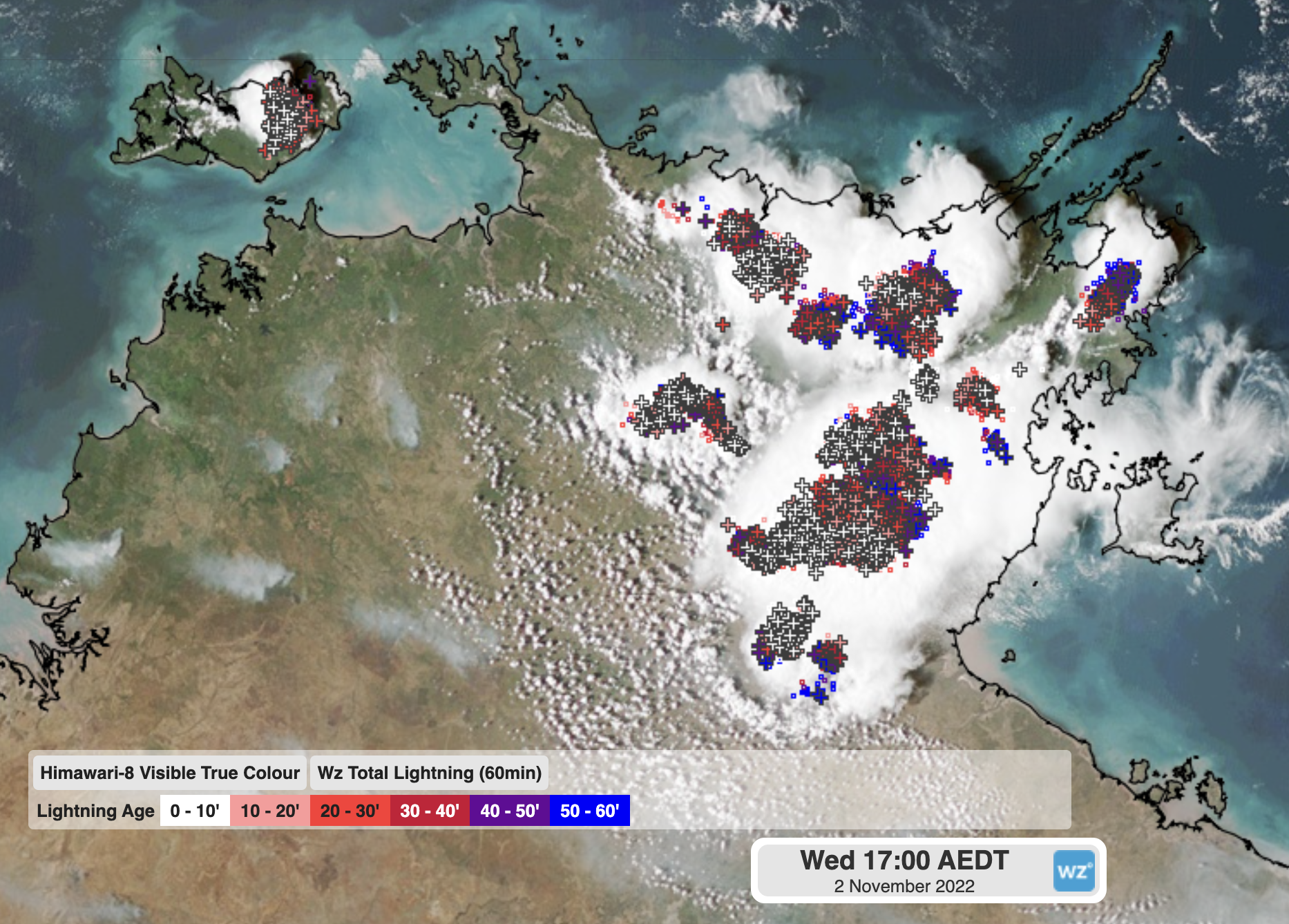
A true dichotomy of weather has played out over the Northern Territory on Wednesday as a trough split the Top End in two.
Video: Satellite and lightning showing the abundance of bush and grass fires in the west with powerful storms building in the east
Plumes of smoke from both bushfires and grassfires can be seen billowing up during the heat of the day. These can often be clearly seen from space as grey trails, showing up well due to the overall clean air the territory sees. Katherine reached a maximum of 42°C on Wednesday, with relative humidity hovering at about 17%.
The NT’s bushfire season runs during the dry season from May to November, but is typically most intense around October, when conditions are at their hottest and driest.
On the east side, Bulman also sweltered through a 42°C day, but with a relative humidity of 30%. That difference may not sound like much, but it meant that Katherine felt more like 38°C while Bulman felt closer to a 45°C day. This mix of high heat and humidity was the catalyst to generate thunderstorms in the afternoon, that quickly cooled Bulman down below 30C at 4pm.
The storms in the eastern Top End yesterday prompted a severe thunderstorm warning to be issue by the Bureau of Meteorology for heavy rainfall, as they were moving slowly.
So what caused the big difference?
What played out yesterday was known as a ‘dry line’. A dry line is like a cold front, in that it is the clear separation of two different airmasses. However, where they differ is that while cold fronts have a clear temperature difference across the boundary, dry lines see a large contrast in humidity.
Where the dry line exists, air tends to rise (hence why it is also a trough) but thunderstorms only have enough energy on the humid side, leading to a drastic contrast by the afternoon.

Image: ECMWF dew points on Wednesday afternoon showing the contrast in humid (blue and purple) from the drier (light blue and green) air over the Top End
Dry lines are particularly important features in Northern Australia because of this dichotomous weather and can be the difference between hot and gusty conditions, or humid and severe thunderstorms. Dry lines also rarely stay stationary, typically moving towards the coast at night, and further inland during the day, further complicating the weather.
DTN APAC can provide high quality temperature, humidity, and thunderstorm forecasts across Australia so you can see where dry lines may exist and prepare for the weather on either side. The Total Lightning Network (WZTLN) and its alerting network can help detect lightning nearby and tells you when conditions are ‘all clear’, so you can maximise safety while minimising costly downtime. To find out more, please email us at apac.sales@dtn.com.


