Parts of northwest WA saw the warmest minimum temperatures and highest rainfall on record in September, with a mean of nearly 6°C above average recorded at Port Hedland.
The map below shows a large portion of the state saw well above average nighttime temperatures in September, except for parts of the southeast which saw the lowest minimums on record. As a whole WA’s minimum temperatures were the highest on record this September, peaking at 2.34°C above average.
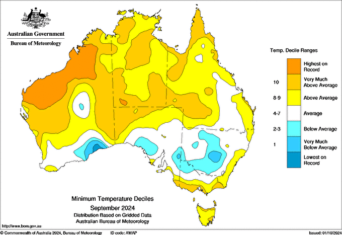
Image: Minimum temperature deciles for September 2024. Source Bureau of Meteorology
The record warm minimums were observed in parts of the Kimberley, Pilbara, Gascoyne and Northern Interior in September.
Port Hedland in the Pilbara region saw an average minimum temperature of 21.4°C in September, which is 5.8°C above the average. The coldest night the town saw was 17.8°C, which is still 2.2°C above the September average.
Not so coincidently, the rainfall in the Kimberley, Pilbara and Northern Interior districts was the highest on record in September, as an upper and low level trough combined with tropical moisture to bring unseasonable rainfall to the region. As a whole WA saw the seventh highest rain on record in September.
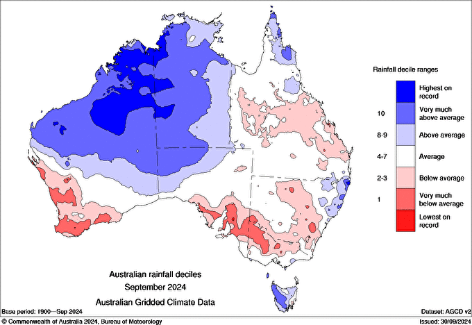
Image: Australian rainfall deciles for September 2024. Source: Bureau of Meteorology
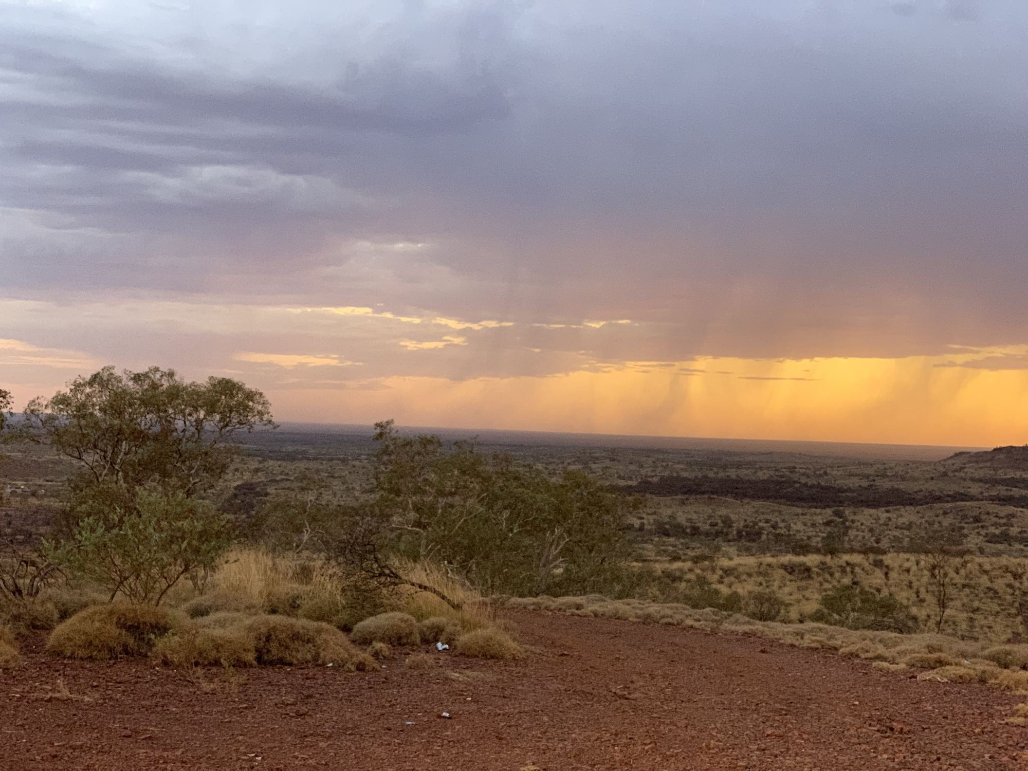
The rain events in September brought days of cloud cover to the northwest of WA, which acted as a blanket overnight keeping minimum temperatures warm in the region.
Another contributor to the record-breaking rain and minimum temperatures was the well above average Sea Surface Temperatures (SSTs) off the northwest coast of WA.
The map below shows that in this region ocean temperatures are 1-2°C above average, while some areas of the Kimberley coast are around 3°C above average.
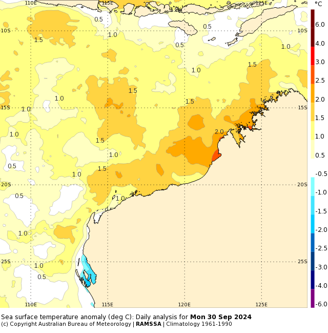
Image: Sea Surface temperature anomaly (°C) daily analysis for Monday, September 30. Source: Bureau of Meteorology
These warm ocean temperatures helped moderate the minimum temperatures in September across the northwest of WA. They also injected tropical moisture into the region, which helped fuel rain and thunderstorms during the first month of spring. For more information on how the SSTs could impact your spring and summer forecast in WA, please visit our website or email us at apac.sales@dtn.com.


