Prosper in a dynamic world
Search

Rain returning to northern Australia


The build-up is well and truly underway in northern Australia, with showers and thunderstorms on the forecast for Darwin on most days in the coming week.

Northern Australia is currently coming out of its dry season and has entered the build-up, a time of year that is characterised by rising humidity and increasing rain and thunderstorms in the tropics.

The first rainfall of the season that is sufficient to stimulate plant growth is referred to as the ‘northern rainfall onset’. This is defined as the date when 50 mm or more rainfall has accumulated after September 1.

In a normal year, the northern rainfall onset typically occurs in parts of coastal Qld and the NT’s Western Top End around late October or early November, before spreading to other areas of Australia’s tropics in the following weeks.

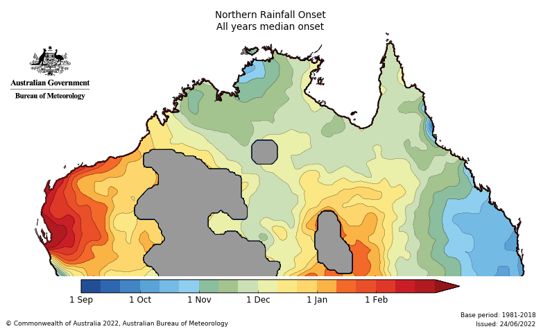
Image: Average northern rainfall onset dates. Source: Bureau of Meteorology

However, during La Niña periods, the rainfall onset usually comes a bit earlier than usual, typically around early-to-mid October for large areas of the NT, QLD and far northern WA.

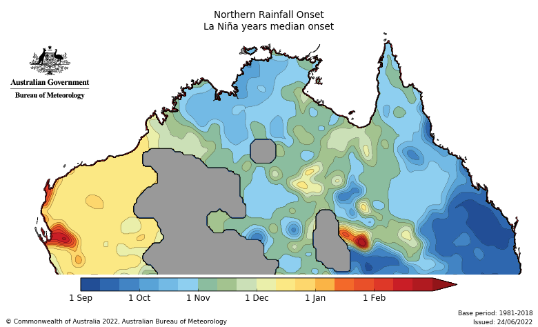
Image: Average northern rainfall onset dates during La Niña years. Source: Bureau of Meteorology

With La Niña currently in place in the Pacific Ocean, we are now entering the time of year that the northern rainfall onset typically occurs in.

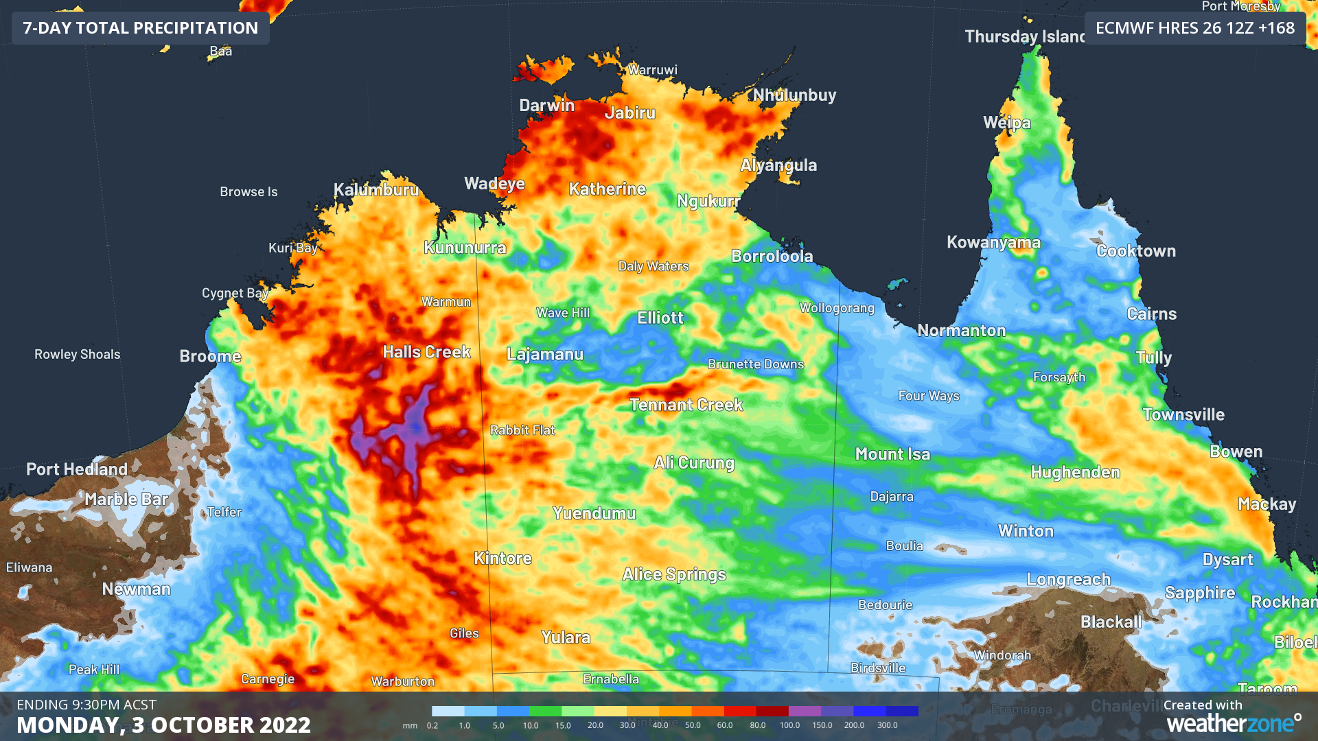
And right on cue, forecast models show that rain and thunderstorm activity is likely to increase from later this week and persist into the opening days of October. The map below shows how much rain one forecast model is predicting across Australia’s northern tropics during the next seven days.

Image: Forecast accumulated rain between today (Tuesday) and Monday next week, according to the ECMWF-HRES model.

The heaviest rain over the tropics during the next week is likely to occur over WA’s North Interior and the NT’s Western Top End. Some inland areas of WA could receive 100 to 200 mm of rain over the next seven days, causing an abrupt end to the dry season.

For more information on the northern wet season and tropical cyclone forecast, please contact us at apac.sales@dtn.com.

Latest news

Satisfy your weather obsession with these news headlines from around the nation, and the world.

How does DTN help businesses monitor bushfire induced pyrocumulonimbus thunderstorms that ignite more fires?

Intense heat from bushfires during elevated fire danger days can trigger fire-induced pyrocumulonimbus thunderstorms that ignite additional fires. In early January 2026, an extreme heatwave sweeping over southeastern Australia brought catastrophic fire danger to Victoria. Intensely hot bush and grass fires spread erratically and quickly in hot, dry and gusty winds, with pyrocumulonimbus generating lightning, […]

Active seas to the north and east of Australia disrupting port and maritime operations

Seas to the north and east of Australia are experiencing periods of increased activity this week, leading to disruptions to port, maritime and offshore operations. Intense and hazardous Tasman Sea Ocean conditions across NSW’s South Coast rapidly deteriorated last Friday as a deep feed of easterly winds whipped up large and dangerous seas. The Batemans […]

Transport, emergency and energy industries flooded across Greater Sydney with weekend deluges

Transport, emergency, energy and port industries in eastern NSW and Sydney were impacted by significant flash flooding with intense and heavy rainfall this weekend. Rainfall rates between 80 and 140mm in one to three hours were registered across parts of Sydney’s Northern Beaches and Central Coast on Saturday afternoon and evening. In some areas, these […]

DTN Dangerous Thunderstorm Alerts in action with severe thunderstorms disrupting Perth industries

Severe thunderstorms impacted southwest WA and the Perth region on Sunday, December 14, 2025, triggering Dangerous Thunderstorm Alerts (DTA) by DTN for industries and businesses in the region. DTN operates Dangerous Thunderstorm Alerts (DTA) which alert businesses and industries to thunderstorms based on intensity and movement. These alerts provide advanced notice of thunderstorms moving into […]