
A powerful cold front is approaching WA, and will generate a wild mix of record warmth, extreme fire danger, 100km/h winds, severe thunderstorms, and heavy rain across the state on Wednesday.
Record heat
Ahead of this front, heat has been building over WA over the last few days. Last night that heat produced the hottest September night on record for some locations.
Kalgoorlie sweated through its hottest September minimum in 82 years of records, staying above 22.8°C all night. Meekatharra also saw a long-term record tumble, only ‘cooling’ down to 23.2°C overnight, nearly two degrees warmer than the previous September record set 43 years ago. Leinster (22.0°C), Norseman (18.9°C) and Leonora (22.7°C) were some of the other locations that broke their monthly records.
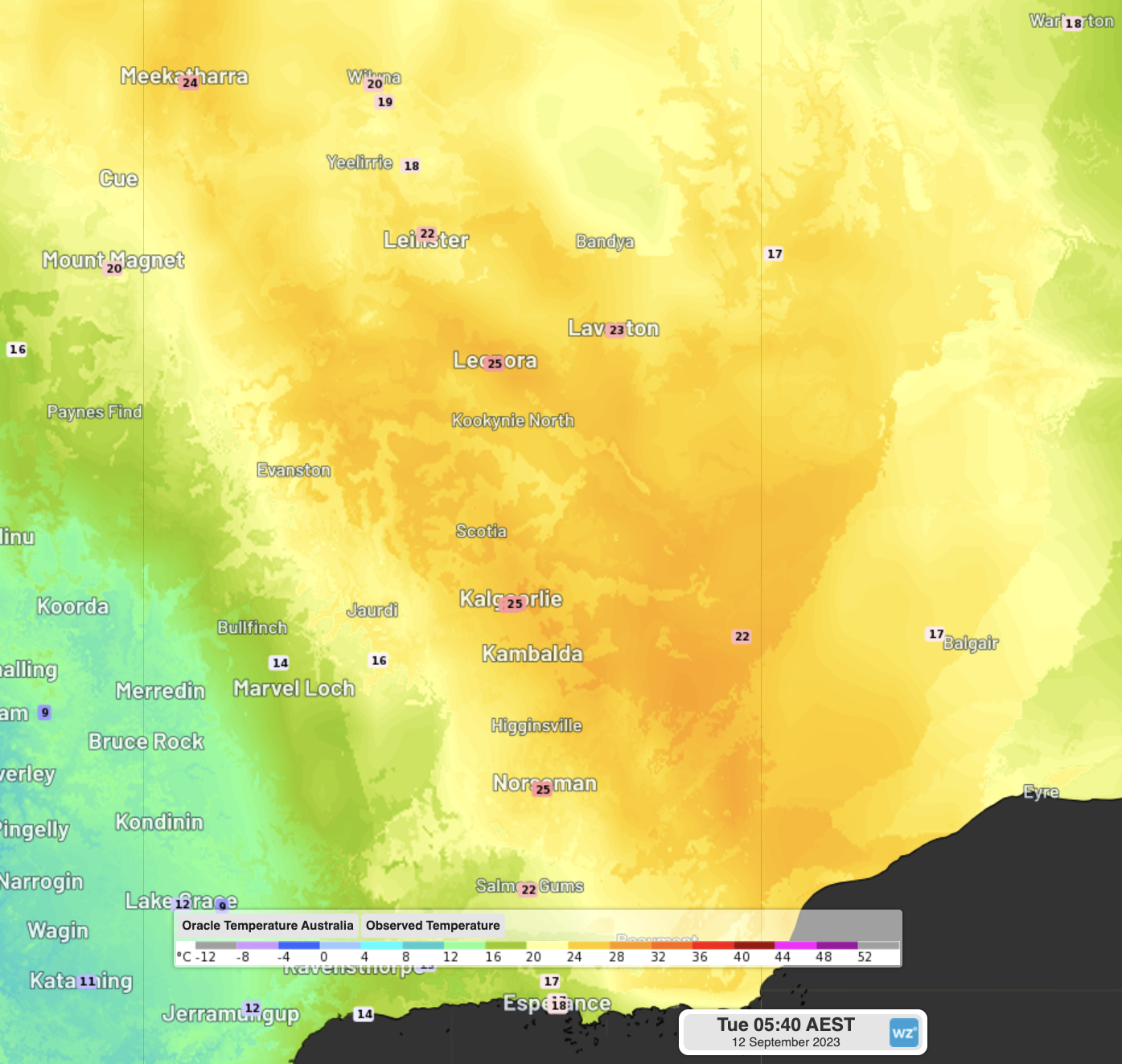
Image: Observed temperatures at 3:40am WST on Tuesday morning
Damaging winds and fire danger
Both ahead of and behind the cold front, powerful winds are expected to impact a large portion of the state on Wednesday. All areas south of a line from Carnarvon to the NT-SA-WA border junction are a risk to see damaging wind gusts exceeding 90km/h, with some areas possibly seeing gusts above 110km/h.
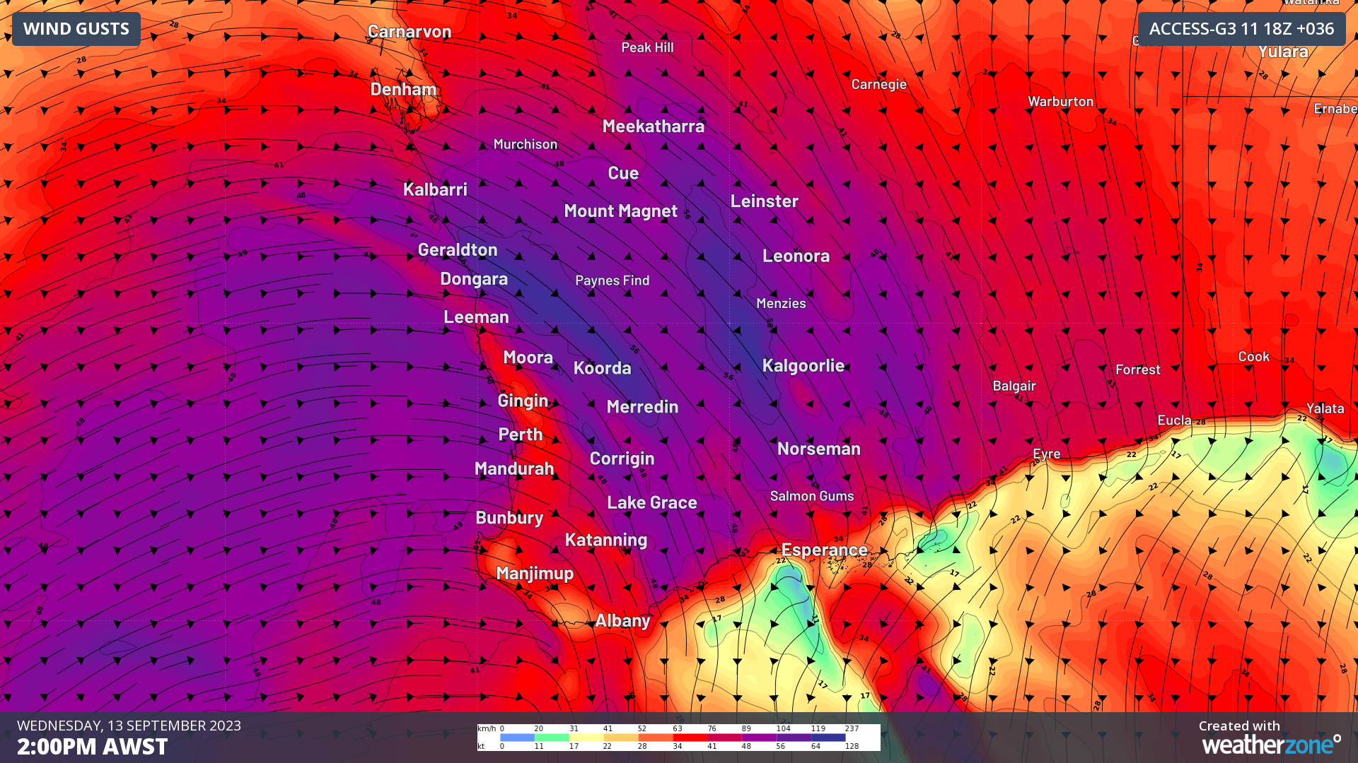
Image: Forecast wind gusts over southwest WA on Wednesday afternoon. Gusts in purple represent gusts exceeding 90km/h, with dark purple exceeding 110km/h. The cold front can be seen as the slightly weaker winds running through Leeman, Perth, Albany and at this timestep.
A severe weather warning has now been issued by the BoM for damaging and locally destructive winds over the region. That warning can be seen here.
The gusty winds ahead of the cold front will coincide with heat, increasing fire danger across the region, but particularly for the central inland. The North Goldfields and South Interior fire districts are forecast to see extreme fire danger on Wednesday, with models showing some localised areas possibly reaching catastrophic ratings. Significant drying of vegetation is also expected in SA on Thursday as the system moves east. Some areas in eastern WA and western SA could also see raised dust ahead with the strong, dry winds.
Thunderstorms and heavy rain
On Tuesday, a pair of pre-frontal troughs will cross southwestern parts of WA, producing some isolated showers and storms, but Wednesday will have the main band of storms.
From early Wednesday, the cold front will start to cross the southwest corner of the state. Thunderstorms look to start off isolated, but by late morning, scattered-to-widespread thunderstorms look to be crossing the west coast, including Perth. Along this rainband, heavy showers and storms are a high chance to bring powerful wind gusts exceeding 90km/h and potentially exceeding 120km/h. Heavy rain is also possible, with 20-50mm expected in less than 3 hours in some areas, possibly producing flash-flooding.
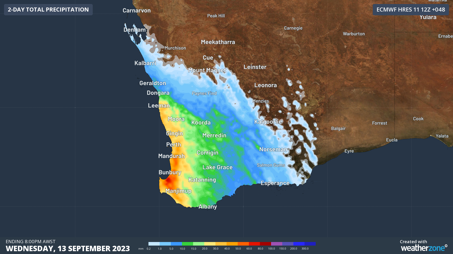
Image: Rainfall expected on Wednesday. Areas with orange and red shading could be at risk of flash-flooding
Ahead of the main front, one of the pre-frontal troughs will also gain strength, delivering scattered showers and storms through much of the inland and south coast of WA, including Kalgoorlie and Esperance on Wednesday. These storms are also a good chance to become severe, with damaging winds the most likely accompaniment.
As the line of storms pushes inland during Wednesday afternoon, rain and showers will cool down the state’s west significantly. Temperatures in Perth will likely feel in the single digits in the mid-afternoon on Wednesday, a big difference from the mid-twenties on Tuesday afternoon.
Luckily for the eastern states, this front will dive south into the Bight from Thursday, meaning it will have little effect other than redirecting the heat. However, western and central parts of SA may still experience windy conditions ahead of the front.
With this slew of severe weather expected, keep track of the warnings issued here.
How Weatherzone can prepare you for Thunderstorms
DTN APAC can help your business deal with thunderstorms through:
- Accurate and easy to understand forecasts beforehand
- Thunderstorm tracking and Lightning Alerting during a storm
- Event and Lightning reporting afterwards.
Our colossal influx of data from all the worlds leading weather forecast models and the Total Lightning Network gives us a unique ability to prepare your business for thunderstorms like no other. To find out more, please email us at apac.sales@dtn.com.




