The long-awaited monsoon could finally develop over northern Australia towards the end of next week, increasing the risk of heavy rain, thunderstorms and tropical cyclones in the second half of January.
Historically the monsoon arrives around late December on average, so its potential arrival next week is considered tardy. However, the latest monsoon onset at Darwin was on January 25, 1973, since records began in 1957.
Despite the absence of the monsoon, much of northern Australia saw above average rainfall during the opening months of the wet season.
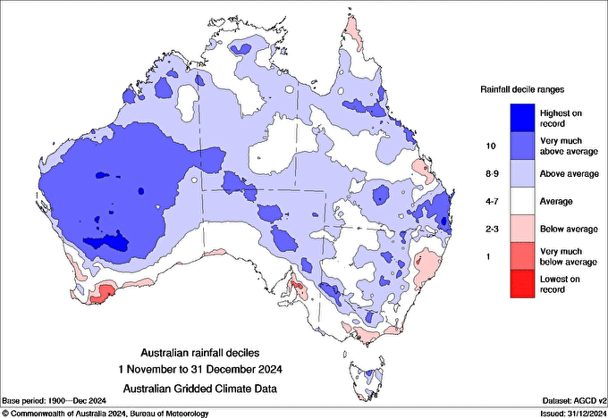
Image: Australian rainfall deciles for November and December 2024. Source: Bureau of Meteorology
The above average rainfall during late 2024 was largely caused by abnormally warm Sea Surface Temperatures (SSTs) surrounding Australia, adding additional moisture to the atmosphere which can fuel rain and thunderstorms.
This rainfall may be enhanced further from next week, with the monsoon typically bringing lengthy periods of heavy rain, thunderstorms and strong squally winds along with an increased risk of tropical cyclones across northern Australia. The monsoon’s arrival typically poses risks for mining and offshore oil and gas operations, including equipment damage, safety issues, and production delays.
Widespread totals of 100 to 200mm are forecast by one computer model during the next two weeks, with isolated falls exceeding 300mm.

Image: Accumulated rainfall forecast for the two weeks leading up to Saturday, January 25, according to GFS.
The monsoon rainfall being predicted over northern Australia in the coming weeks may also be enhanced by an active Madden Julian Oscillation (MJO) and an Equatorial Rossby Wave passing through the Australian region.
Recent forecasts show that MJO should gain strength and possibly pass to the north of Australia in the second half of January. Meanwhile, another tropical wave called an Equatorial Rossby Wave could also move through the Australian region in late-January.
What is the Madden Julian Oscillation?
The Madden Julian Oscillation, also known as the MJO, is a pulse of increased convective activity (enhanced cloud and stormy weather) that moves through Earth’s atmosphere near the equator. This tropical wave travels from west to east and typically takes around 30 to 60 days to complete one lap of the planet.
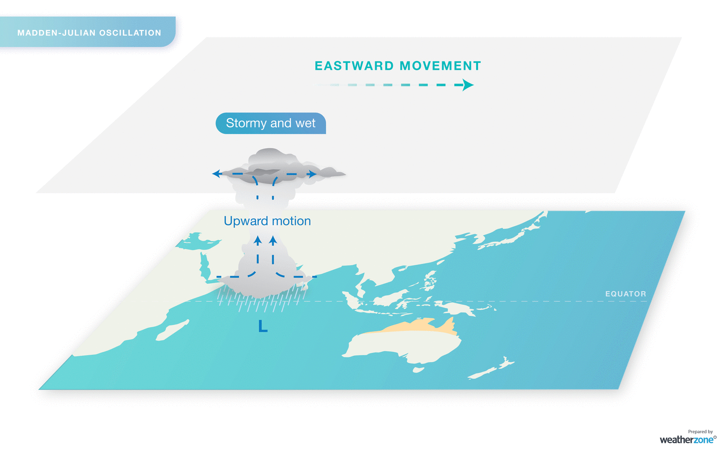
Image: Eastward propagation of stormy weather associated with the MJO.
The MJO varies in strength and its associated impacts. When it is in an active phase near the Australian region, northern Australia is at an increased risk of cloud cover, rainfall, thunderstorms and tropical cyclones.
What is an equatorial Rossby wave?
Equatorial Rossby waves travel through the tropical atmosphere from east to west at roughly the same speed as the MJO (but in the opposite direction). Equatorial Rossby waves typically produce an alternating sequence of high and low pressure systems on either side of the equator, resulting in mirrored zones of cloudiness and clear weather in the tropics of both hemispheres.
The MJO and equatorial Rossby waves both enhance rainy and stormy weather when they are near Australia, but their impacts are compounded when they arrive at the same time.
A recent study found that extreme rainfall is around 1.5 times more likely over northern Australia when an equatorial Rossby wave passes through the Australian region. However, when the Rossby wave coincides with an active pulse of the MJO, extreme rainfall is about three times more likely in northern Australia.
The long-awaited monsoon could finally develop over northern Australia towards the end of next week as these tropical waves sweep through the Australian region.
If the monsoon develops, in the presence of these waves, there will be an increased risk of cyclogenesis in the Australia region later in January. While it is too early to predict individual tropical cyclones in late-January, some computer models are forecasting that several tropical lows could form over waters off northern Australia, which have a higher risk of becoming cyclones with the waves and monsoon potentially in the region.
As the climate shifts into unchartered territory, weather events could affect your mine with increasing force.
Miningzone is the proven and trusted turnkey solution –deployed at over 400 mines globally – offering you tailored forecasting and alerting systems to protect your valuable staff and assets.
Weatherzone’s integrated services are intuitive and user-friendly, providing you with the specific weather and blast data needed to gain a complete environmental picture.
You will have access to our lightning and severe weather tracking and alerts, EPA-approved blast dispersion modelling, thunderstorm tracking and high precision and site-specific forecasting, along with comprehensive reporting capacity.
Precise, market-leading data is delivered via multiple platforms including Weatherguard – our easy-to-use app – and can be fully integrated into your operational control or SCADA systems.
The tailored solution to drive your decisions. For more information contact us at sales.apac@dtn.com
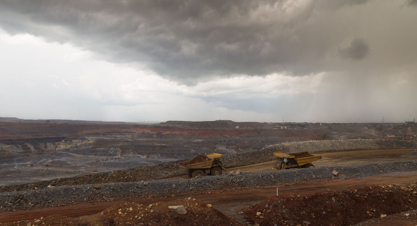
Thumbnail: Istock/Thomas_Moore


