
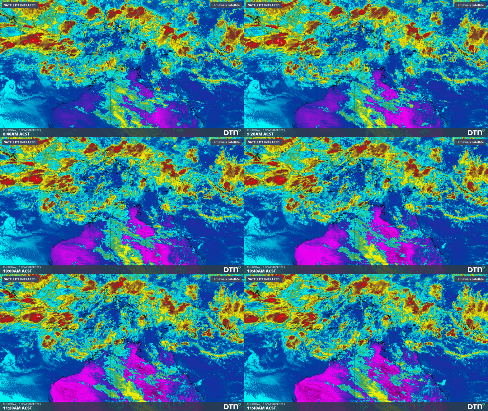
Sea surface temperatures exceeding 31°C off the coast of northern Australia and an active phase of the Madden-Julian Oscillation (MJO) are increasing the likelihood of early-season tropical cyclone activity, with hints of the season’s first tropical cyclone coming as early as next week.
Tropical cyclones require sea surface temperature of 26.5°C or warmer to develop, with higher ocean temperatures providing more energy for cyclones to gain strength.
Water temperatures to the north of Australia are currently sitting around 1-2°C above average for this time of year, with sea surface temperatures as high as 31°C to the west of the Top End and north of the Kimberley.
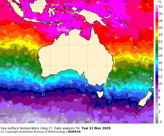
Image: Sea surface temperatures near Australia on November 11. Source: Bureau of Meteorology
The blob of warm water to the northwest of Darwin ranks in the top 10 percent of historical records for this time of year, meaning the ocean is primed to support tropical cyclone development in the coming weeks.
Some forecast models suggest that a tropical cyclone could develop over this area of warm water next week. The Bureau of Meteorology’s official 7-day tropical cyclone forecast gives a low chance of a cyclone forming as early as Tuesday.
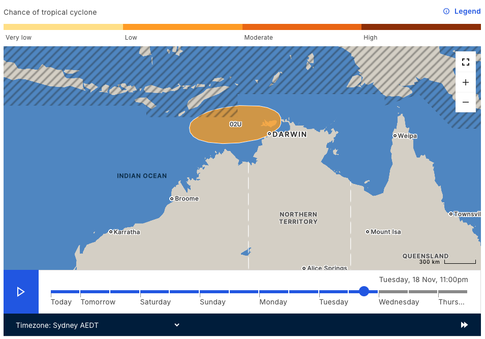
Image: 7-day tropical cyclone forecast from the Bureau of Meteorology.
Modelling from the European Centre for Medium Range Weather Forecasts (ECMWF) also hints at growing tropical cyclone potential over the pool of warm water towards the end of next week.
The map below shows that the ECMWF model is predicting a 20 to 30% chance of a tropical cyclone activity west of the Top End on Friday, November 21.
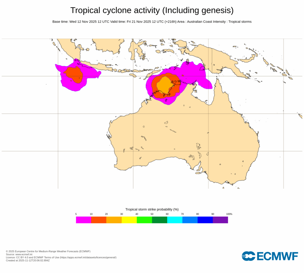
Image: Tropical cyclone potential near Australia late next week. The colours on the map represent the likelihood that a tropical cyclone will pass within 300 km of that location within 48 hours of 11pm AEDT on Friday, November 21. Source: ECMWF
Another factor that adds weight to the increasing potential for early-season tropical cyclone activity next week will be a tropical atmospheric wave passing to the north of Australia. This wave, called the Madden-Julian Oscillation (MJO), will cause an increase of cloud and thunderstorm activity near northern Australia over the coming week or two. This enhanced storminess can help create low pressure systems that can deepen to become tropical cyclones.
While there is still only a low chance of a tropical cyclone forming near Australia next week, industries across northern Australia should keep a close eye on the latest forecasts and warnings.
The Australian tropical cyclone season runs from November 1 to April 30 and the first tropical cyclone to form this year will be named Fina.
How DTN APAC helps businesses across the 2025-26 Tropical Cyclone Season
DTN APAC specialises in industry-leading forecast, alerting and threat analysis of tropical cyclones across Australia and Asia, offering you expert, customised solutions when the weather turns wild.
Providing rapid-update forecast information, we alert you to any low-pressure system gaining power within your region and, unlike other providers, can track its development out to 7 days. This gives you the time to prepare and safeguard your staff, sites and assets.
You will have the most precise weather intelligence charting rainfall, wind speeds and potential storm surges to help you make critical decisions quickly. Whether it’s adjusting key work schedules, protecting your staff or securing your site, we have the alerting capability to keep you steps ahead of the storm.
As the climate delivers increasingly severe weather events, their potential to impact your business operations grows.
Whether it’s preparing for the coming season’s tropical storm potential, or rapid-response forecasting with a typhoon approaching, or simply ensuring your operations team is equipped to confidently make decisions ahead of severe weather, our weather Risk Communicators are here for you.
Our weather risk communicators deliver short- to long-term guidance from:
- hourly-event weather monitoring (alerting you of impending destructive winds and heavy rain ahead of a tropical cyclone).
- week to month operational planning based on likely timing of increased monsoonal rain or periods of reduced cyclone activity.
- seasonal long term planning based on climate drivers and the likely trends across the coming months.
We deliver clear and comprehensive weather data, personalised risk assessments and briefings to you and your team, so that your critical decisions can be made with confidence.
We are available 365 days a year, so you always have the timely guidance you require, especially when severe conditions hit.
You have our insights to rely on to see you through complex situations, minimising potential loss of profit and maximising the safety of your staff and assets.
Learn more about our large range of industry leading products and services or email us at sales.apac@dtn.com




