The heaviest September rain in half a century has fallen over the Pilbara region of Western Australia overnight, with heavy rain still to come for a majority of Australia’s desert areas.
Widespread falls of 20-50mm fell over the Pilbara and Kimberley on Saturday night and is continuing on Sunday. Some of the standouts in the 24 hours to 9am Sunday have been:
- 38mm at Newman, its wettest September day in 59 years of records
- 24mm at Wyndham, its wettest September day in 55 years
- 18mm at Fitzroy Crossing, its wettest September day in 50 years
- 23mm at Argyle, its wettest September day in 39 years of records
Video: Estimated radar from DTN APAC Oracle, with satellite and rainfall observations of the rain falling on Saturday night and Sunday morning.
The mining camps of Fortescue Dave Forest (61mm), Coondewanna (57mm), and Christmas Creek (53mm) made up the wettest locations in the Pilbara. The remote Kimberley community of Yulmbu recorded the heaviest falls across the state of 65mm in the 24 hours to 9am Sunday.
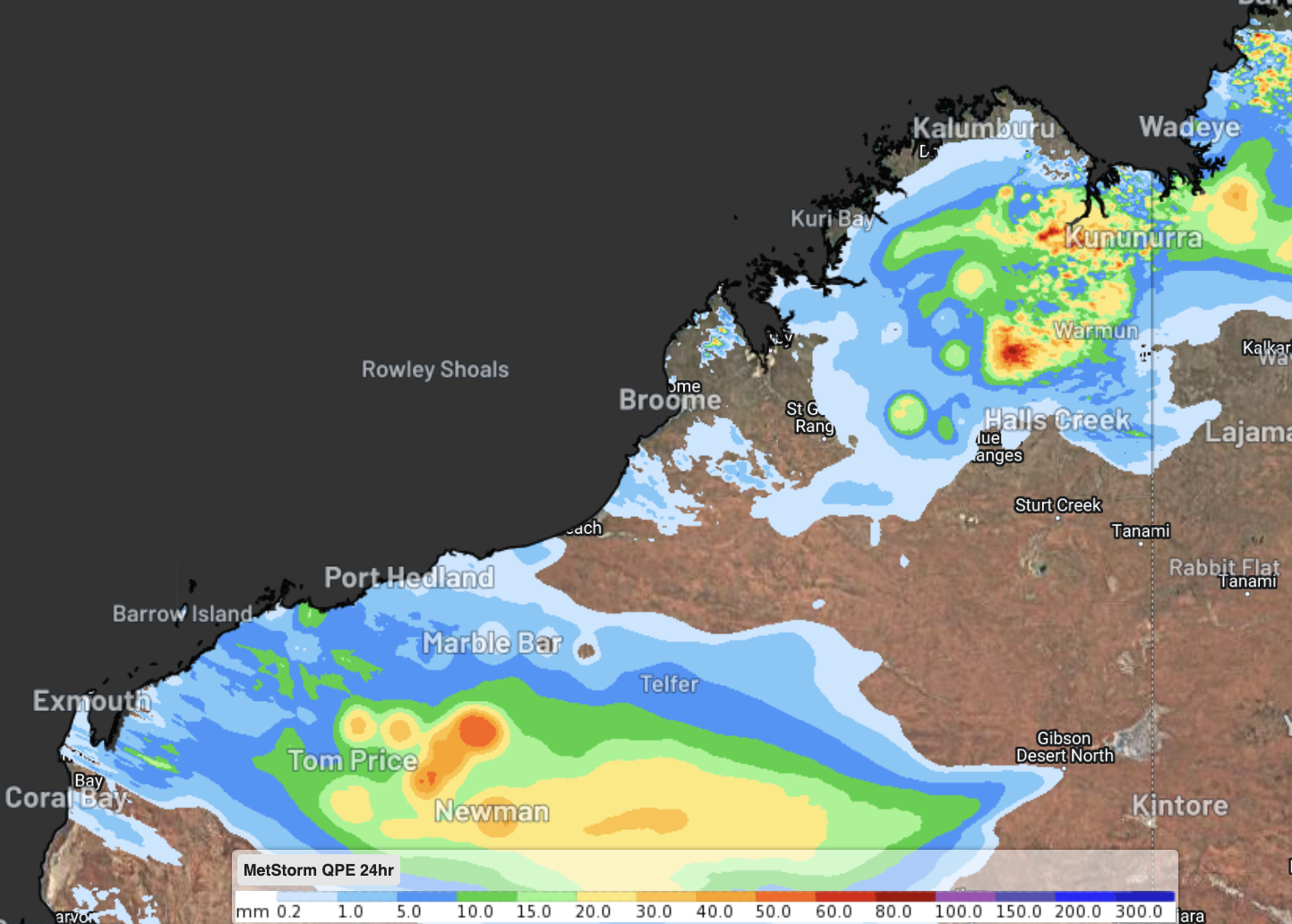
Image: Observed 24hr rainfall to 9am WST on Sunday September 22
Falls this heavy are extremely uncommon over the region at this time of year. Newman’s September average is a piddly 4.8mm, with well over half of Septembers recording no rainfall at all.
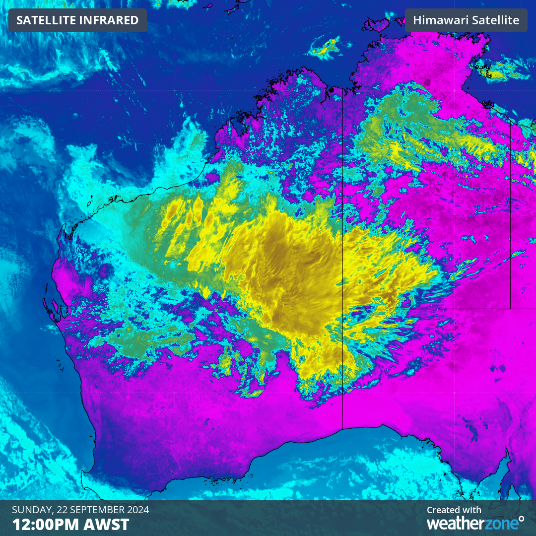
A feed of tropical moisture is congregating over the Pilbara region, stemming from the tropical disturbance that brought Darwin its wettest September day in 43 years last week. This moisture has now linked up with a trough and has formed into a northwest cloudband.
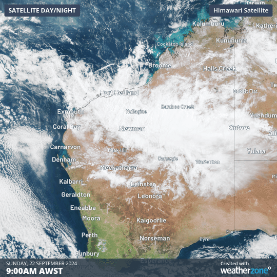
Image: Visible satellite on Sunday morning showing the northwest cloudband over northern WA
Over the next 72 to 96 hours, this northwest cloudband will continue to deliver heavy, unseasonable falls to large parts of inland WA, the southern NT, and northern parts of SA. The WA-NT border area is expected to see the highest falls, with the potential to see 100-160mm fall over a three-day period.
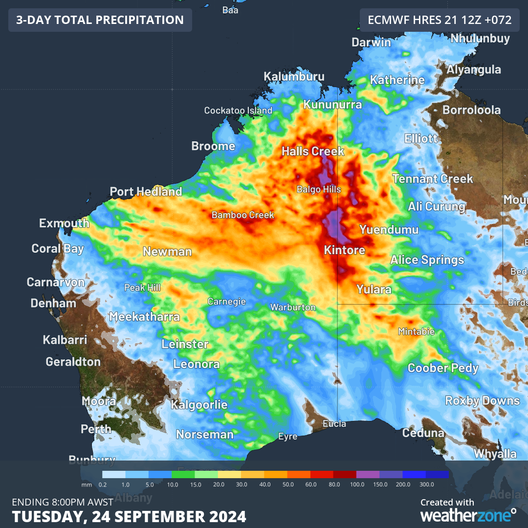
Image: ECMWF forecast rainfall to Tuesday evening over northern Australia.
A flood watch has been issued for the Sturt Creek District, Sandy, Tanami and Western Desert catchments, with both flash-flooding and riverine flooding in the region over the coming days. You can keep up to date with the latest warnings at Weatherzone.com.au.
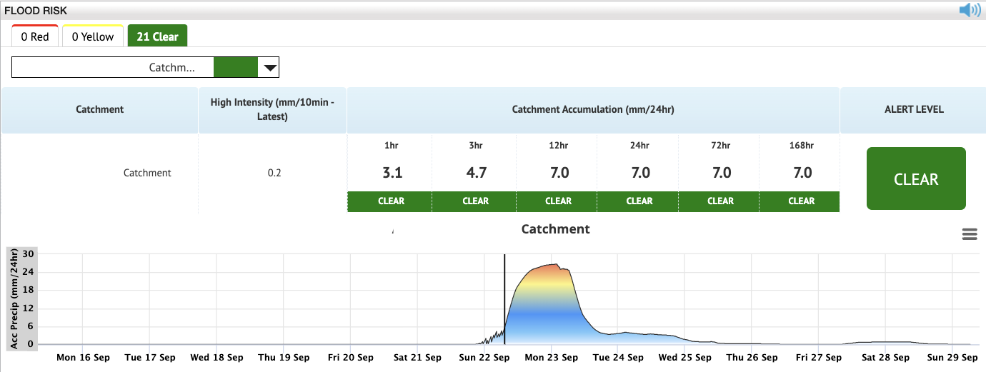
DTN APAC has all the tools necessary to forecast and visualise heavy rain and flooding events, even in remote locations. Our Flood Risk Dashboard (real data from this event shown below) highlights times of the heaviest rainfall, and tracks rainfall accumulations over several key time periods. Weatherzone Oracle also supplements this, providing satellite-based radar coverage across Australia, even for locations with no radar coverage.
To find out more about Weatherzone Oracle or our Flood Risk Dashboard, please email us at apac.sales@dtn.com.


