Australia’s northern tropics are awakening, with growing potential for tropical cyclone development later this week.
The image below shows the cloud and thunderstorms impacting northern Australia on Wednesday morning.
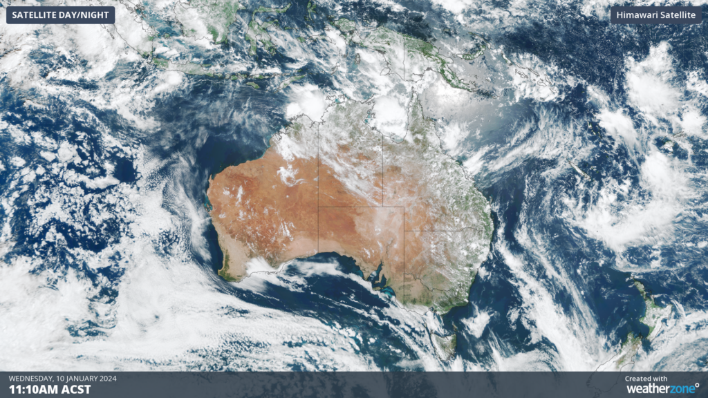
Image: Himawarri-9 satellite image at 11:20am on Wednesday, January 10.
As we wrote yesterday, the monsoon trough is set to arrive in Australia on Thursday, bringing an increased potential for tropical cyclones, gusty winds, heavy rain, frequent storms across northern Australia.
Often tropical cyclones form within the monsoon trough, particularly if embedded low-pressure systems remain over warm water for several days.
Forecast models currently suggest that three tropical lows could form within monsoon trough by Sunday, which increases the risk of tropical cyclone development later this week.
The map below shows where the Bureau of Meteorology expects the lows to be located on Sunday, January 14, with the centre of the systems expected to be located somewhere inside the orange or yellow shaded areas.
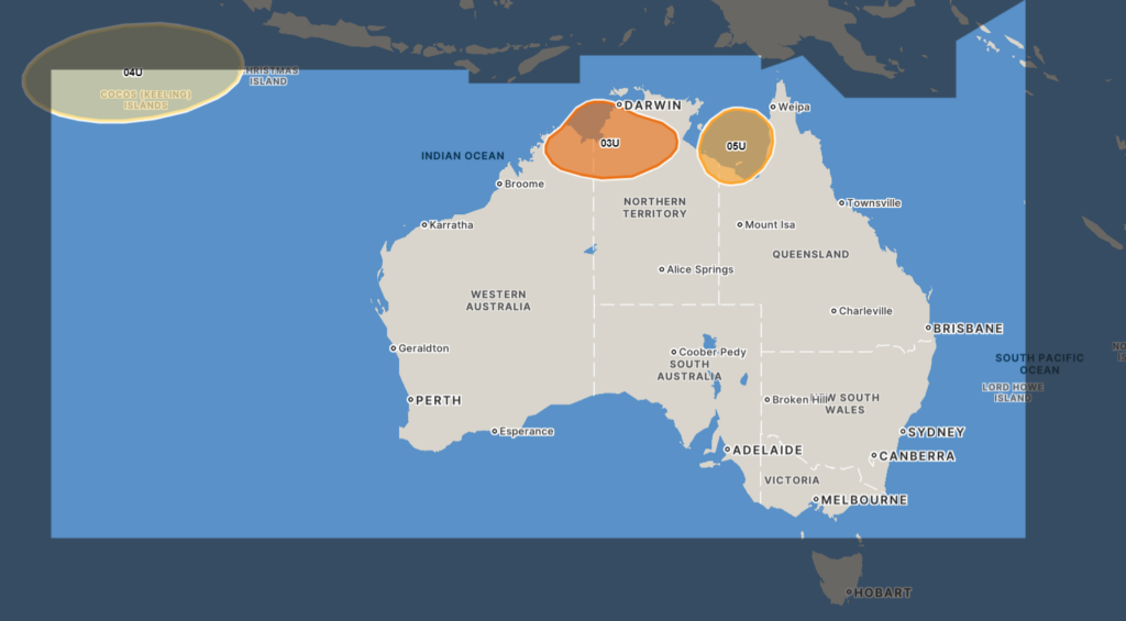
Image: The forecast location for the systems (03U, 04U and 5U) on Sunday, January 14 is expected to be located somewhere in the orange or yellow shaded areas. Source: Bureau of Meteorology.
The first tropical low, designated 03U (the 3rd tropical low of the season in the Australian region), could form near the Joseph Bonaparte Gulf to the west of Darwin on Friday and if it remains over water, it could develop into a tropical cyclone. This system should move southwards over the weekend with a medium chance of developing into a cyclone from Saturday. It could make landfall in the NT or Kimberley in WA over the weekend.
Another tropical low, 05U, could form in the Gulf of Carpentaria from Friday or Saturday. If this system forms and remains over water, there is a low chance of it developing into a tropical cyclone from Sunday, January 14.
The other system, designated 04U, is a potential tropical low that could form near the Cocos (Keeling) Islands this weekend. While there is a small change that it could become a tropical cyclone early next week, this system currently poses no threat to the Australian Mainland.
Regardless of tropical cyclone status, the low 03U and monsoon trough should bring heavy rainfall which could lead to flooding in parts of the Top End or Kimberley in WA. Meanwhile, tropical low 05U is forecast to bring heavy rainfall to Far North Queensland, potentially soaking areas that are still recovering from the floods caused by Cyclone Jasper late last year.
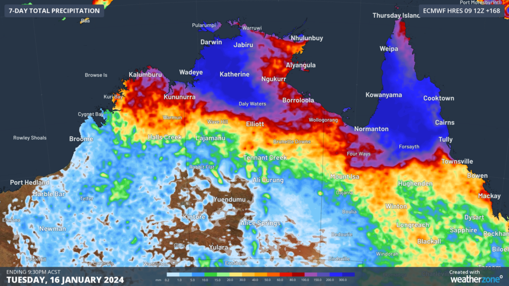
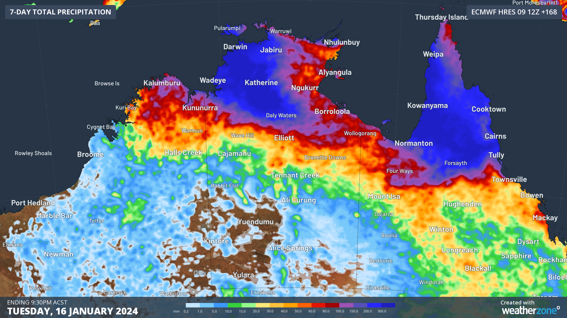
Image: ECMWF accumulated forecast rainfall for 7 days leading up to 9:30pm ACST on Tuesday, January 16. Areas in dark blue could see up to 500mm.
While the monsoon trough is behind the activity this week, another climate driver that is moving into the Australia region next week which could enhance activity further.
The Madden Julian Oscillation (MJO) is a pulse of cloud and rain that moves around the equator every 30-60 days. When it is over the Maritime continent or near the shaded continent in the map below, it can enhance rainfall, thunderstorm and cloud across northern Australia and increase the risk of tropical cyclone development.
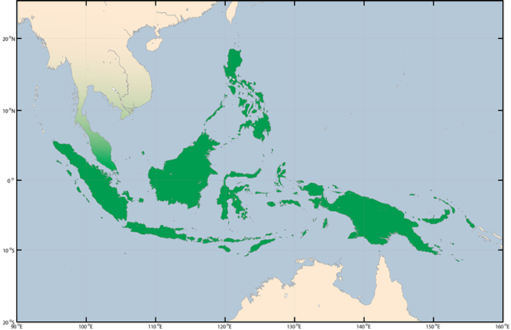
Image: The green shaded areas show the maritime continent to the north of Australia, Source: BOM
From next week, the MJO is forecast to be over the maritime continent until early February, which could increase the likelihood of cyclones and bring periods of heavy rain and thunderstorms.
We will be watching the tropical lows, the MJO and the monsoon closely over the coming week and update you further. DTN APAC, specialises in industry-leading forecast, alerting and threat analysis of tropical cyclones, offering you expert, customised solutions when the weather turns wild. For more information, please contact us at apac.sales@dtn.com.


