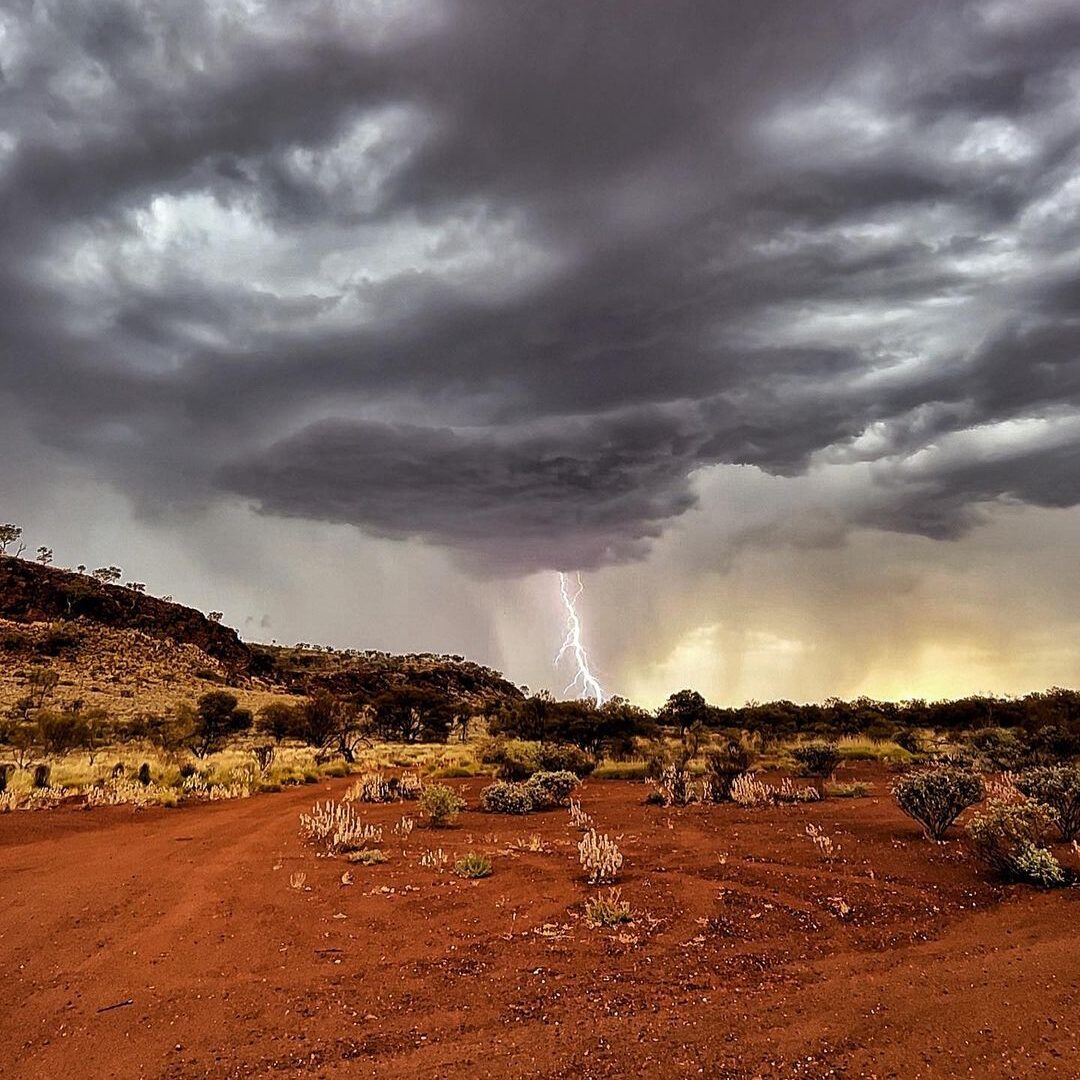
After narrowly avoiding the monsoon and ex-Tropical Cyclone Ellie, heat and thunderstorms are returning to the Pilbara.
The build-up refers to the time between monsoon onsets, and features building heat, humidity and thunderstorms, particularly in the afternoon. The monsoon last arrived just before Christmas, heralded by the arrival of Tropical Cyclone Ellie, and lingered over the Kimberley for nearly three weeks.
Temperatures have been the first to rise as the monsoon moved away. A trough pushing near the western Pilbara coast will make Friday the hottest day of the year so far for the region. Exactly one year since its Australian record-equalling 50.7°C, Onslow is expecting a top of 45°C, although it may rise as high as 48°C depending on the timing of a seabreeze. The mercury will also reach the mid-to-high forties over the weekend before some cooling occurs thanks to thunderstorms.
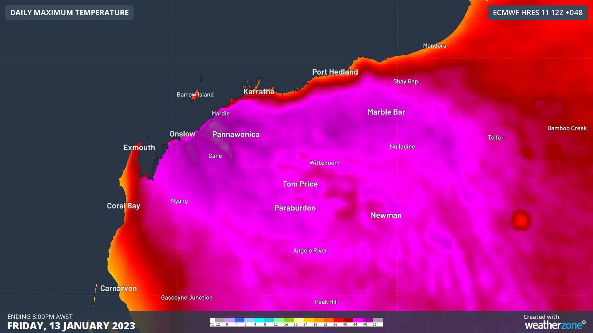
Image: Maximum temperatures forecast for Friday 13th from ECWMF
Humidity will start to flow into a trough over the Pilbara from Saturday, helping to produced scattered showers and thunderstorms each afternoon for at least the next week. Due to the high temperatures the storms will form in, some storms will be severe with damaging winds, while others will be slow-moving, increasing the chance of heavy rain and isolated flash-flooding.
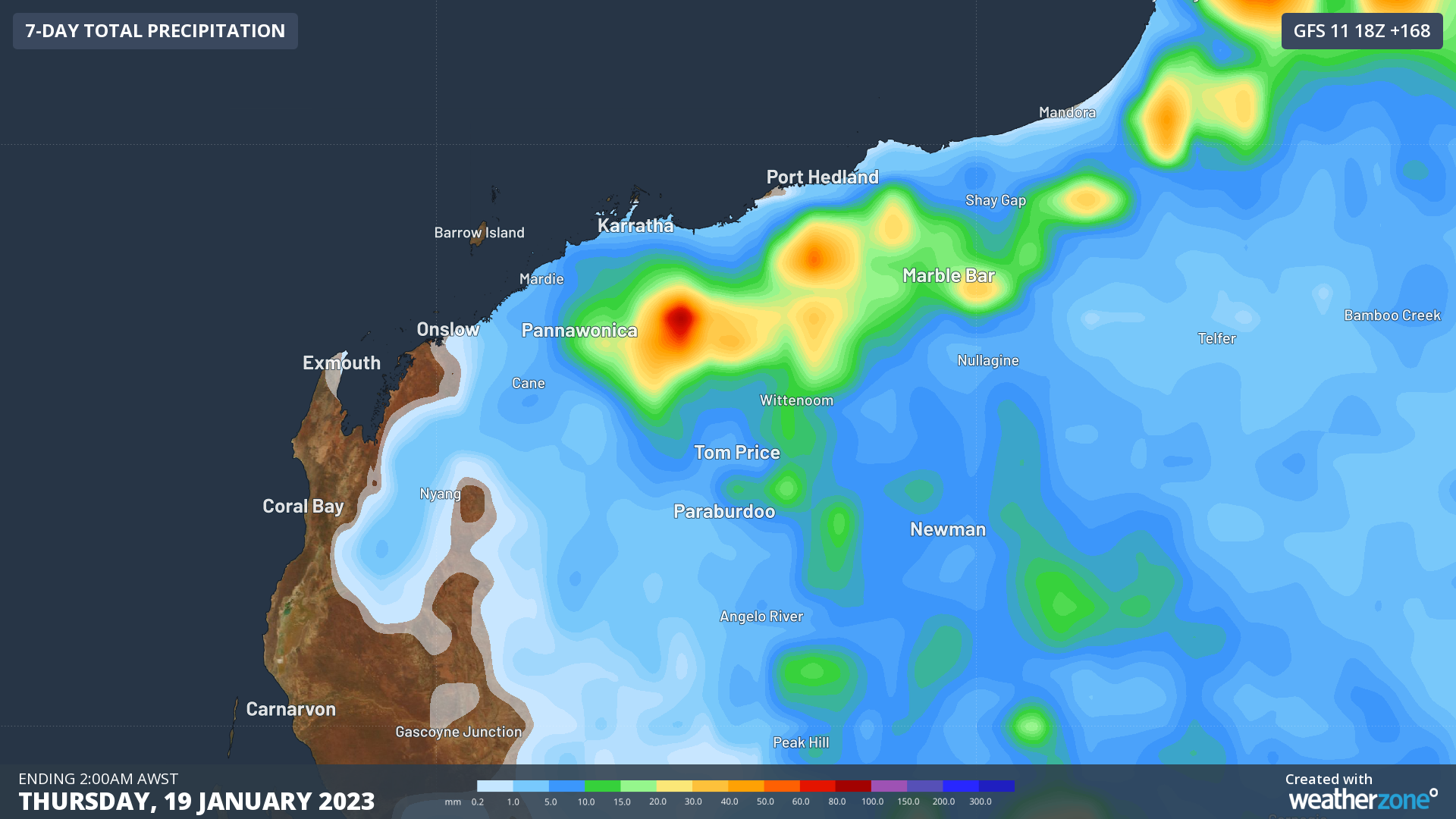 Image: Weekly rainfall forecast from GFS, with the rainfall ‘bullseyes’ indicative of rain falling with thunderstorms
While thunderstorms will be mainly inland, there are a few opportunities for storms to form near the coast for places such as Karratha and Port Hedland. As is typical for these locations, storms are most likely in the morning before or just after sunrise. This is because the afternoon seabreeze cools these locations too much for thunderstorms to form, so they typically form further inland. During the night, a landbreeze forms, allowing the instability to move back towards the coast, where the overnight temperatures are higher. Coastal parts could see a storm or two on Monday and Tuesday mornings next week, with a higher chance possible at the end of the week.
Build-up conditions like these will continue for several weeks over the Pilbara as the monsoon is active over other parts of the globe. The monsoon typically retreats for 4-6 weeks before returning to Australia, so keep an eye out in February for the next arrival.
DTN APAC provides detailed forecasts of thunderstorm, temperatures, wind, and any other weather impacts that may affect your assets, through our talented meteorologist team. Combine that with our automated alerts due to extreme weather and lightning, you can maximise your preparedness for adverse weather, and minimise downtime where they do occur. To find out more about how Weatherzone can help your business, please email us at apac.sales@dtn.com.


