Severe storms are flaring up in Kimberley and Top End as the build-up to the monsoon ramps up.
The build-up season is an unofficial season that generally runs between September and December in northern Australia. It is characterised by hot temperatures and building humidity. As the build-up continues, thunderstorms (especially in the afternoon) become a more regular occurrence. This activity reaches a peak just before the monsoon arrives, which brings heavy rain, storms, cooler temperatures and an increased chance of tropical cyclones.

Image: Thunderstorms over northern Aus shown by the Total Lightning Network (WZTLN) and Weatherzone Oracle
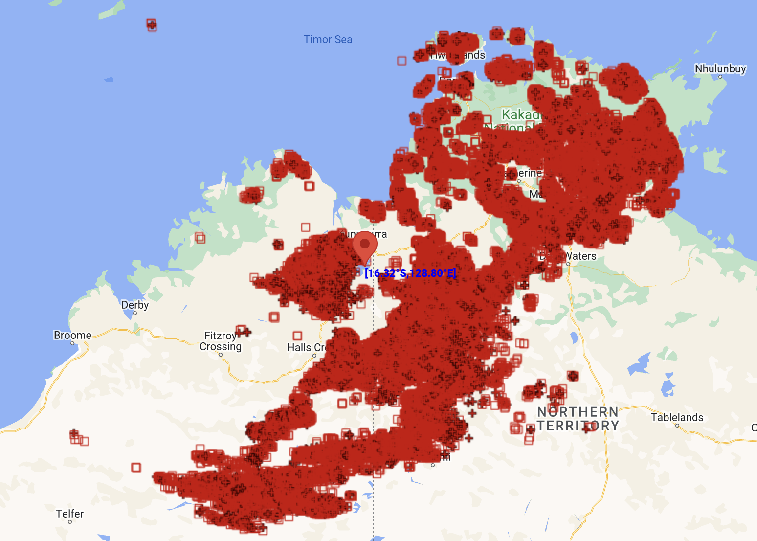
Build-up thunderstorms are once again sparking up over northern Australia, with some of these storms being severe, producing damaging winds and heavy rain. As of 4pm ACST, there had already been over 250,000 strikes recorded over the Top End and Kimberley, with plenty of strikes still to come into the evening.
 Image: Lightning strikes within 800km of Lake Argyle recorded up to 4pm ACST Thursday 17th from the WZTLN
The coming week will see regular scattered-to-widespread thunderstorms occurring over the north each afternoon, with more thunderstorms also forming overnights and in the mornings. Some of these storms will likely be severe with damaging wind gusts and heavy rain possible. You can find the active warnings on our website here.
Over the next fortnight, thunderstorms look to become more of a regular occurrence over the coast just north of Australia as well. This is a tell-tale sign that the monsoon is not too far off and may be building early in December. During La Niña years, the monsoon tends to arrive earlier, usually in mid-December.
 Image: Rainfall expected over the next week from ECMWF
DTN APAC can provide access to our industry leading WZTLN and Oracle products so that your business can track thunderstorms, allowing you to safely and efficiently avoid their severe affects. To find out more, please email us at apac.sales@dtn.com.


