The number of tropical cyclones in the Australian region is expected to be close to the long-term average in the official season which runs from the start of November to the end of April, according to the Bureau of Meteorology.
But the BoM cautions that the likelihood of severe tropical cyclones of Category 3, 4, or 5 is higher than usual, due to warmer-than-average ocean temperatures forecast for the Australian region in coming months.
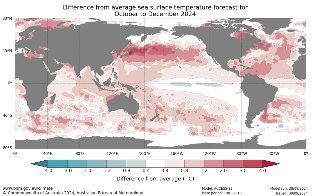
Image: Sea surface temperatures are expected to be warmer than usual during the last three months of 2024, enhancing the likelihood of tropical cyclones becoming severe season. Source: BoM.
Australia sees between nine and ten tropical cyclones per season on average (the average is based on the World Meteorological Organisation’s standard 30-year baseline period from 1990 to 2020).
On average, four make landfall (cross the Australian coastline) while five are severe.
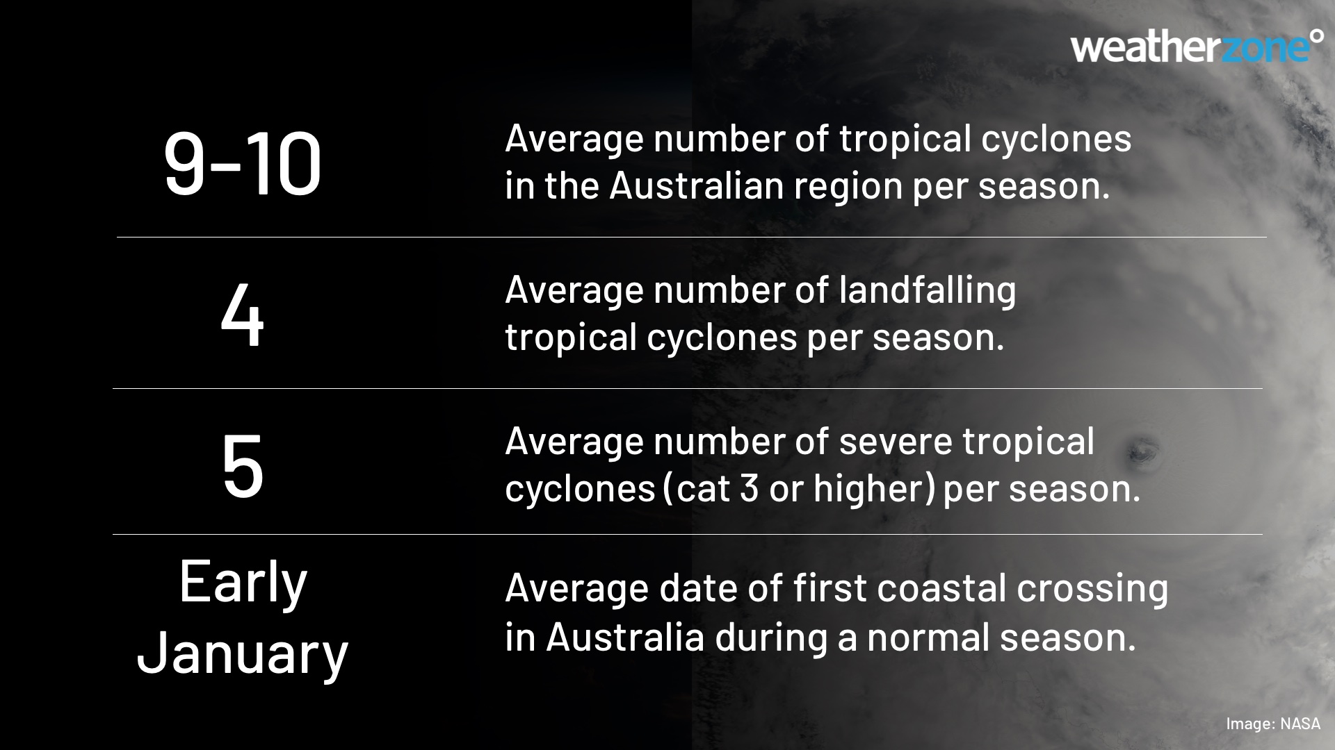
Image: Stats on tropical cyclones in the Australian region.
The graph below shows the number of tropical cyclones year-by-year in the Australian region since 1980.
While the data shows that the last two seasons had a below-average number of cyclones, it’s worth noting that more than half of the cyclones in both seasons were classed as severe.
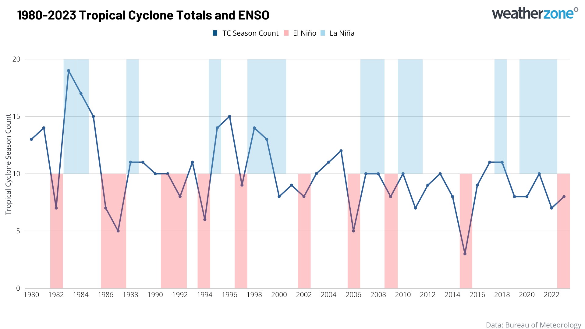
Image: Tropical cyclone frequency in Australia since 1980.
The graph also shows years in which there was an EL Niño (red bar) or a La Niña (blue bar) event.
As you can see, El Niño events are very well correlated with the quietest seasons on record, like in 1987-88, 2006-07, and 2015-16. The relationship is not quite as strong with La Niña, but many of the most active seasons occurred during La Niña years, including 1983-84, 1995-96, and 1998-99.
Currently in Australia we are not experiencing an EL Niño or La Niña, although the scales appear to be tipping in favour of a La Niña event developing during tropical cyclone season.
Meanwhile the first cyclone that forms this season will be named “Robyn”.
How do they name cyclones?
The BoM keeps a list of approved names, in alphabetical order by the first letter. It alternates between male and female names. Each name is a single word, usually a given name.
It would be unprecedented in the age of meteorological record-keeping to see 20 cyclones in the Australian region over the course of one season, but just in case the average total of nine to ten is doubled, here are the next 20 names, in order.
Robyn, Sean, Taliah, Vince, Zelia, Anthony, Bianca, Courtney, Dianne, Errol, Fina, Grant, Hayley, Iggy, Jenna, Koji, Luana, Mitchell, Narelle, Oran.
Weatherzone provides our clients with detailed Tropical Cyclone, wet season, thunderstorm, heavy rainfall and extreme heat seasonal forecasts, helping businesses prepare for the upcoming cyclone season. For more information, please visit our website or email us at apac.sales@dtn.com.