The Australian tropics could be on the verge of awakening, with growing signs that heavy rain and increased tropical cyclone risk could impact mining operations next week.
Despite frequent showers and thunderstorms over parts of northern Australia in the last couple of months, there has been a noticeable absence of sustained monsoon rainfall and tropical cyclone activity so far this season.
It’s unusual to go this far into the ‘wet season’ without the monsoon reaching northern Australia. In an average year, the monsoon usually arrives in northern Australia around the middle of December, with the latest recorded monsoon onset date at Darwin being January 25 in 1973.
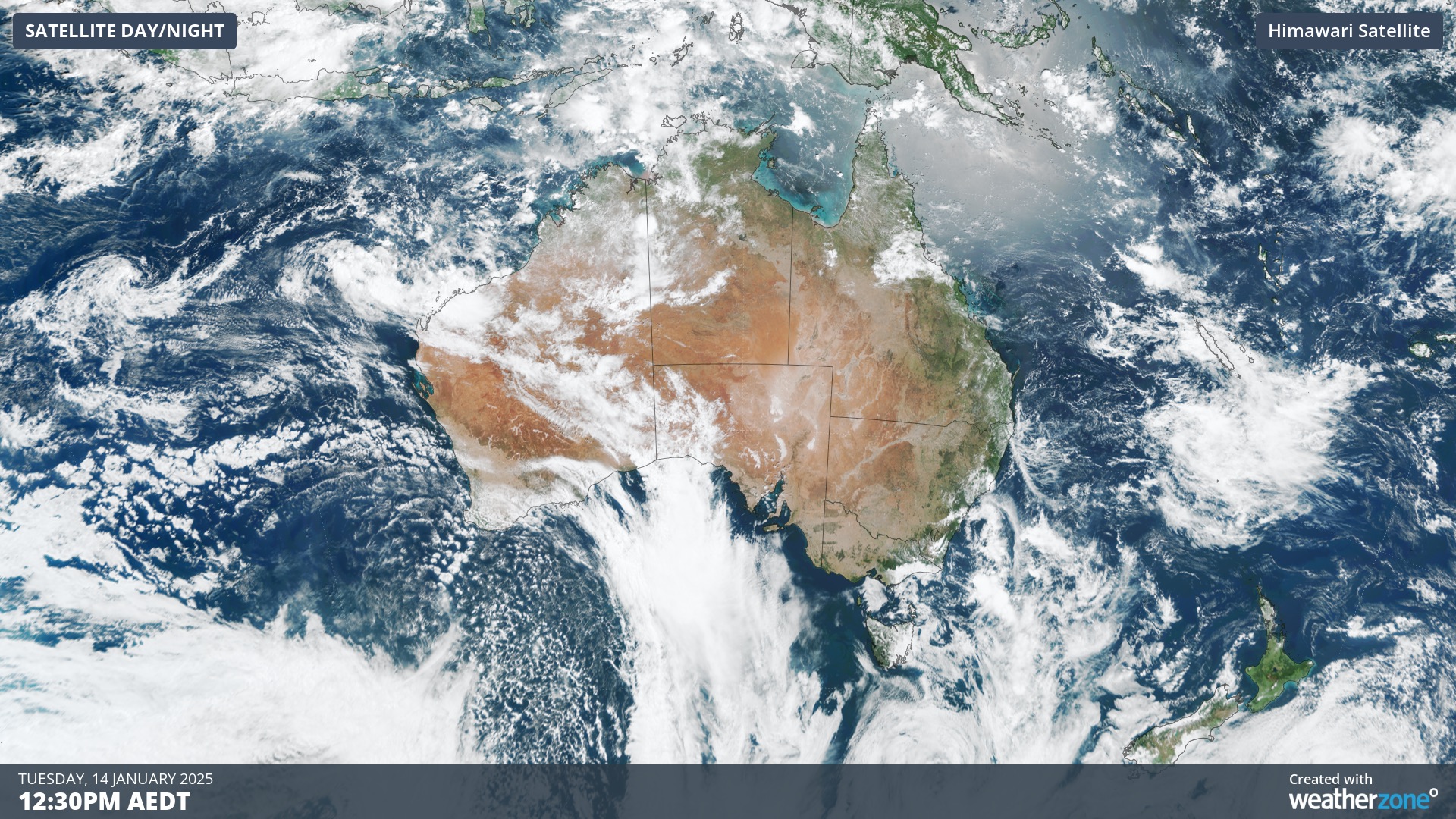
Image: Satellite image showing little cloud cover over Australia’s tropics on Tuesday, January 14, 2025.
There has also only been one tropical cyclone named in the Australian region so far this season (Robyn) and none have come anywhere near our coast. In an average year not influenced by La Niña or El Niño, the first tropical cyclone to make landfall would be around late December.
By all measures, it has been a sluggish start to the wet season in northern Australia, but this could be about to change.
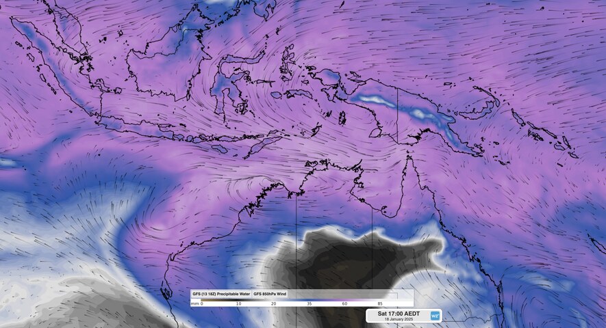
Some forecast models suggest that a surge of tropical moisture will encourage more typical monsoon-like rainfall over parts of northern Australia next week, while also increasing the likelihood of tropical cyclone activity near Australia’s tropical coast.
The driving force behind this tropical surge will be an active phase of the Madden-Julian Oscillation (MJO) passing to the north of Australia.
The MJO refers a large region of increased rain and thunderstorm activity that moves around the planet from west to east near the equator, typically recurring every 30 to 60 days. When the MJO is active near Australia, it increases the likelihood of rain, thunderstorms and tropical cyclone activity in the Australian region.
An active MJO is expected to pass through the Australian region from the week starting January 20 through to early February.
The impending MJO burst will be bolstered by a huge pool of abnormally warm water lying off the northwest of Australia. This warm water, where sea surface temperatures are about 2-4°C above average, will add extra moisture to the atmosphere and provide more energy for cyclogenesis (the formation of low pressure systems that can go on to become tropical cyclones). These warm waters will also help a tropical cyclone intensify, should one form.
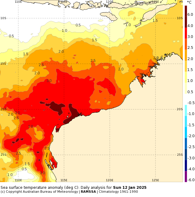
Image: Observed sea surface temperature anomalies off the northwest coast of Australia on January 12, 2025. Source: Bureau of Meteorology.
Rainfall forecasts for the coming seven days are showing increased rainfall over parts of Australia western tropics, particularly between the western Top End and the Pilbara. The map below shows the forecast accumulated rain over the next seven days, although the heaviest rain is expected to develop from late this week into next week.
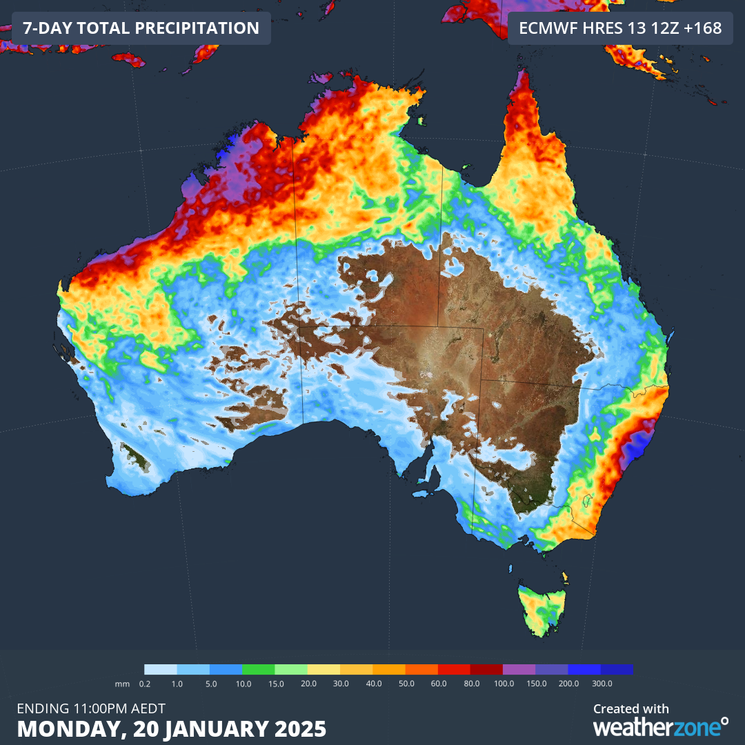
Image: Forecast accumulated rain during the seven days ending on Monday, January 20, 2025.
The Bureau of Meteorology is also monitoring two potential tropical lows that are expected to form off the north coast of WA during the coming week. While these lows only have a low risk of becoming tropical cyclones this week, the risk increases to moderate for one of the systems from early next week.
It is too early to know if this impending surge of moisture will qualify as a fully-fledged monsoon onset for northern Australia. It’s also too early to know if a tropical cyclone will develop and how strong it will be. However, there are already clear signs that the tropics could be about to wake up, so be sure to keep an eye on the forecasts and warnings as we head into the final fortnight of January.
As the climate shifts into unchartered territory, weather events could affect your mine with increasing force.
Miningzone is the proven and trusted turnkey solution –deployed at over 400 mines globally – offering you tailored forecasting and alerting systems to protect your valuable staff and assets.
Weatherzone’s integrated services are intuitive and user-friendly, providing you with the specific weather and blast data needed to gain a complete environmental picture.
You will have access to our lightning and severe weather tracking and alerts, EPA-approved blast dispersion modelling, thunderstorm tracking and high precision and site-specific forecasting, along with comprehensive reporting capacity.
Precise, market-leading data is delivered via multiple platforms including Weatherguard – our easy-to-use app – and can be fully integrated into your operational control or SCADA systems.
The tailored solution to drive your decisions. For more information contact us at sales.apac@dtn.com


