A powerful Tasman Low spinning off Australia’s East Coast is whipping up large waves along coastal NSW.
A low pressure trough that slowly made its way from outback Queensland and over NSW over the past week, delivering widespread flooding, moved off the NSW coast this weekend. Very warm sea surface temperatures, along with support from low pressure in the upper atmosphere, allowed a powerful Tasman Low to spin up on Sunday, March 30.
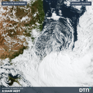

Image: Satellite loop of the low developing on Monday, March 31.
The central pressure of the low at 11pm AEDT on Sunday, March 30, was 997hPa, and is forecast to quickly drop below 980hPa by Monday afternoon. This technically classifies this low as a bombing low, another way of saying it has undergone explosive cyclogenesis. This rapid intensification generated strong southerly winds along the coastal fringe, reaching over 100km/h for exposed coastal locations. The strong gale to storm strength winds have generated large seas across the Tasman, with significant wave heights reaching around 10 metres near the low, as reflected in the forecast image below.
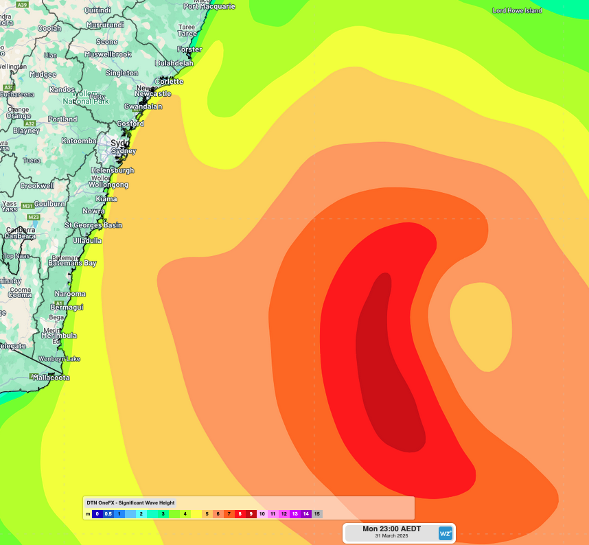
Image: DTN’s OneFX significant wave heights in the Tasman Sea at 11pm on Monday, March 31.
The image below shows wave heights rapidly climbing at NSW’s wave observation buoys on Sunday, March 30, reaching 4-5.5 metres across buoys south from Sydney. Significant wave heights reaching 5-6 metres will continue to batter the coastline through the remainder of Monday and Tuesday, before slowly easing on Wednesday. Maximum wave heights reaching 11-13 metres are also expected over this period.

Image: Significant wave heights recorded across NSW waverider buoys over the past week, with a rapid increase in height on Sunday, March 30. Source: Manly Hydraulics Laboratory.
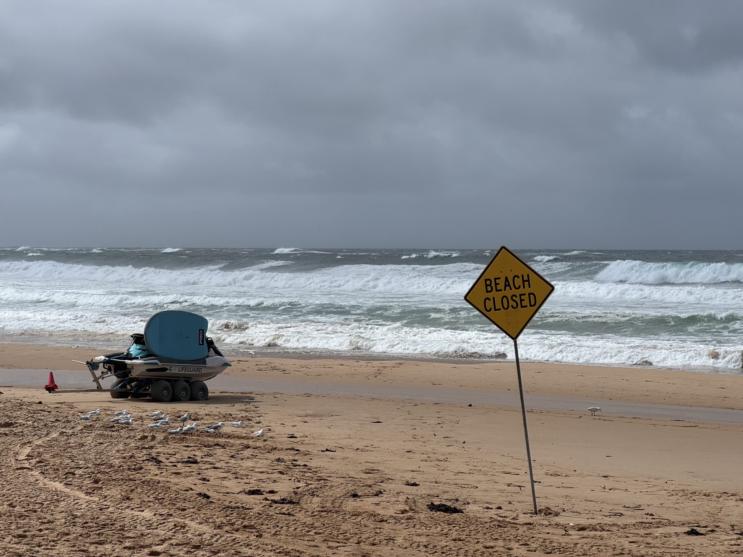
Coastal erosion is usually subdued in powerful south swells like this one with south facing beaches protected by offshore sandbars and healthy sand dunes. However, the peak of the swell should occur around Tuesday’s high tide around 11am, with the swell veering slightly to a more south-southeast direction. This could result in some enhanced sand loss across south facing beaches, with waves potentially lapping on the sand dunes. Needless to say, with a warning for damaging surf across the NSW coastline south of about South West Rocks, a day at the beach is ill-advised.
More low pressure in the Tasman to come?
Autumn and early winter are peak times for significant low pressure systems to develop over the Tasman Sea. These include Tasman Lows, East Coast Lows and coastal troughs. This is mainly due to the lingering very warm sea surface temperatures that run off the Australian East Coast. Ocean temperatures generally lag about two months behind the atmosphere’s temperature, and with record warm sea surface temperatures likely to continue around Australia, conditions are primed for more lows to form off the east coast.
Long range modelling of sea level pressure anomalies, as shown below, indicate increased potential for negative pressure anomalies off the East Coast in late autumn. This anomaly suggests that more low pressure systems than normal, like Tasman Lows and East Coast Lows, could form over the remainder of autumn and early winter.
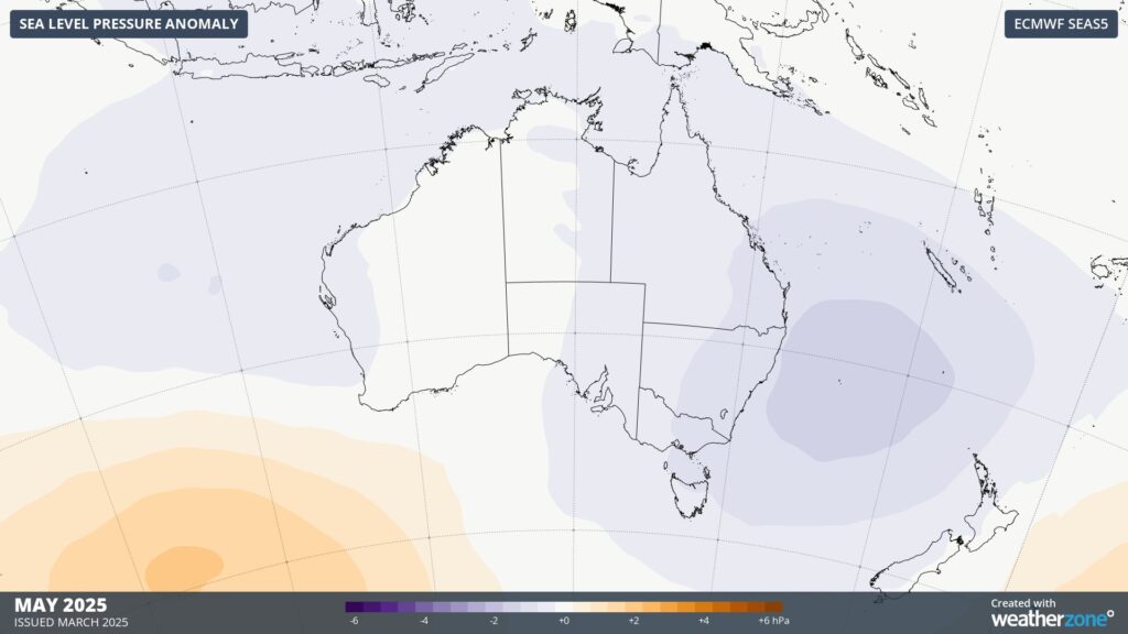
Image: Forecast monthly sea level pressure anomalies around Australia in May 2025.
With some areas still recovering from coastal erosion brought by Tropical Cyclone Alfred, the outlook for more powerful storms in the Tasman is an unwelcome sign.
How DTN APAC can help
From port operations to council planning, powerful wind and swell events can cause all sorts of issues for your business. The shifting climate is creating increasingly complex extreme weather risks, affecting businesses worldwide. We are here to help optimise your resilience.
DTN APAC users have access to extensive weather data through an integrated dashboard plus the support of experienced, on-call meteorologists. We also deliver a full suite of metocean services, including wave and current modelling, data analysis and consulting.
Our Risk Communicators work closely with you to analyse how weather impacts your operations and communicate potential risks. We can then support your risk management planning and provide situational awareness and post-event reporting when extreme weather events hit hard.
Receive targeted meteorological briefings, weather resilience analysis, and risk communication regarding weather impacts for your operations in the coming days, weeks, months and seasons. Our experts are there to assess and support your risk mitigation and management, customise your weather solutions and monitor conditions on site, 365 days a year.
Rely on our insights to see you through complex situations, maximizing the safety of your staff and assets, and your uptime where possible.
To find out more about large range of products and services contact us at sales.apac@dtn.com


