
A developing tropical low to the north of WA’s Kimberley coast may become a tropical cyclone later this week, although this time its unlikely to directly hit the mining hubs and ports in the Pilbara and Kimberley.
The animation below shows the sun rising over a tropical low located in the Timor Sea to the west of Darwin. This low has been producing thunderstorms and showing clear signs of rotation over the past 24 hours, which are both signs of a developing low pressure system.
Image: Day/night satellite images showing a developing tropical low over the Timor Sea on Tuesday and Wednesday morning.
Environmental conditions will be favourable for this tropical low to gain strength as it moves towards the west in the next few days.
One factor that will support the system’s development in the coming days is the abnormally warm water sitting off Australia’s northwest cost. Sea surface temperatures will be hovering around 29-30°C in low’s predicted future path, which is considerably warmer than the 26.5°C threshold that’s required to induce cyclogenesis (the formation of a tropical cyclone).
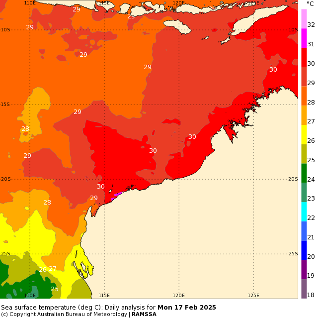
Image: Sea surface temperatures to the north of WA on Monday, February 17, 2024. SourceL Bureau of Meteorology
Despite the favourable environment for further strengthening in the next few days, there is quite a lot of uncertainty between forecast models and agencies.
The Bureau of Meteorology currently give this system a 35 to 45% chance of being a tropical cyclone towards the end of this week and early next week.
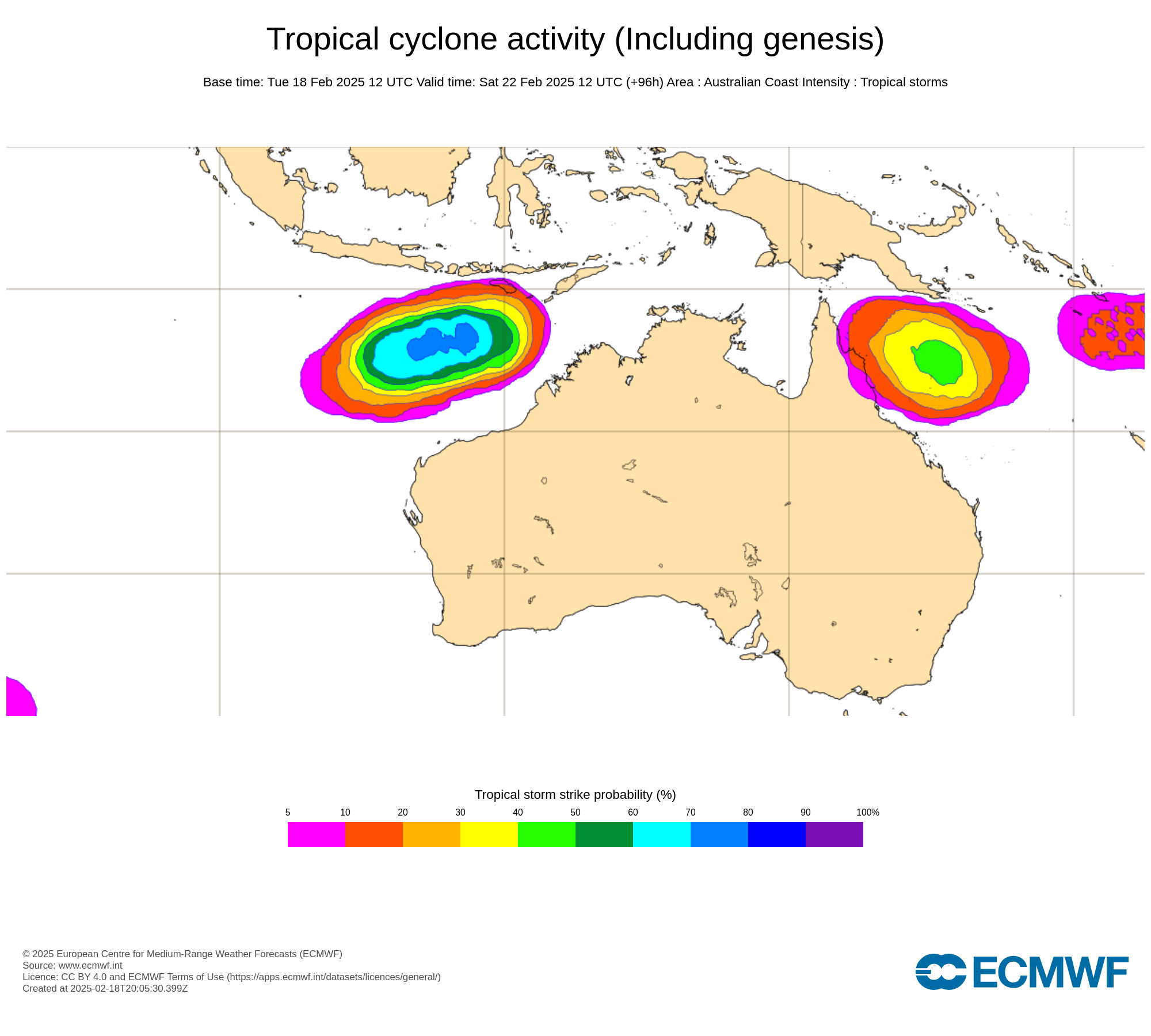
However, an ensemble model from the European Centre for Medium-Range Weather Forecasts (ECMWF) gives a 70% probability of tropical cyclone formation towards the end of this week.
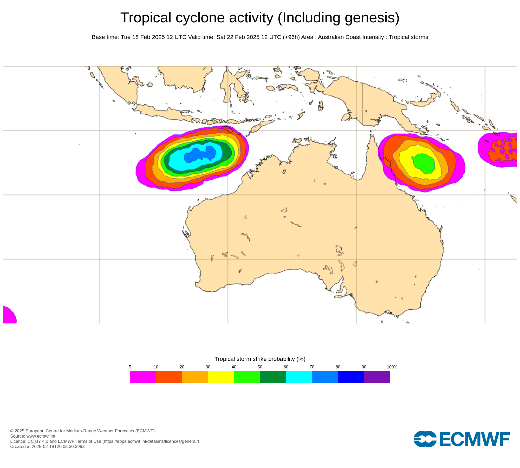
Image: Probability that a tropical cyclone will occur within a 300km radius of a given location within a time window of 48 hours. Source: ECMWF
Most forecast sources agree that, regardless of this system strength, it is likely to move towards the west-southwest in the coming days and remain away from the Australian mainland until at least early next week.
DTN APAC offers a comprehensive suite of services, refined through years of collaboration with the marine, ports and offshore industries, to optimise the safety and efficiency of your operations.
We work with you to understand your intrinsic operational challenges and customise high-precision forecasting, metocean and aviation services to your exact location and operational scope.
When working offshore, our solutions can underpin planning and safe execution for offshore oil and gas enterprises and wind farms. Our data can support your exploration, development, rig moving, shuttle tanker operations, and production and decommissioning phases. Whether your crews are on-site, being transported to shore, or diving to perform maintenance, we deliver tailored weather risk briefings to ensure you choose the optimal time to proceed.
DTN APAC’s trusted nowcasting and forecasting system, OpticastTM, allows you to rapidly respond to changing conditions offshore, en route and in port. We take your port topography and berth orientation into account, ensuring site-specific forecasts. For offshore oil & gas, wind farms, ports and logistics, we have your weather situational awareness covered, no matter where you are. We deliver real-time severe weather and lightning alerts to your team via your integrated dashboard: Portzone, and our Weatherguard app.
DTN APAC’s Total Lightning Network (TLN) ensures you avoid hours of unnecessary downtime by providing the most accurate technology in lightning detection and alerting. Safeguard your teams and assets with lighting and Dangerous Thunderstorm Alerts (DTAs), customised to your existing parameters and delivered in real-time across all devices in your network. You gain full spatial awareness of developing severe weather systems, allowing you to plan ahead and, where needed, execute your shutdown and evacuation procedures.
With extreme conditions slowing production and affecting infrastructure, safety and transport, trust us to deliver Australia’s most precise weather data and tailored insight, giving you decisive confidence when it’s most needed. For more information, contact us at sales.apac@dtn.com




