
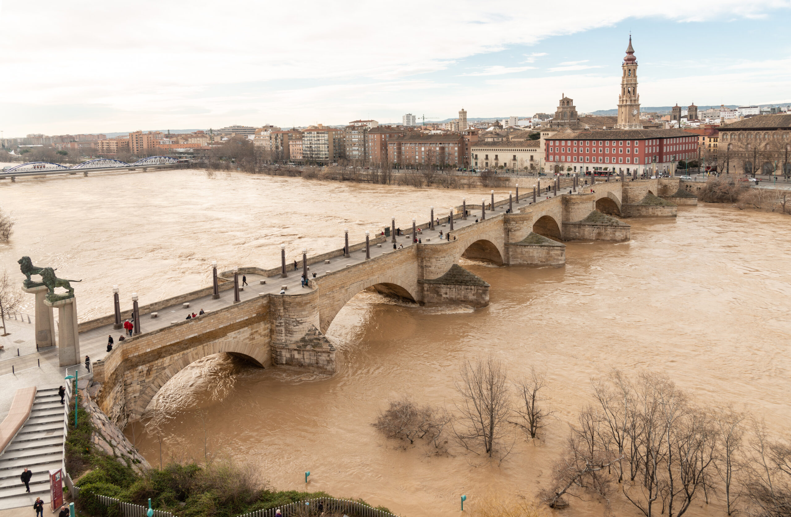
An intense flash flood swept through Zaragoza in northeastern Spain last Thursday, catching motorists completely off guard by the torrent of water.
On Thursday 6th a near-stationary supercell thunderstorm formed over the region, dumping a torrential 20mm of rain in just 10 minutes. All up, 54mm fell over the town, nearly equal to its entire average summer rainfall falling in just one hour.
Upstream was even heavier, with nearly 30mm falling in 10 minutes in Alcañiz, rivalling rainfall amounts rarely seen even in tropical Australia.
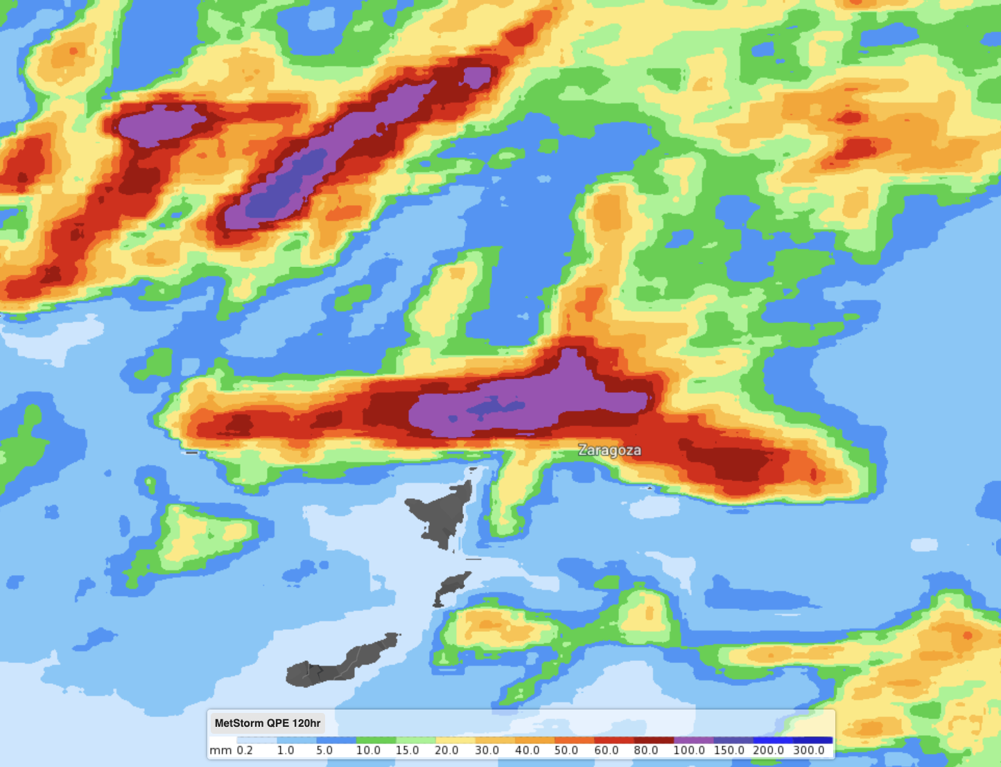
Image: Observed rainfall near Zaragoza, Spain last week.
The huge influx of water rapidly turned streets into rivers, forcing drivers to jump on the roofs of their cars to escape the torrent.
Zaragoza, Spain pic.twitter.com/U66YJEMvg1
— Danijel Višević (@visevic) July 8, 2023
Catastrophic damage in Zaragoza, Spain from flash flooding. Reports sound very bad.
pic.twitter.com/wfs7ptdkV1— Nahel Belgherze (@WxNB_) July 6, 2023
Zaragoza (about 260km west of Barcelona) sits along the Ebro River, the longest river entirely in Spain. Large mountains well above 1500m sit to both the north and south of the valley, that itself is only 263m above sea level. This acts as a giant funnel for water to flow down into the river, making it susceptible to flash flooding.
Despite this, Zaragoza itself is normally an arid location. On average, it receives 322mm of rain a year, only marginally wetter than Alice Springs in central Australia. Summers are the driest time, averaging 60mm over the three months, with this type of deluge rare.
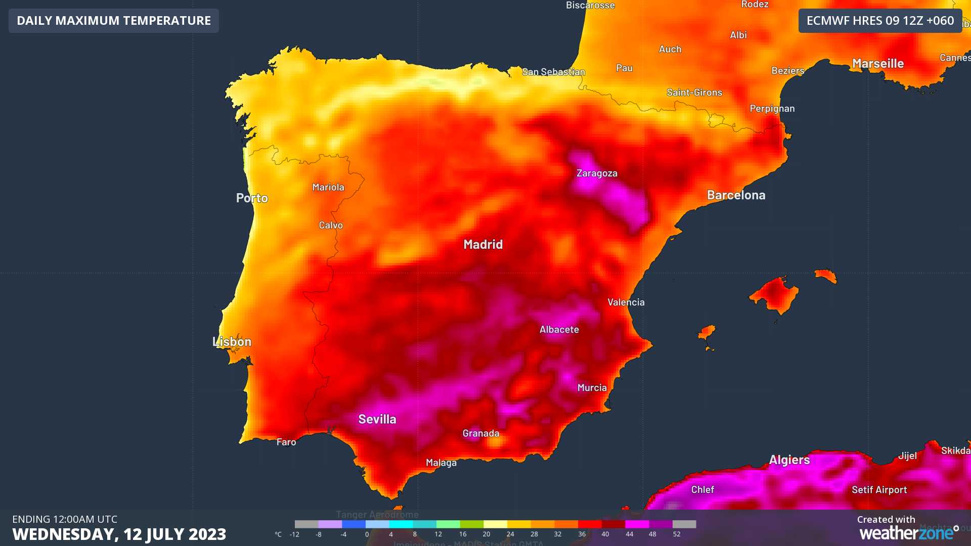
Unfortunately, Zaragoza is now seeing a risk of breaking another unwanted record. Temperatures are expected to soar to 44ºC on Tuesday, just half a degree within its all-time hottest temperature of 44.5ºC set in 2015. An extreme heat alert has been issued by the Spanish State Meteorological Agency.
The good news is the coming week is likely to be rain-free for the region allowing the still swollen Ebro River to ease over the coming days.




