
Heavy rain and cooler temperatures that impact Indian industries, businesses and communities during the southwest monsoon have begun withdrawing from the Indian sub-continent.
The Indian Southwest Monsoon rainfall to date
The graph below shows a healthy overall cumulative rainfall across India so far this wet season – currently running about 7% more than normal.
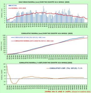
Image: Daily and cumulative monsoonal rainfall across India since June 1, 2025. Source: India Meteorological Department (IMD).
Parts of northern and eastern India saw heavy rainfall and thunderstorms during May, with remaining parts of India experiencing heavy flooding rainfall between mid-June and September.
Withdrawal of the Indian Southwest Monsoon underway
As the Northern Hemisphere summer comes to an end, the northern Indian subcontinent cools and the pressure increases, leading to a reversal of the Southwest Monsoon (called the Northeast Monsoon). Cold and dry winds flow down the Himalayas into India – causing the retreat of the Monsoon during September and October.
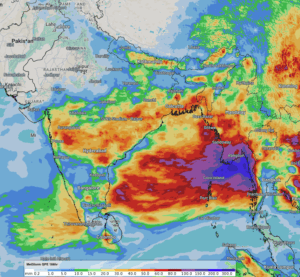
Image: DTN’s Quantitative Precipitation Estimates showing little rainfall across northwestern India over the past week.
Over the past two weeks, the southwest monsoon has gradually withdrawn from northwestern India, approximately five days ahead of the normal withdrawal date.
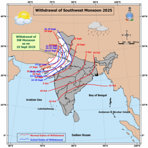
Image: Withdrawal of the 2025 southwest monsoon (blue) and the normal dates of withdrawal (red). Source: IMD.
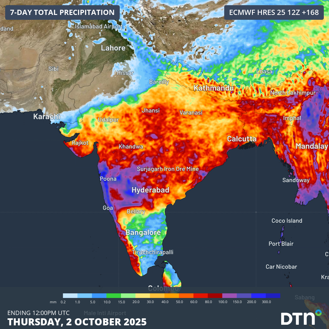
The withdrawal of the southwest monsoon will slow down over the coming week, with 100-200mm of rainfall expected across parts of western and central India, including Mumbai, over the next seven days. Away from the northwest, broader parts of the country can expect weekly falls of 20-60mm as well.
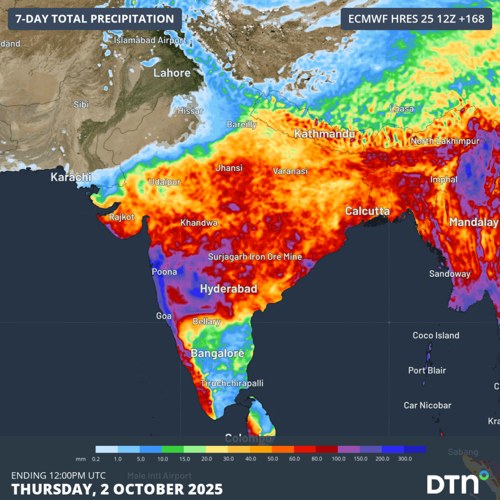
Image: Forecast weekly accumulated rainfall across India in the next seven days.
The withdrawal of the southwest monsoon should resume through the first half of October, before likely clearing the country before the end of the month. Relief from flooding rainfall causing disruptions to transport, energy and infrastructure industries is brought with the withdrawal of the monsoon. A healthy monsoon season of rainfall is also imperative to the agricultural industry, with ground moisture remaining high well into the dry season.
How DTN APAC supports businesses through seasonal changes in tropical cyclones and monsoonal rain activity
DTN APAC specialises in industry-leading forecast, alerting and threat analysis of tropical cyclones across Australia and Asia, offering you expert, customised solutions when the weather turns wild.
Providing rapid-update forecast information, we alert you to any low-pressure system gaining power within your region and, unlike other providers, can track its development out to 7 days. This gives you the time to prepare and safeguard your staff, sites and assets.
You will have the most precise weather intelligence charting rainfall, wind speeds and potential storm surges to help you make critical decisions quickly. Whether it’s adjusting key work schedules, protecting your staff or securing your site, we have the alerting capability to keep you steps ahead of the storm.
As the climate delivers increasingly severe weather events, their potential to impact your business operations grows.
Whether it’s preparing for the coming season’s tropical storm potential, or rapid-response forecasting with a typhoon approaching, or simply ensuring your operations team is equipped to confidently make decisions ahead of severe weather, our weather Risk Communicators are here for you.
Our weather risk communicators deliver short- to long-term guidance from:
- hourly-event weather monitoring (alerting you of impending destructive winds and heavy rain ahead of a tropical cyclone).
- week to month operational planning based on likely timing of increased monsoonal rain or periods of reduced cyclone activity.
- seasonal long term planning based on climate drivers and the likely trends across the coming months.
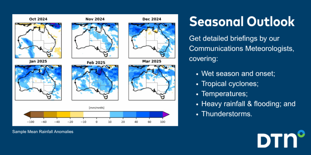
We deliver clear and comprehensive weather data, personalised risk assessments and briefings to you and your team, so that your critical decisions can be made with confidence.
We are available 365 days a year, so you always have the timely guidance you require, especially when severe conditions hit.
You have our insights to rely on to see you through complex situations, minimising potential loss of profit and maximising the safety of your staff and assets.
Learn more about our large range of industry leading products and services or email us at sales.apac@dtn.com




