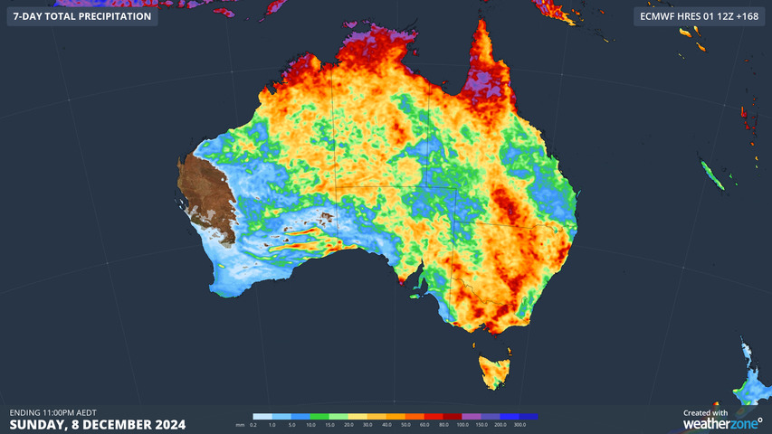
After a stormy November across much of the country – especially in large parts of northern and eastern Australia in the final week of the month – the unstable pattern is set to continue into the first week of December.
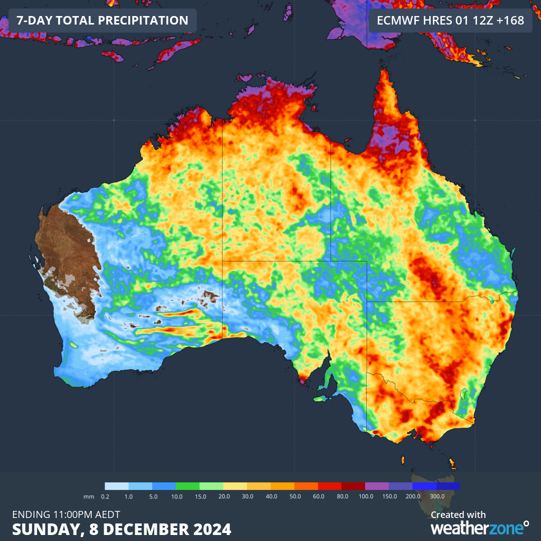
Image: Accumulated rainfall totals across Australia predicted by the ECMWF model for the week ending Sunday, December 8.
As the 2024/2025 summer kicks off, widespread storms will continue across the country due to a range of factors, with the two key elements being:
- An array of surface-based low pressure troughs interacting with a series of upper-level troughs
- Above-average sea surface temperatures to the northwest and southeast of Australia, which will supply ample moisture for storms due to enhanced evaporation
It’s worth taking a look at Australia’s sea surface temps to illustrate the degree to which they are contributing to recent and current weather.
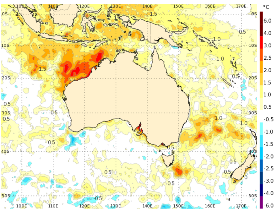
Image: Sea surface temperature anomalies (difference compared to the average) for Australian waters on Saturday, November 30. Source: BoM.
Of particular note is the relatively large area of water off northwestern Australia which is between two and four degrees above the long-term average.
We saw the effects of that broad area of warm ocean last week, as a colossal conveyor belt of tropical moisture caused storms and areas of heavy rain across roughly half the country.
Some of the newsworthy rainfall observations over the weekend included:
- Falls exceeding 200mm within 24 hours in the Gold Coast hinterland, where flooding was reported.
- Canberra’s heaviest rainfall day of the year to date, with 40.4mm to 9am Sunday.
- Heavy rain and storms that extended all the way south to Victoria, Tasmania, and to southeastern parts of SA.
This week’s rainfall totals may not be as extreme as last week’s in many places, but it’s definitely set to be another active week of stormy weather – and not just in the tropics and eastern Australia.
Indeed there were already active storms on Monday morning in Central Australia, far western Queensland and some fairly arid parts of South Australia.
Image: Combined two-hour radar and satellite loop for central parts of the continent on the morning of Monday, December 2, 2024.
Stormtracker is a severe weather solution that can assist you in observing, in real-time, any storm or event that has the potential to impact your business.
Embedded in DTN’s industry interfaces, the system gives you a time advantage when monitoring conditions developing over your infrastructure and location.
Stormtracker is our Global Information System (GIS) tracking tool, providing multiple weather layers and zoom controls overlaid on a map of your location and infrastructure. You can choose a snapshot or full screen view, depending on your requirements. The maps allow you to monitor all weather, and specifically any systems likely to cause risk for your business. You also have the capacity to observe:
- real time lightning and thunderstorm alerts
- localised lightning strike frequency
- official warnings for storm, cyclone, wind, flood and fire
- sentinel hotspot fires and fire agency current incidents
Stormtracker’s radar imagery updates every 10 minutes, so you are always able to respond rapidly to changing conditions. You can customise alerting to notify you when your staff or infrastructure are under threat. With increased situational awareness, your ability to make informed decisions quickly is optimised.
DTN’s experience and intelligence gives you a clear path through complex situations. Let us assist you, offering actionable insight when extreme weather poses risk to your business. For more information please visit our website or email us at sales.apac@dtn.com.


