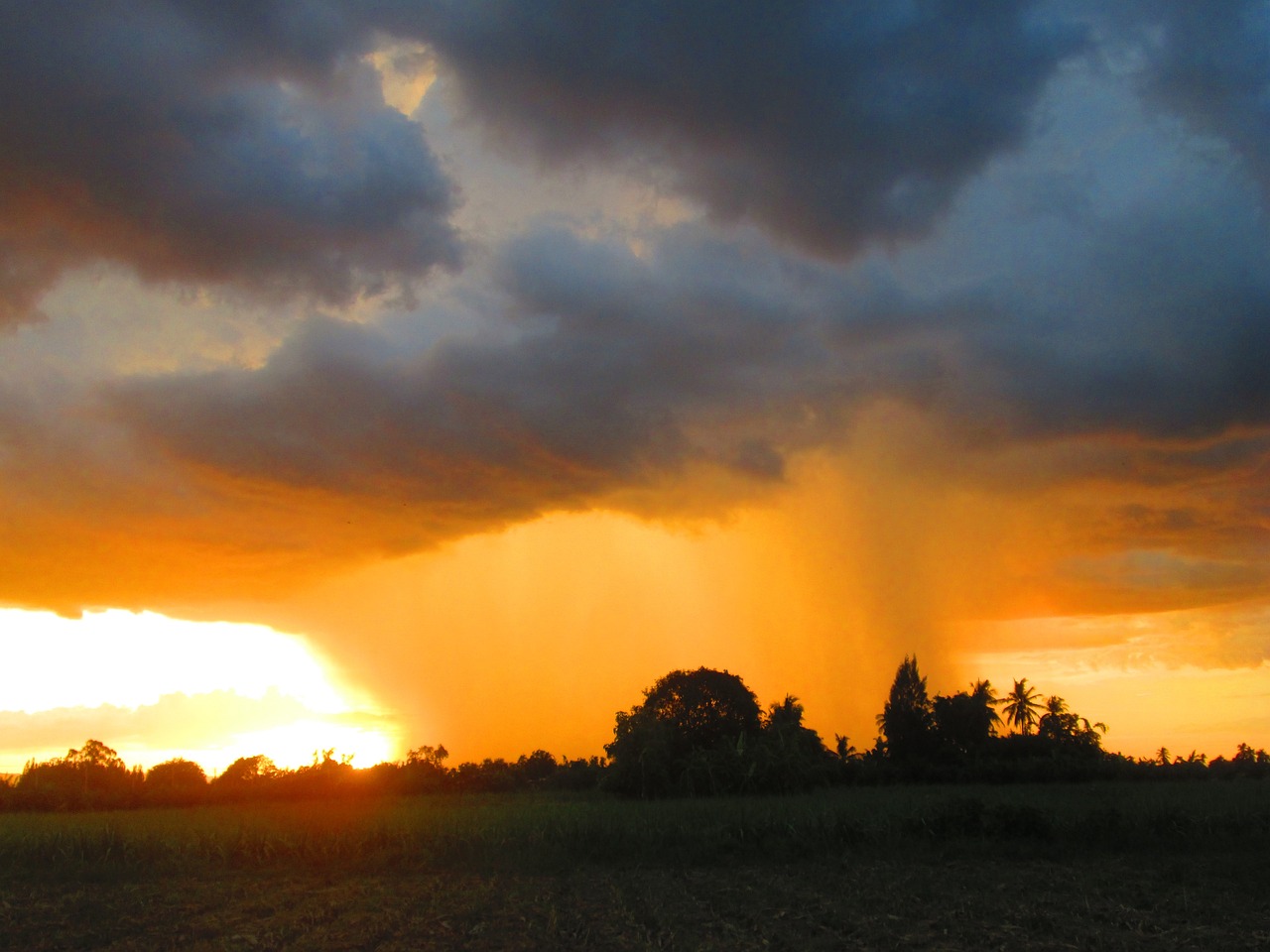
Thunderstorms have developed in southeast Qld and northeast NSW on Thursday, bringing a risk of heavy rainfall to the region.
The storms are being triggered on a southerly change which is moving up the Qld coast on Thursday afternoon. The video below shows the storms moving slowly across the region.
On Wednesday night, over half a months’ worth of rain fell in parts of central and western Sydney, as the southerly changed moved up the NSW coast. North Parramatta and Lidcombe recorded the most, both with 55mm in the gauge to 9am on Thursday, September 28.
Dora Creek in the Hunter Valley saw its wettest September day in 15 years, recording 44mm to 9am on Thursday.
The map below shows the large rainfall totals that fell along the central NSW coast on Wednesday night.
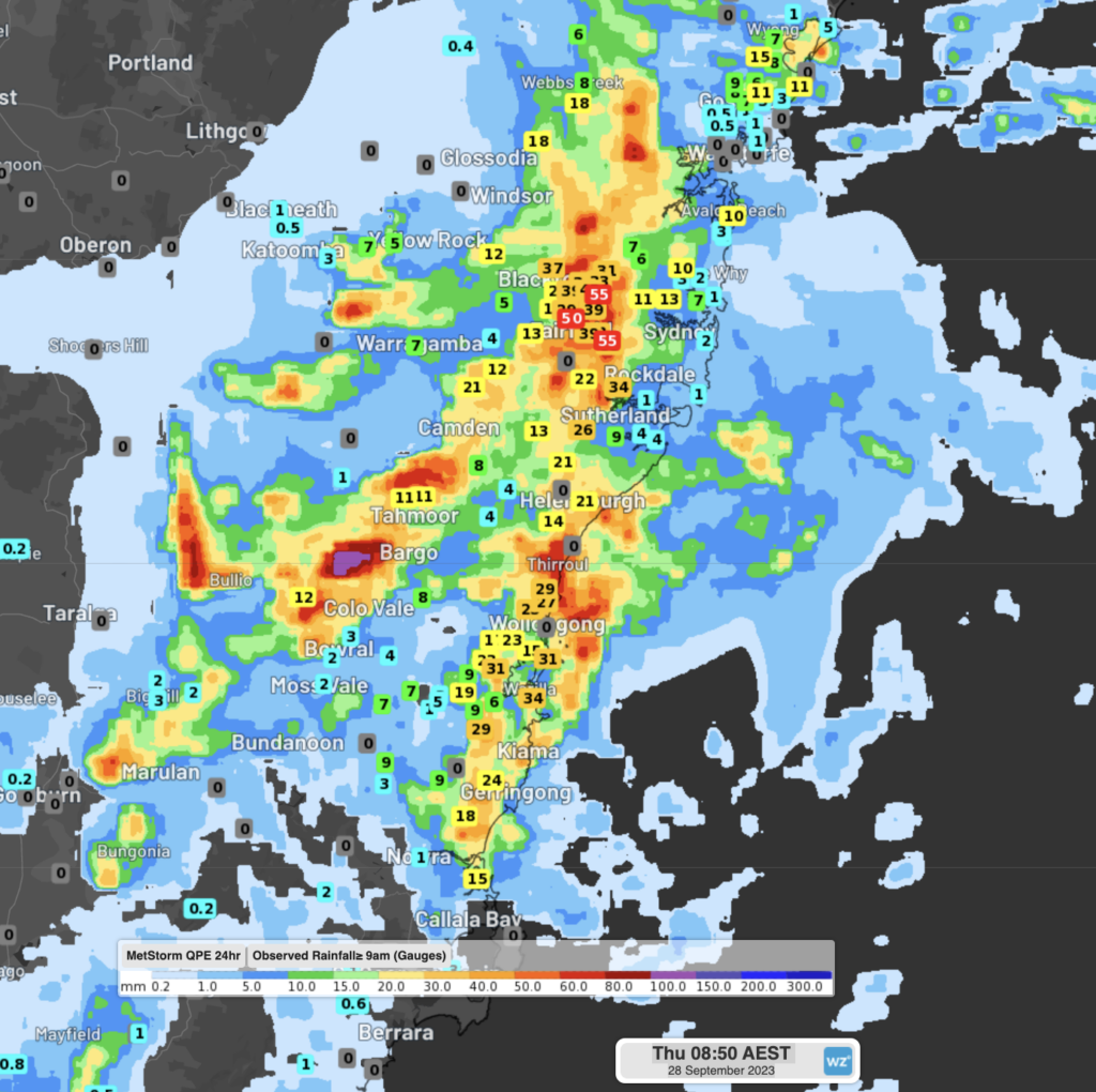
Image: Rainfall observations in the 24 hours up to 9am Thursday, September 28.
Heavy rainfall rates were also recorded in NSW’s northeast on Thursday morning, with 82mm in an hour falling in Lismore and 47mm in half an hour at Repentance Creek.
The heavy rainfall in Lismore caused flash flooding in the region.
View this post on Instagram
The severe thunderstorms on Thursday are also slow moving and are producing heavy rainfall that may lead to flash flooding. A warning has been issued for these thunderstorms.
This electric weather is typical of spring, which is one of the stormiest seasons of the year.
The peak storm season in Australia occurs during the warmer months of the year between September and March. However, they can happen at any time of the year. The most lightning-active areas in Australia are in the northern tropics, and from southeastern Qld down to central NSW.
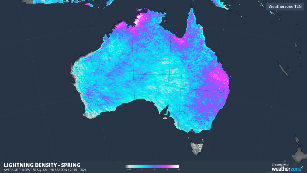
Images: Mean lightning density in spring based on all lightning pulses detected by Total Lightning Network between 2015 and 2021.
This spring, Australia will be affected by several dry-phase climate drivers in the second half of 2023. These climate drivers typically reduce moisture in the atmosphere, which can hinder thunderstorm development.
However, one area that may see more storms than a typical El Niño is far eastern Australia, due to the unusually warm sea surface temperatures near the coast.
This season, the most likely severe phenomenon in this region would be damaging or destructive winds and large hail, under the influence of El Niño. However, today’s severe thunderstorms are a reminder that heavy rainfall isn’t out of the question.
Our Total Lightning Network is the intelligent solution that goes above and beyond to increase your lead time before the storm hits.
We utilise a vast global sensor network, created with our partner Earth Networks. Over 1200 sensors in 40+ countries provide a worldwide view of both intra-cloud (IC) and cloud-to-ground (CG) lightning strikes, enabling businesses to plan and respond with the most precise insight available.
Offering unsurpassed accuracy, with real-time detection to <200m, we integrate with your existing systems. Keep your enterprise operating within your defined severe weather thresholds.
Leave nothing to chance. Be confident working outdoors with the most sophisticated lightning alerting system, delivering intelligence to any device across your business network. For more information, please contact us at apac.sales@dtn.com.


