Southeast Queensland and northern NSW will be hit by a flurry of severe thunderstorms on Wednesday as a widespread storm outbreak erupts over eastern Australia.
Humid air feeding into a broad low pressure trough will produce showers and thunderstorms over parts of Qld, NSW, Vic, Tas and the ACT on Wednesday. Another region of low pressure will also cause storms over northern Australia and into WA’s interior.
The map below shows the forecast accumulated rainfall for Wednesday, giving a general idea of where the rain and storms are likely to occur.
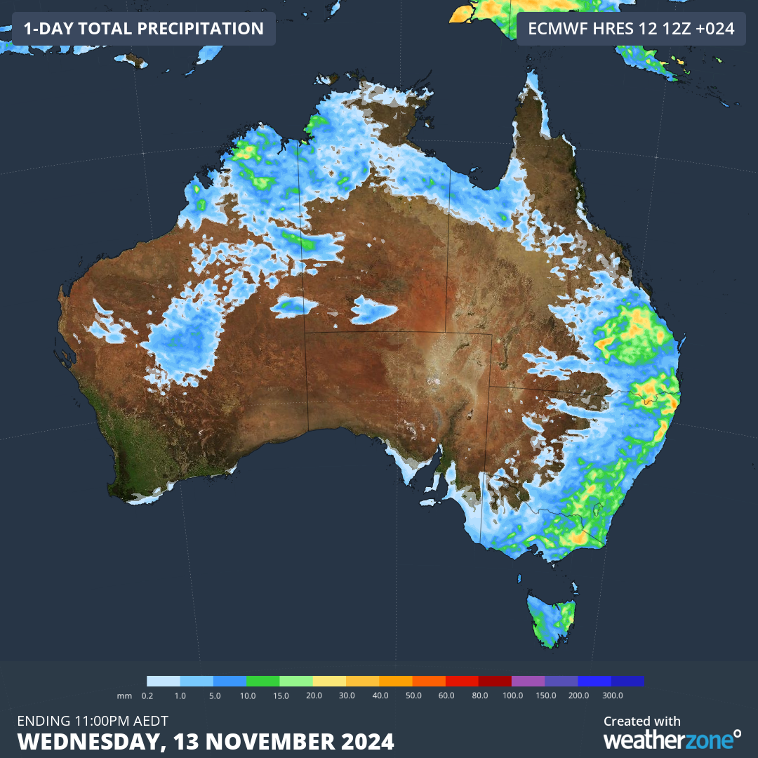
Image: Forecast accumulated rain on Wednesday, November 13, 2024.
There is a good chance that severe thunderstorms will develop in eastern Australia on Wednesday afternoon and evening. The most likely area for severe storms will be southeast Qld and northeast NSW, where damaging winds, large hail and heavy rain are all likely. Supercells are also high chance in the region and can bring giant hail, destructive winds, intense rain and an increased risk of tornados and waterspouts.
Brisbane, Sydney and Canberra all have a chance of seeing storms on Wednesday, with severe storms possible in or near each city, most likely in Brisbane and the nearby Gold Coast and Sunshine Coast regions.
Wednesday’s stormy weather is part of a prolonged thunderstorm outbreak that’s expected to cause millions of lightning strikes across Australia this week.
Stormtracker is a severe weather solution that can assist you in observing, in real-time, any storm or event that has the potential to impact your business.
Embedded in DTN’s industry interfaces, the system gives you a time advantage when monitoring conditions developing over your infrastructure and location.
Stormtracker is our Global Information System (GIS) tracking tool, providing multiple weather layers and zoom controls overlaid on a map of your location and infrastructure. You can choose a snapshot or full screen view, depending on your requirements. The maps allow you to monitor all weather, and specifically any systems likely to cause risk for your business. You also have the capacity to observe:
- real time lightning and thunderstorm alerts
- localised lightning strike frequency
- official warnings for storm, cyclone, wind, flood and fire
- sentinel hotspot fires and fire agency current incidents
Stormtracker’s radar imagery updates every 10 minutes, so you are always able to respond rapidly to changing conditions. You can customise alerting to notify you when your staff or infrastructure are under threat. With increased situational awareness, your ability to make informed decisions quickly is optimised.
DTN’s experience and intelligence gives you a clear path through complex situations. Let us assist you, offering actionable insight when extreme weather poses risk to your business. For more information please visit our website or email us at sales.apac@dtn.com.
Title image source: iStock / georgeclerk


