
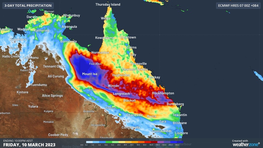
A surge of tropical moisture will produce heavy rain and thunderstorms in parts of northwest and central Queensland during the next several days, likely causing flooding and road closures in parts of the state.
A slow-moving tropical low pressure system will help drag copious moisture across Qld from the northwest in the coming days. The image below shows thick clouds being driven over northern Qld and the NT by the low on Tuesday afternoon.
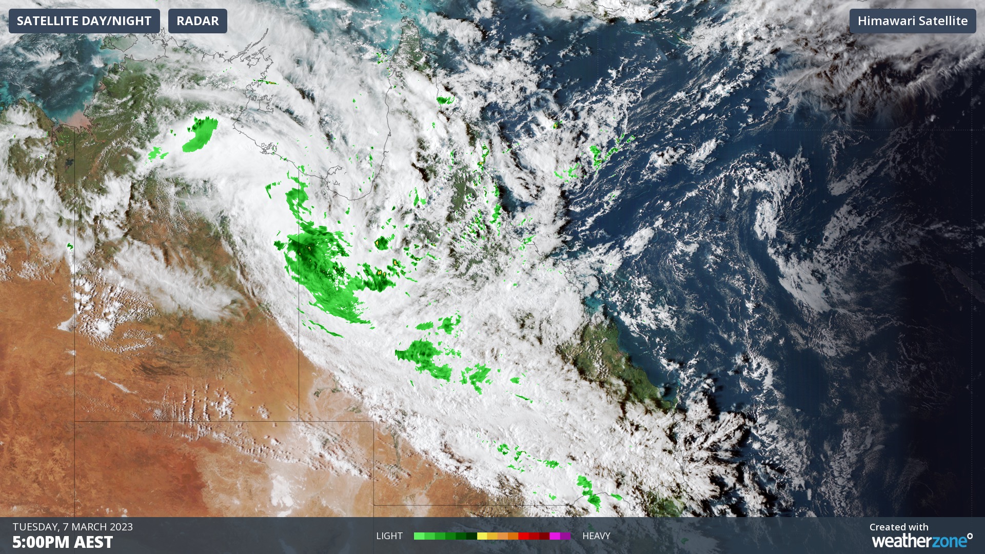
Image: Composite satellite and radar at 5pm AEST on Tuesday, March 7, 2023.
Century Mine, located in far northwest Qld, collected 120 mm of rain between 9am and 7pm on Tuesday. This followed 173 mm at Burketown during the 24 hours to 9am Tuesday, which was its highest daily total in eight years.
Rain and storms will continue to spread over large areas of northern and central Qld on Wednesday and Thursday, and possibly into parts of southeast Qld later in the week. The heaviest rain over the coming days should fall in the state’s northwest, where some places near the northern Qld-NT border could see more than 400 mm.
However, it is important to point out that there is some disagreement between forecast models regarding where and how much rain will fall from this system, particularly for the southeast of the state. The maps below show the predicted accumulated rain from the middle of Tuesday to Friday night from three different models.
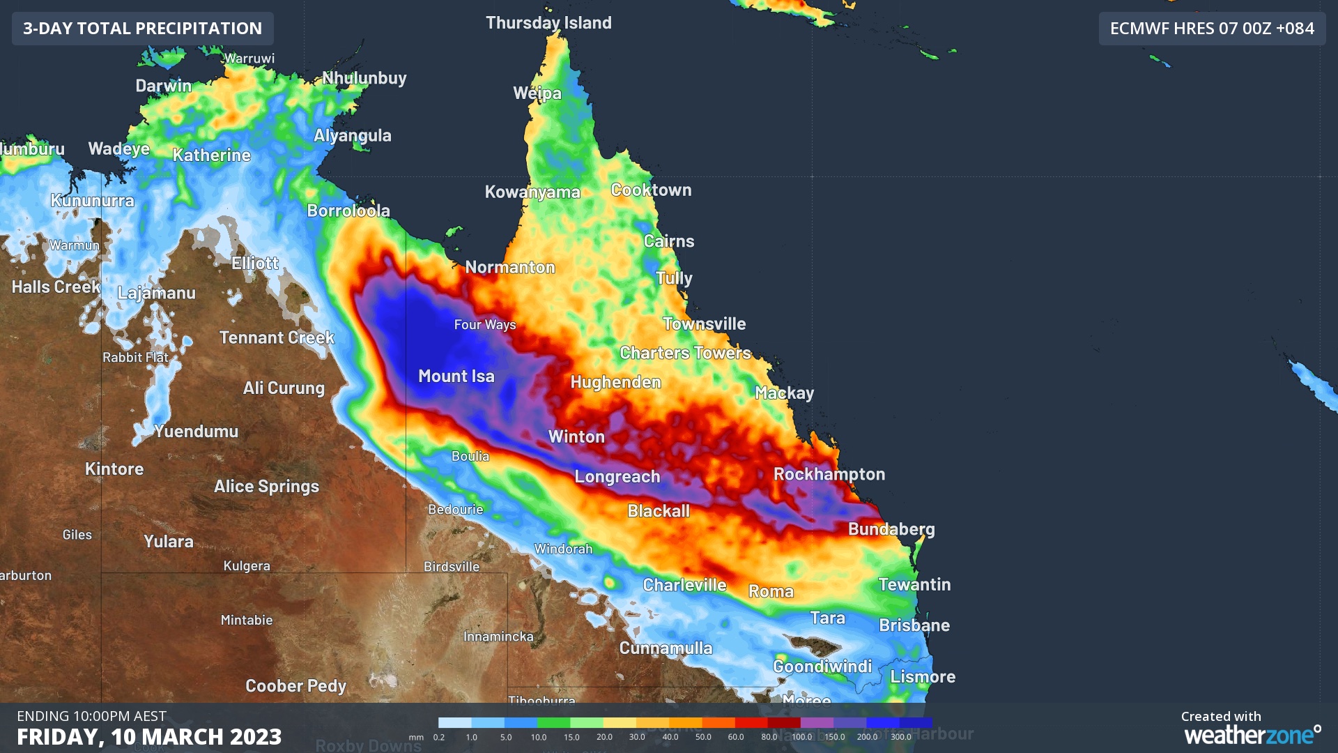
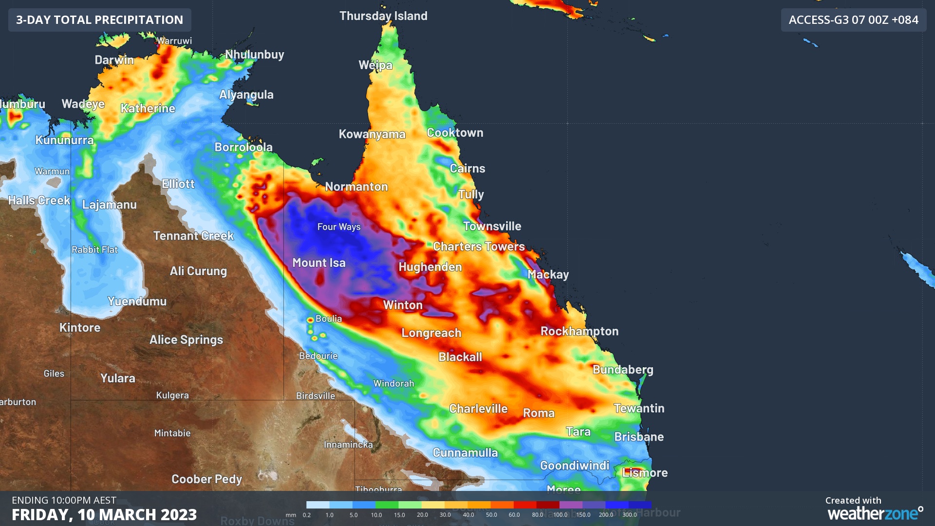
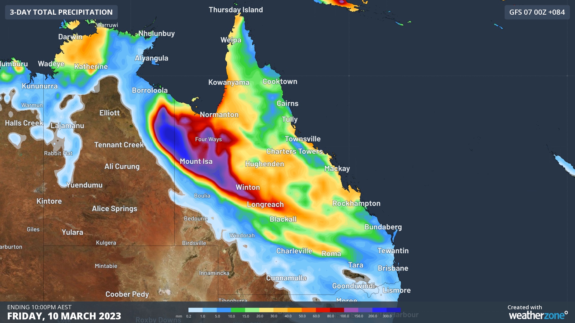
Images: Forecast accumulated rain between 10am AEST on Tuesday and 10pm AEST on Friday, according to the ECMWF (top), ACCESS-G (middle) and GFS (bottom) models.
Despite the current model uncertainty, a broad area of northwest and central Qld is likely to see enough rain to cause flooding over the next several days. Some areas will respond to this rain faster than usual due to catchments already being saturated from recent wet weather.
Be sure to check the latest Qld weather and flood warnings during the remainder of this week and monitor current road closures here.
DTN APAC and its weather forecasts and alerting services, please visit our website or email us at apac.sales@dtn.com.




