Extremely heavy and in some cases record-breaking rain has fallen across New South Wales in the 24 hours to 9 am Wednesday, with 351 mm falling at one South Coast location.
This truly was a remarkable 24 hours of rainfall, and not just because of the massive totals in many areas, but because of the widespread nature of the falls.
It’s rare that you’d see 24-hour totals approaching or even exceeding 100 mm in multiple forecast districts both along the coastal fringe and well inland, but that’s what happened overnight
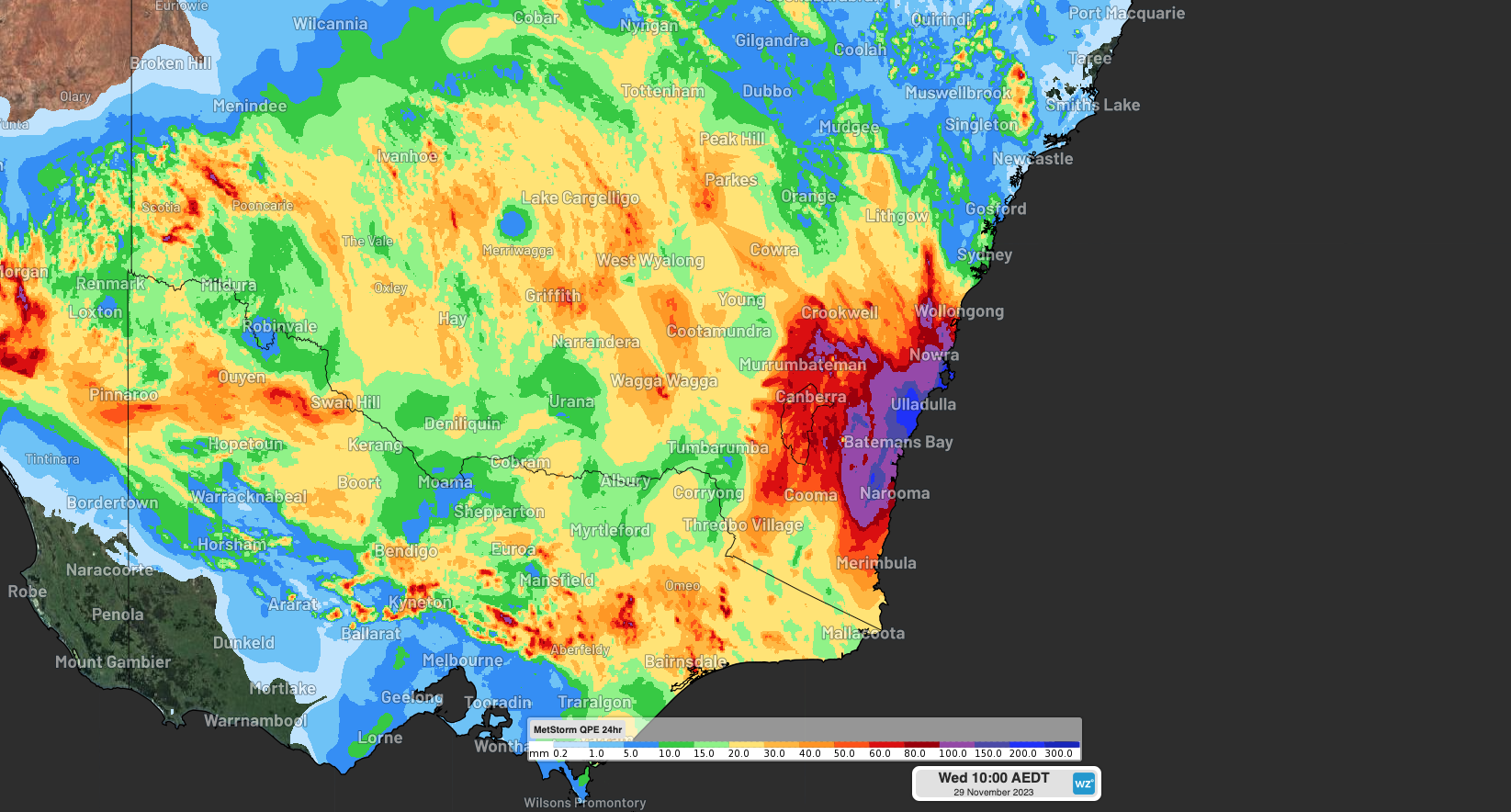
Image: Observed 24hr rainfall to 10am AEDT.
Some of the falls of note in the 24 hours to 9 am AEDT Wednesday included:
Porters Creek (South Coast): This was by far the highest total in NSW overnight, with a whopping 351 mm. Porters Creek is just inland from the Jervis Bay area which also saw extremely heavy falls of 226.8 mm at Point Perpendicular, while the town of Ulladulla couldn’t quite pull a Glenn Maxwell, falling just short of the double-century with 196.4 mm to 9 am.
Deniliquin (Riverina) 135.4 mm: This was the town’s wettest November day on record, its wettest day in any month for 145 years, and its second-highest daily rainfall on record in any month in records going back to 1858.
Goulburn Mt Gray (NSW Southern Tablelands) 115 mm: It was a huge night of rain for the large town famous for its giant merino sheep parked at a service station. The Goulburn Airport rain gauge picked up 98.2 mm, which is more rain in a day than it has had in any month this year.
Menindee (Lower Western) 65 mm: The small town of 500 people near Broken Hill had its heaviest day of November rain for 90 years.
Swan Hill (Mallee, Vic) 85.4 mm: While this was primarily a NSW event in terms of the heaviest rainfall, the Victorian Murray River centre of Swan Hill copped a drenching which would have been welcomed by most locals, with 85.4 mm in the can – the wettest day in any month for 25 years.
To put the scale of this event into perspective, two places mentioned in the list above (Menindee and Ulladulla) are almost exactly 1,000 kilometres apart.
This really was a vast and very active weather system as you can see on the video loop above.
For more information about why we’re having such a wet week in parts of the country when we have come to expect drier weather during El Niño, please read Ben Domensino’s fascinating explainer story from Monday.
The upper-level low that’s driving the thunderstorms and rain over eastern Australia. ???????? pic.twitter.com/op1ggLuDz4
— Andrew Miskelly (@andrewmiskelly) November 28, 2023
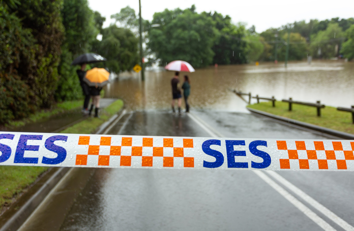
Meanwhile the steady rain continues this Wednesday, especially in southern NSW, the ACT, and eastern Vic. Flooding is certain to eventuate in numerous locations too, so please check the Weatherzone warnings page, especially if you have travel plans.
DTN APAC provides a suite of services tailored towards the insurance industry. From severe weather ‘heads-up’ from our meteorologist team, to detailed warnings and extreme observation alerts, to post-event reporting, we can cover any major weather event. To find out more, please explore our website or email us at apac.sales@dtn.com.


