The Australasian Fire Authorities Council (AFAC) has released its seasonal bushfire outlook for spring 2023, and it’s not great news for residents of several states.
Take a look at the map below.
Red shading represents areas with an increased risk of fire – which AFAC defines as the likelihood of an increased number of significant bushfires occurring in the outlook period compared to average.
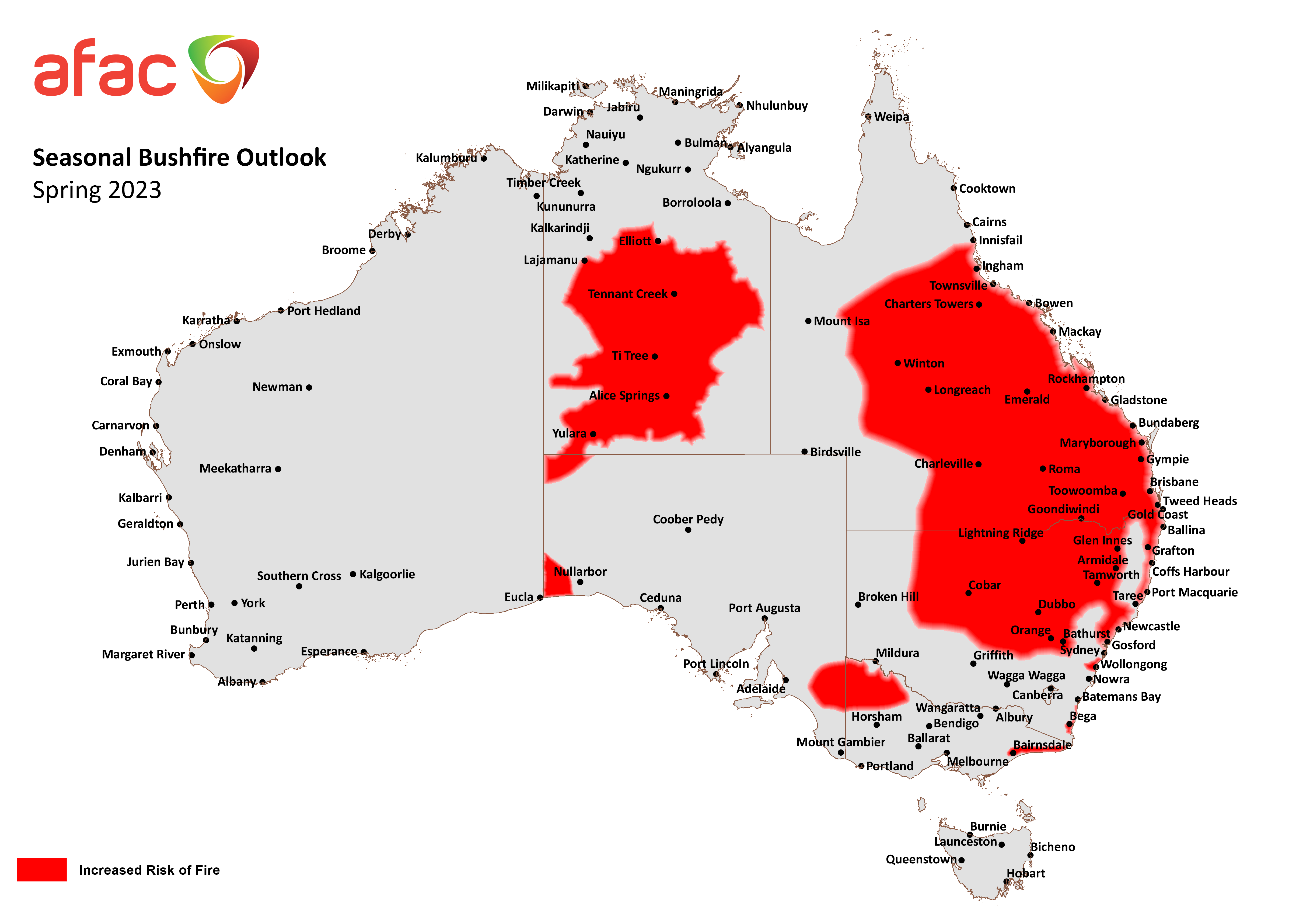
Image: The soggy springs and summers with low fire danger in subtropical Australia could be behind us. Source: AFAC.
- As you can see, about half of Queensland, plus large chunks of New South Wales and the Northern Territory are at risk of more significant bushfires than usual in spring.
- There are also smaller areas of increased bushfire risk within South Australia and Victoria.
It’s worth mentioning that AFAC has changed the format of its seasonal outlooks in its spring 2023 outlook (and presumably from here onwards).
The outlooks used to show areas with ‘normal fire potential’ and ‘below normal fire potential’. Those categories have now been binned, possibly because they generated complacency.
The outlooks are all about increased risk now. And there’s no secret why there’s an increased risk in such a large area this spring. The reasons include:
- Plenty of vegetation: Following three La Niña events, vegetation has flourished across a vast area, including normally arid parts of Australia. That’s why we can expect grassfires as well as forest fires, and it’s worth noting that many of the red shaded areas are grasslands, not forests.
- Recent dry weather over autumn and winter: Recent months have been much drier already in most parts of mainland Australia since the La Niña Taps turned off, which is allowing all that formerly lush vegetation to dry out.
- The developing positive Indian Ocean Dipole (IOD) and potential El Niño: Both of these climate drivers increase the likelihood that the 2nd half of 2023 will be warmer and drier than average.
The first two factors (vegetation and recent dry weather) have already combined to create ripe conditions for an active spring fire season in parts of central and eastern Australia.
The third factor (coming warmer-than-average weather) could make the summer bushfire outlook even more worrying.

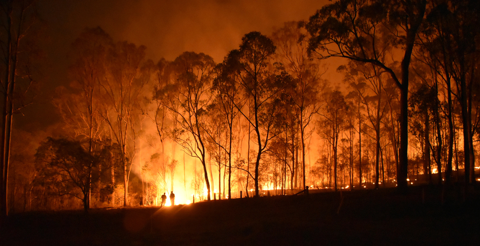
Image: A fire at Gregory, just south of Bundaberg Qld. Queensland is the state with the largest area of increased fire risk this spring. Source: iStock.
“The Seasonal Outlook identifies areas of increased risk of bushfire so communities are aware and primed to take appropriate action,” The APC outlook states.
“It is not intended as a prediction of where and when bushfires will occur. Fire risk can vary greatly, even at the smaller scale, between bordering states and territories.”
For more information on the severe weather season please contact us at apac.sales@dtn.com.


