
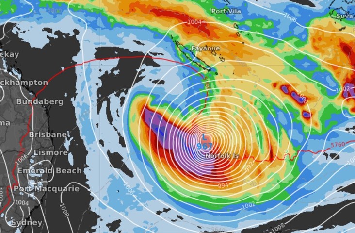
It promises to be a nervous few days for the 2200 residents of Norfolk Island, as a dangerous tropical storm develops in the Coral Sea and tracks southwards.
At this stage, the weather system is still classified as a tropical low, but it’s likely to develop into a cyclone in the next day or so. If that happens, it will probably be called Cyclone Gabrielle.
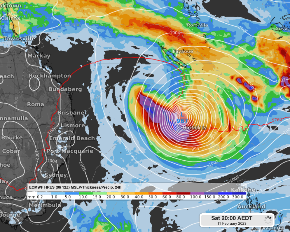
The image below pains a pretty dramatic picture. It shows the intensity of low pressure centred almost directly on Norfolk Island, as projected for this coming Saturday night, February 11.
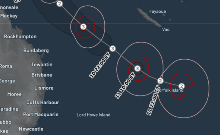
The BoM’s cyclone track map shows a similar picture. Norfolk Island is the tiny brown speck just below the pair of twos at the end of the of the track.
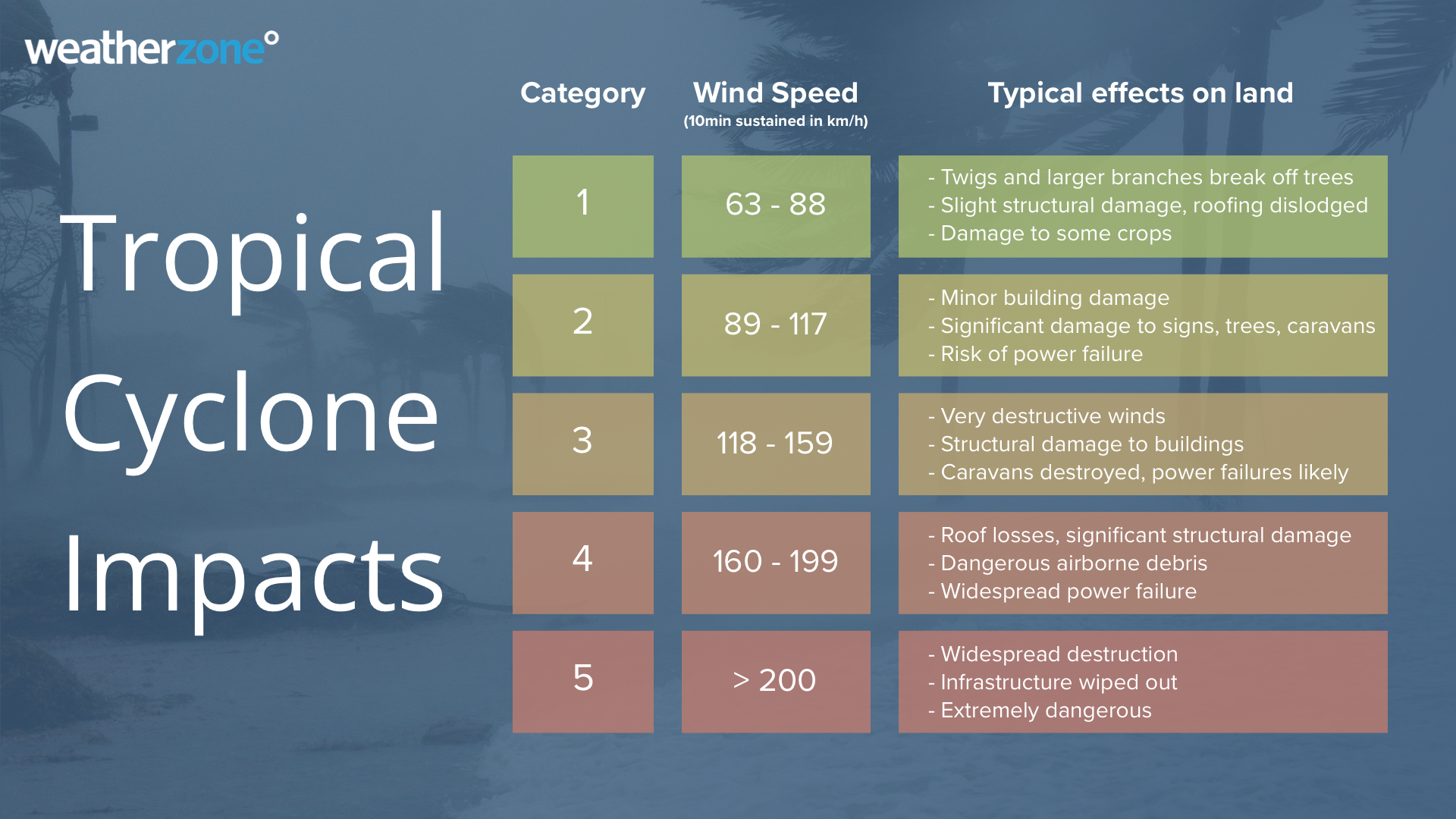
That means it could be facing a Category 2 tropical cyclone, with sustained wind speeds of 89 to 117 km/h, and typical gusts over open flat land or seas of 125 to 164 km/h.
A breakdown of tropical cyclones is below.
Are tropical cyclones common on Norfolk Island?
The short answer is yes, but destructive cyclones are very uncommon.
If Norfolk Island were part of the Australian coastline, it would be located about 100 km south of the Queensland border. So it’s a fair way south for cyclone activity. For example, it’s been more than 30 years since a cyclone struck Byron Bay or further south
But cyclones tend to maintain strength for longer out at sea, and because Norfolk Island is so far away from the mainland (it’s 1471 km from Brisbane!), cyclones track its way quite frequently. Between 1969 and 2010, approximately 49 cyclones passed within 500 km of the island, according to the BoM.
While most of those cyclones weaken, there is always the chance that a cyclone can maintain its strength as it reaches the island, as this week’s charts suggest could happen. We’ll keep you updated.
Why don’t we know the name of this potential cyclone yet?
As we told you on Monday, there were three low pressure systems around northern Australia this week that all had the potential to become topical cyclones.
TC Freddy, located off WA’s northwest coast, became a cyclone on Monday night, and the low in the Coral Sea could be next. As mentioned, that would make it Cyclone Gabrielle, although if the tropical low currently over the Cocos Islands develops into a cyclone first, the Queensland low would become Cyclone Herman.
How Weatherzone can help you prepare
DTN APAC has a suite of tropical cyclones services we provide to deliver our clients with as much forewarning of tropical cyclones as we can. We have 4 levels of forecasts timeframes:
- Tropical cyclone seasonal outlooks
- Weekly tropical update
- Daily 7-day tropical cyclone forecast
- Detailed tropical cyclone impacts (issued every 1-6 hours aligning with the BoM’s offical advisories)
Through these products you can have as much preparation as possible for tropical cyclones and their impacts. To find out more, please email us at apac.sales@dtn.com.




